
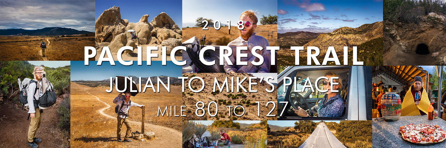
PCT 2018: Days 5-8, Julian to Mike's Place
Photos and stories from my thru-hike of the PCT. This post covers days 5-8 from Julian to Mike’s Place, mile 80-127.
May 9, Day 5
17.6 miles [98.0]
Wow, I had the hardest day. At 2 a.m. Adam woke up with an 8-10-inch long centipede under his quilt, biting him. Like a scene from a horror film, I chased that f@&*er around, dispatching it with flurry of impassioned heel-strikes. I'm not sure now how I feel about cowboy-camping anymore. Neither of us got much sleep after the event. Today's entire hike was exposed. Alien. Wind hotter than hair dryers constantly caught my umbrella, whipping my hand and head, pulling me backwards. All that would seem tolerable, but all day yesterday I had a pain in my right knee upon extension. Tonight, three miles away from camp, I paused for a breather. When I went to move, it felt like a knife had pierced my kneecap, locking my leg in place—9/10 pain. All I could think about was 'failure'. I can't let it consume me. We made an early dinner and I chugged 1,000mg of acetaminophen. Adam insisted on taking my pack for the remaining few miles. What a champ. Eat more, drink more, go slow; you must.
San Felipe Hills, California, mile ~86.
Small natural cave, mile 96.1.
May 10, Day 6
11 miles [109]
Crossed a big milestone today—mile 100. Exited Anza-Borrego and San Felipe Hills, it feels like I'm finally out of another desert. Tried to stay on top of hydration, but nonetheless, my knee hurt all day. Luckily we only planned on making it to Warner Springs—11 miles. I spent way too much time thinking about the implications of injury. Found our way to the Community Center and was surprised at what they had to offer. We both took bucket showers and laundry which were much needed. I also purchased a pair of two-ounce flip-flips which are going to be a big score for camp-life and future showers. Made a small trek to the Post Office to pick up our resupply box. Stopped at the golf course on the way back; there was a closeout sale on junk food. Score. One of the employees was clocking out; she offered us a ride back in her bitchn' 80's Tacoma.
Eagle Rock, California, mile 106.2.
Hiking through Warner Springs Meadows, mile 103.4.
Adam hitches in a pickup truck on Highway 79, mile 109.5.
A very nice Angel from Warner Springs Golf Grill.
May 11, Day 7
0 miles [109]
We took our first zero today; not stoked about needing the rest so early on. I don't think Adam wanted to stop but it's clear he's worried about me. Fortunately, we both got to sleep in due to overcast skies. I wore my puffy all day; finally a nice day in the desert. We used today's downtime to rethink gear, trying not to get sucked into social media. I bought a much needed hooded shirt from 2 Foot Adventures since my right nipple had been rubbed raw by my cheap button-up. This is a major boost in my quality of life. Adam realized his pad popped in the wake of the centipede kerfuffle, but at the end of the day, a Z Lite found it's way into the hiker box. Adam snatched it up—huge score! We also ordered odor-proof bags to store food after a rogue crow took a packet of ramen from our resupply box when I wasn't looking. Finished the day with a life-affirming footbath and ate dinner in the tent.
May 12, Day 8
18 miles [127]
Got an early start leaving Warner Springs; I can finally wake up and pack camp in under 40 minutes. The entirety of today's hike was overcast! Gorgeous Bay Area clouds blanketed the sky which kept me cool during our 18 miles of rolling hills. My knee felt much better for the first nine miles or so, but soon after, a dull and constant pain returned. Challenging. Fortunately, we stayed at Mike's Place tonight. “Off-Trail” made us feel at home by giving us beers and cooking legit wood-fired pizzas. He even offered to let us cook—Adam made a spectacular 'za. Hung out with a dozen other hikers we had seen the past week and reminisced about our short time on trail. Possible chance of rain tonight.
Leaving Warner Springs, mile 109.6.
Adam makes pizza at Mike’s Place, mile 127.0.
Lost Valley, California, mile 118.6.
Hike On?

PCT 2018: Days 9-12, Mike's Place to Cabazon
Photos and stories from my thru-hike of the PCT. This post covers days 9-12 from Mike’s Place to Cabazon, mile 127-211.

May 13, Day 9
18.4 miles [145.4]
Today sucked. Why does life seem so much harder for me than everyone else? Stupid. We woke up in the clouds at Mike's, everything was soaking wet—in the desert. I hastily tried packing the tent only to end up arguing with Adam about something minor and borderline meaningless. Didn't manage my calories well at all and me knees bothered me the whole day. The cloud cover didn't even last long. By 9:30 a.m. I was sweltering once again. Adam made a call home in the afternoon, and somehow, I ended up talking with Mom. Exhausted and dripping, I was curt and rude. Fuck. I hate the phone. I'm so tired of being a goddamn weather-vane of emotions.
Beavertail pricklypear cactus.
Chihuahua road, Lost Valley, California, mile 127.3.
May 14, Day 10
6.4 miles [151.8]
Today we hiked with a group we had been seeing on and off the past few days. This morning, Ryan, Mitchy, “Mio”, Erin, Adam and I all woke soaking wet having cowboy-camped at “Mary's Water”, another morning in a cloud. I was legitimately cold last night. Everyone swiftly got moving, I was the last person to fully pack up. Mood was much better today, I was motivated for town and a burger at Paradise Valley Cafe. It was a short hike to Highway 74 where the owners gave us a hitch back to their cafe. I ended up going with biscuits and gravy and a beer. Very contented, very happy. Knee hurt, but a low-mileage day was helpful. Hitched into Idyllwild; I volunteered to sit shotgun and keep the driver company. Purchased a group campsite, laundry and coin-op showers, more beer and snacks, and a full resupply—five full days worth. Dinner was chili with Fritos and real cheese. What a fun group.
Erin hitching to Idyllwild, mile 151.8.
Adam at Mt. San Jacinto Park.
May 15, Day 11
12.7 miles [186.6]
Spent the morning trying to sleep in with little success. State campgrounds are never going to be quiet. The gang lazed around in the shade and rested up. I medicated with a few Budweiser's. We left Idyllwild in the afternoon and took the Deer Springs trail towards Mount San Jacinto—our goal was sunset on the peak. I now understand this means I skipped 31.7 miles of trail. I knew it had been closed due to fire, but I didn't realize our group didn't plan on going back for the alternate. Note: this doesn't feel great. I should take great caution if I feel the need to do this again. Found myself missing PCT-grade trails and was generally pissed most everyone is faster than me. However, the summit views were intense. Gorgeous, rich hues filled the hazy valley; Palm Springs glowed like a dull ember. We made a hasty camp and cooked Knorr garlic shells by headlamp. “Mio” wants to leave by 3:45 a.m. Ugh.
Adam scrambling on San Jacinto peak.
Deer Springs trail back to the PCT, mile ~183.
Sunset over San Gorgonio mountain.
Sunset over Santiago peak.
The city of Palm Springs, California lit up at dusk.
May 16, Day 12
25.1 miles [211.7]
My alarm rudely went off at 3:30 a.m. I quickly found myself towards the back of the pack during the long, grueling slog down Jacinto. As painful as it was, “Mio” was right—we needed all the time we could get. More than nine hours of descent, my legs are dead. Yesterday we added Darby, to our hiking group. While we waited, rested, and snacked at the water faucet, she taught us “hinky-pinky”, a rhyming word-game. Lots of laughs. Regrouped, we made tracks for Interstate 10. Four miles through sand into a forceful headwind made for rough hiking. We crossed under the overpass and found trail magic! We met Ken, a hopeful hiker for 2019, who offered to drive us anywhere we wanted. Everyone nodded in unison at the idea of In-N-Out in Cabazon. After snarfing down a couple double-doubles, we piled back into the pickup bed and tried to look inconspicuous. I split up an 18-pack of beer; three cans weighs too much. We ended a few miles away from the highway, resulting in my new longest day—25 miles.
Sunrise on Fuller Ridge, mile 187.5.
Descent off Mount San Jacinto, mile ~191.
Seeking shade in the California desert, mile ~196.
A distant San Gorgonio mountain, mile ~195
Mount San Jacinto, north of Interstate 10, mile ~211.
Interstate 10, mile 209.5.
Sunset on Mesa Wind Farm, mile 211.7.
Hike On?

PCT 2018: Days 13-16, Cabazon to Big Bear
Photos and stories from my thru-hike of the PCT. This post covers days 13-16 from Cabazon to Big Bear, mile 211-266.

May 17, Day 13
17.3 miles [229.0]
It wasn't a bad dream, our shelter blew down before dawn—it sounded like a tornado. Capitalized on the misfortune and got an earlier start. Once again, “Mio” lead the charge while the rest of us tried to keep up. Entered Section C and was blown away by the views. Angular piles of rusted rock among dozens of agave species surrounded me. At the Whitewater Preserve junction, we found a note from “Mio”. He has always been trying to catch his friends; it was only a matter of time before he split. I sincerely hope I see him again. We celebrated in his honor by taking a long siesta at Whitewater River to beat the midday heat. Everyone dropped down to their skivvies and took a refreshing dip. We played spades and passed around Adam's small flask of vodka. I won by going nil on the last hand—a real dirty move! Left and busted out another nine miles before dinner. Knee hurt, but not nearly in the same way it has the past few days. Improvement.
Ryan in the San Gorgonio Wilderness, mile ~223.5.
Erin crossing Whitewater River, mile 220.1.
San Jacinto peak near Whitewater River, mile 221.5.
Sand to Snow National Monument, mile ~217.
May 18, Day 14
19.7 miles [248.7]
Gang wanted to wake at 4 a.m., but when my alarm went off no one was moving. Dozed for another hour then got moving. Followed Mission Creek up a canyon for 10 miles. Tons of elevation but a few clouds made it tolerable. Took another 4-hour lunch break to avoid the heat, hydrate, and play more spades. Darby shared her kippers with me at lunch; I might have discovered a new item I can pack out. It paired well with a dollar lemon pie and several spoonfuls of peanut butter. Lots of laughs with Ryan and Mitchy; I'm still amazed we get to hike with another pair of brothers. Stoked for Big Bear tomorrow. Stinky, grimy, sore feet, but my knee's feeling good.
Looking towards Sugarloaf Mountain, mile ~241.
Cooking dinner on trail, mile 244.7.
Erin at Mission Camp, mile 239.9.
Adam at Mission Camp, mile 239.9.
Sand to Snow National Monument sunset, mile 248.7.
May 19, Day 15
17.4 miles [266.1]
Managed 17 miles to Highway 18 on very little food. Grandma's cookies, a packet of ramen, and a tortilla—I was running on fumes. At the Highway I met “Jitterbug”, a thru-hiker from '16 who cooked us tacos. Said our thanks and hitched into Big Bear where we all agreed on more Mexican food. Darby and Mitchy split a vegetarian “Big Juan”—a 7-pound burrito in less than 45 minutes for a free T-shirt. We were all a few pitchers of margaritas in and they had only made it halfway. The hostess kindly reminded everyone a man ate two in the allotted time. We digested and played spades covered by a small sliver of shade in the parking lot and waited for “Mountain Mama”. Her and “Papa Smurf” are trail angels who have opened up their house to hikers. I'm glad we had their contact info for a place to sleep. Otherwise, I had drawn the short straw to rent a U-Haul under my name for the next two days. Town is huge, I certainly don't remember it being this expansive on our family trips all those years ago.
US Forest Service trail sign, mile 259.6.
Ryan engages in full hiker-trash, Big Bear, California.
May 20, Day 16
0 miles [266.1]
Got a decent night's sleep for being directly under a streetlight. It was a slow morning, we played cards to pass some time. Our parents arrived and showered us with love and food. I sent back a camera lens. We went to an authentic German deli for lunch, their potato salad was unreal. I spent about 45 minutes after lunch calling Sprint trying to unlock my cell phone from the previous owner. Jesus Christ, I'd rather be hiking. We regrouped with our hiking family and piled in our car for a resupply at the Dollar Tree. Back at the house, we said our love-you’s and thank-you’s and watched our folks drive off. I overheard someone say the toilet was “severely clogged”, a few hikers who had arrived that morning seemed uncomfortable about the situation and began to leave. I saw “Mountain Mama” high-tail it into through the front door with what I later confirmed to be a drain snake. With absolutely zero experience, Adam and I politely took over. Two YouTube videos later, we were trained experts in home plumbing. I luckily fished out a rogue Dixie cup from the wreckage. We cleaned up everything, going through an entire roll of paper towels in the process. It was stressful and exhilarating to say the least. “Papa Smurf” returned home and quickly relaxed. Zero days are weird; I can’t wait to get hiking again. Knees feel good!
Mitchy and dog from Big Bear, California.
“Trash Bath” shows his Pop-Tart likeness.
Hike On?

PCT 2018: Days 17-21, Big Bear to Wrightwood
Photos and stories from my thru-hike of the PCT. This post covers days 17-21 from Big Bear to Wrightwood, mile 266-376.

May 21, Day 17
16.2 miles [282.3]
Leaving our host's house was quite challenging. A few hikers still needed to do some errands which felt like it took forever. Adam and I got dropped off at Von's for a few supplies, then waited patiently for our ride to show up. While standing at an intersection, a braceleted arm shot out of a '01 Toyota Camry, waiving a $20 bill. Two girls, their Coachella sticker prominently displayed on the rear window, iced Starbucks in hand, were looking right at us. I yelled back “Hiking!”, then immediately realized I wasn't above accepting free money while I watched them speed off. Oh well. Finally, around noon, we arrived back at Highway 18, resupplied, showered, and rested. I felt amazing. Did 16 miles before setting up camp on top of a small mountain Mitchy insisted we check out. He wasn't wrong, the view was completely worthwhile. Crushed a tuna taco—I could get used to these.
The gang gets dropped off at highway 18, mile 266.1.
Dog goes for a ride, Big Bear, California.
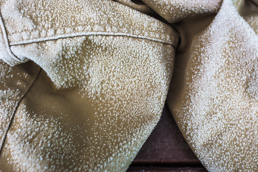
Sun worn wood texture.
Scrub oak and setting sun, the colors of California.
Sunset over San Bernadino National Forest, mile 282.3.
May 22, Day 18
27.8 miles [310.1]
New longest day at 27.8 miles in addition to crossing the 300 mile-marker! Got decent sleep, started hiking by 7 a.m. Didn't talk much with the group, knees felt good so I just kept moving. At one of the Deep Creek Canyon crossings there was a collapsible ice-chest with fresh apples and caramel which was quite refreshing in the afternoon heat. Most of the day just went by until Adam and I arrived a the Deep Creek Hot Springs. I soaked my feet and cleaned off the past few days of dust and sweat in the soothing, warm water. We waited for an hour but our group didn't show up. With daylight left and camping at the hot springs illegal, we did a few more miles while dusk settled in. Finished the day with tuna taco and avoided mosquitoes. I guess they exist in the desert too. Bastards.
My worn hand from using a hiking pole.
Sunset over Deep Creek, mile 310.1.
May 23, Day 19
25.5 miles [335.6]
Another 25-plus mile day. Had a Snickers and washed my feet on the last crossing of Deep Creek. Made great time and managed 18 miles to Silverwood Lake where we stopped for lunch. I'd noticed over the past few days Adam has been quieter than usual, his playful snarky demeanor replaced with quiet somberness. It was bumming me out. I inquired and he told me he wants more independence, something I'm shocked I didn't realize sooner. We left the lunch spot, not saying another word. I guess I could do this hike alone—I just don't want to that badly. Bad thoughts. It was hard to think about anything else for the remainder of the day. Only the hope of tomorrow's McDonald's was enough to keep my legs moving. We set up camp, distant train horns filled the still air every 20 minutes. While eating dinner, we met “Kickstand” who mentioned he's working on a calendar year triple crown. It took me a few moments to realize the extent of his plans. “Mind if I crash your campsite?” he asks, taking off his pack and pulling out dinner. We both nod, tired from the days efforts. “Man, it's so cool that you guys are doing this. My brother would bitch and moan about Tuna Creations or filtering water.” Nervously laughing, I found myself holding back tears. It had been an exceptionally hard day.
Cleghorn Mountain, outside of Big Bear, mile 331.8.
The last crossing of Deep Creek.
Abandoned used pair of shoes.
A band of quartz, mile ~312.
Cedar Spring dam, mile 324.
May 24, Day 20
26.1 miles [361.7]
Today hurt the most since it was our third day in a row doing over 25 miles—but I'm still stoked. Woke up covered in dew which made me nervous about packing away my quilt. Made it to McDonald's like it was the last mile of the Boston Marathon. When we arrived we saw “Kickstand” impatiently waiting, he begrudgingly mentioned it was closed due to a power-outage. Also waiting were two other hikers, Will and “Two for Two”. With all layers on we waited in the damp clouds watching tourists and commuters get out, throw a small fit their Micky-D's was closed, and drive off. I wanted to inform them this was our only water source for another 21 miles. After an hour, they finally opened. I ordered a McMuffin, two hash browns, two sausage burritos, and a coffee, devouring it quicker than it took to make. Will, wracked with hiker-hunger, had some trouble understanding exactly what was included in the combo meal, taking several laps with the cashier. I made sure to call him “Combo” for the rest of the day. A quick stop at the gas station for a beer to smash and one to pack out and we were back on trail. The clouds burned off and we were left hiking up a huge hill, hot, exposed, and buzzed. Had another tuna taco and the other Steel Reserve.
Agave americana, mile ~362.
Burn area and rebirth, mile ~360.
Hiking in the mist towards Cabazon, mile ~363.
Adam admiring an agave bloom, mile ~347.
Cajon Pass view, mile 343.4
Swarthout Canyon, mile 347.2.
Interstate 15 at Cajon Pass, mile 342.
May 25, Day 21
14.5 miles [376.2]
Woke up to an island in the sky—a huge bank of clouds covered the valley floor—and saw where we were five days ago. Took a relaxing snack break on the Discovery chair lift at Mountain High. Hitched into Wrightwood and got a free hot dog with fixin's at the market. Resupplied at Jensen's, then celebrated our hard work with a BBQ chicken pizza from Mile High splurging for cinnamon twists, what the heck. Got a ride out from Ed in his BMW 328i and tried to levitate over his leather seats. Neglected to fill up water and found myself needing more only a few miles after starting. Made a naive call to filter water at Jackson Flat which was off trail and probably not necessary. Adam wasn't thrilled. Aimed to get as close to Mount Baden-Powell as possible; the cool evening air made the ascent far more enjoyable. Cloud cover which had hung out all day suddenly began to glow with the setting sun. Rich cotton-candy hues filled the fog around me. It's going to be a cold night.
Pinus lambertiana, sugar pine, mile ~376.
Ascending Mount Baden-Powell, mile ~376.
Vincent Gap, highway 2, mile 374.
Hike On?

The Road Trip Day 6: Badwater, Good Vibes
Holy cow, it was FREEZING. I don't know which was more of a struggle: storing my DSLR at the bottom of my sleeping bag, or...

Death Valley National Park, California
May 12, 2015
Holy cow, it was FREEZING.
I don't know which was more of a struggle: storing my DSLR at the bottom of my sleeping bag, or using two hay bales as a mattress. I got absolutely zero sleep.
Dawn was at 6:30 a.m. We hustled to pack our belongings while attempting to stay warm. Caleb had to summon a bit of courage to put on his pants—they were completely covered in frost!
We had a long drive ahead of us.
Frigid britches.
So, we started driving, stopping only for a Costco pizza in Bakersfield, California.
Through the middle of nowhere, down roads I didn't think would be healthy for any car's suspension, we drove. About six hours later we arrived at Badwater Basin, the lowest point in North America.
Finally, it was warm once again!
It's 282 feet below sea level. The sign was so tiny. Hard to imagine that much water being above my head. And all around me.

The sign in the top left says, “sea level”.
The main reason our drive took so long was to navigate around Mt. Whitney which ironically is the highest point in the contiguous US. Both extremes lie less than 100 miles from each other.
Weird.
We also made a stop at Artist's Palette.

We can't stay for very long.
A sign informed us the color in the rocks comes from oxidizing metals.

I'd visited before on a family vacation many years ago but since forgotten just how vivid the colors were.

What an alien world.
We stopped for a quick group shot before exiting the park.

Feeling artistic at Artist's Palette.
It was another 175 miles to our destination outside of Las Vegas.
Seven hours down, two to go. We continued driving.
Hey, want a ride?
Turn it around:
Stick your thumb out:
About the Blog

Justin Kernes is a photographer and writer who thrives in the great outdoors.
From 2010-2017, he worked in the backcountry at Philmont Scout Ranch in New Mexico.
In 2018 “Tiny Slice” successfully thru-hiked the Pacific Crest Trail.
Search the Blog
Featured Posts


Photos and stories from my thru-hike of the PCT. This post covers day 111, Goat Rocks and my 30th birthday.