
PCT Thru-Hike: By the Numbers – Time, Cost, and Tuna Packets
In 2018, I thru-hiked the Pacific Crest Trail. Here are the stats, the aftermath, the by-the-numbers account of my time on trail.

In 2018, I thru-hiked the Pacific Crest Trail with my brother, “Shocks”. I kept a fairly rigorous account of my trail experience, purchasing everything on my credit card so I could track spending. I journaled every night, noting mile number and time. Whether you’re looking to gain insight for your next hike or if you want to relive the good days spent on trail, keep reading. Here are the stats, the aftermath, the by-the-numbers account of my time on the PCT.
Other Blog Topics
Planning | Analysis | Gear Review
Trail Analysis
Here’s a by-the-numbers list of some of the quantitative aspects to my hike. I need to thank “Froggy’s” parents for two nights in a hotel in Ashland, I definitely could have gone further on my longest day, and the hitches always worked out.
Start: May 5; Campo, California.
Base weight: 15.5 pounds
End: September 11; Manning Park, Vancouver, Canada
Base weight: 14.8 pounds
Total Miles Hiked: 2,746
130 days
Total PCT Miles: 2,533 (87.4 of closure)
Reroute Miles: ~67 (designated PCT)
Skipped Miles: 31.7 (Day 11, mile 151.8 to 183.5)
Extra Miles: ~115 (side-hikes and leaving trail)
Longest Day: 35.0 miles (Day 68, mile 1216-1251)
Average Miles/Day: 21.13
Highest 3-day Avg: 31.53 mpd
Highest 7-day Avg: 29.17 mpd
Approx. Avg. Moving Speed: ~2.27 mph
Zeros: 9 (and a glorious double-zero in Cascade Locks)
Neros: 9 (less than 11 miles)
Hitches: 49
Nights in a Hotel: 5
Resupplies: 27
Boxes Sent: 10
Longest Span Without a Real Shower: 43 days
Longest Span Without a Real Bed: 44 days
Bucket and Civilized Showers: 11
Bucket and Machine Laundry: 14
Tuna Tacos: ~56
Pairs of Shoes: 2
Katadyn BeFree Filters: 3
Fire Reroutes: 4
Photos Taken: 3,421
Resupply Stops
On average, every 4-5 days you’ll want to pick up more food; resupply. These seemed like popular options from previous years. Bolded towns are places we sent resupply boxes.
California
Julian, mile 77.3
Warner Springs, mile 109.5
Idylwild, mile 179.4
Big Bear, mile 266.1
Wrightwood, mile 369.3
Agua Dulce, mile 454.5
Tehachapi, mile 566.4
Kennedy Meadows (South), mile 702.2
Bishop, mile 788.5
Mammoth Lakes, mile 906.6
Tuolumne Meadows, mile 942.5
Kennedy Meadows (North), mile 1016.9
South Lake Tahoe, mile 1090.7
Sierra City, mile 1195.4
Chester, mile 1331.3
Burney Mountain Guest Ranch, mile 1419
Mount Shasta, mile 1501.2
Etna, mile 1599.7
Oregon
Ashland, mile 1718.7
Crater Lake, mile 1820.9
Shelter Cove, mile 1906.6
Sisters, mile 1983.7
Washington
Cascade Locks, mile 2146.6
Whites Pass, mile 2294.9
Snoqualmie, mile 2393.1
Skykomish*, mile 2464.2
box was stuck at PO, we hitched to Gold Bar and purchased food.
Stehekin, mile 2571.9
Cost Analysis
For my first thru-hike, I certainly learned a ton of lessons. After the fact, it looks like I spent well-above the average hiker. However, the following analysis should provide some clarity.
How much does it cost to hike the Pacific Crest Trail?
Where My Money Went
It cost me $5,700.
Your results will vary. Research told me to prepare $4,500, but I saved a bit more for three reasons (listed below). A year prior, I knew I was going to hike the trail, so I began saving my money. Preparing in this aspect took a full year mostly because I earn very little as a seasonal employee.
- Here's an entire blog post dedicated to planning, preparing, and problem solving for the PCT.
Three Reasons I Spent $1,775 More:
New Phone
My iPhone 5c, lovingly used since 2014, barely held a charge for an entire day in civilization. By all accounts, I was going to be listening to podcasts, taking photos, and using GPS for maps and water sources fairly regularly; it was clear I needed a new phone.
So after a week of online shopping, I bought lightly used iPhone 7+ and an Otterbox case totaling $422. Should this count towards trail or life expenses? I could have gotten another year or so out of my 5c, so I guess this was an unavoidable cost.
The phone was physically too big. It served me great, but the lack of a headphone jack was the cause of many frustrations.
Sunglasses
Mom and Dad shouldn’t take this the wrong way, but our family isn't one which purchases 'luxury items'. I'm eternally thankful I was taught the value of money. However, I spent a disgusting amount on a pair of sunglasses. Correction: superawesome-steampunk-jetpilot sunglasses complete with prescription lenses.
I went all out. My thinking was 1) good glass is always worth it (quoth the photographer) 2) my eyes are really important 3) I will exist outdoors all day, every day. So I found a style I didn't tolerate, but loved, and Adam showed me a great company for custom lens replacement. They arrived the afternoon before I left! All in all, I spent $365 on my shades. I don't regret it in the least, but that's still hard to justify to this day.
Camera
My relationship with photography is complicated, but I can confidently say it will always be in my life. I knew I needed a dedicated camera, just a phone camera wasn't going to cut the mustard.
After much level-headed research (luxury items be damned when buying cameras), I purchased a refurbished Canon SL2 and three lenses. My full kit for the trail cost $988 which is a lot. Period.
- An in-depth camera review will be posted later.
Since these items are in a gray area, they will be left out of further calculations entirely.
With that said, here's my cost breakdown for hiking the Pacific Crest Trail in 2018.
Gear Costs
Even though I had plenty of prior backpacking experience, I didn't have any gear suitable for thru-hiking. The only items I didn’t purchase were: beanie, pocket knife, buff, and legs base-layer. Most of my gear which returned home could survive another 2,000 miles or more.
Gear Cost Total: $1,879
Spent Before Trail: $1,468
$1,775 not included due to reasons listed above.
Spent During Trail: $411
Pair of shoes, two shirts, pants, two water filters, Z Lite, and $32 in postage mailing gear back home.
Estimation of value in surviving gear: ~$850
Big Three, some clothes, headlamp, and power bank.
Estimation of gear 100% consumed: ~$410
Two shoes, three water filters, two shirts, Z Lite pad.
- Here’s a comprehensive review of the gear I used on trail.
Food Costs
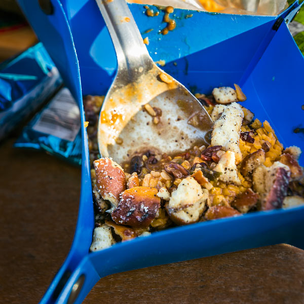
There are two types of food. For the majority of the time, I ate food like tuna tacos, cold-soaked Knorr sides, or tortilla mélange held together with peanut butter; trail food. And while you eat that food and hike all day, you’ll constantly dream about the second type; town food. Burgers, pizza, burritos, and endless ice-cold beverages.
Food Cost Total: $1,685
Resupply Costs (trail food): $865
Tuna, peanut butter, cookies, goldfish, Pop-Tarts, tortillas, olive oil, Chili Cheese Fritos, Crunchy Flamin’ Hot Limón Cheetos, and fruit snacks.
Meals out (town food): $700
Coffee, burgers, brunches, buffets, burritos, ice cream, pizza, fast food, sodas, and a few beers.
Booze: ~$120

A fairly standard resupply outside Tehachapi, CA. Too many crackers, not enough candy.

(L-R) “Shocks”, “Combo”, and “Trash Bath” enjoy burgers and beer in North Kennedy Meadows, CA.
Additional Notes
I managed to keep my miscellaneous purchases to a minimum for a few reasons. Because of Adam’s great research, we avoided paying package pickup fees for most of our resupplys. Additionally, two stints of 40+ days without buying a hotel also helped. Lastly, we had a friend drop us off at the southern terminus and only needed a cheap flight from Vancouver back to California.
Additional Cost Total: $368

Even though a room at Harrah’s sounded enticing, we found a place to stealth nearby.
Phone plan: $108 (May through August)
Entertainment and fees: ~$80 (Incredibles 2, Hostel California, various campsite fees, package pickup)
Transportation: $180 (train ticket to southern terminus, flight from northern terminus)
Bonus! +$+
Huge thanks to Mom and Dad who paid postage for our 10 resupply packages. Adam and I each saved roughly $100 from their generous support.
They also visited us at three locations: Big Bear, Kennedy Meadows (South), and Cascade Locks. They offered us full support, even paying for a hotel two nights. They are true Trail Angels.
Final Thoughts
I don’t have any regrets in the slightest.
I know I spent more than the average hiker and I’m perfectly fine with it. I saved all summer. I worked my ass off in the winter. I splurged on gear which has some lasting value past burgers and beer. I avoided hotels because I knew no matter how nice they felt in the moment, I would remember my nights on trail getting chewed by mosquitoes, not nights spent under fresh sheets. I rarely said no to a huge meal in resupply towns.
“Money is like dirt; one good rain and it’ll all wash away.” - Jean ”Bubbe” Kernes

The Road Trip: Three Friends Tour America's West
For the better part of the last three months, Carter, Caleb, and I have been planning a two-week long road trip throughout the western United States.

Brea, California
May 6, 2015
I can't wait for tomorrow.
For the better part of the last three months, Carter, Caleb, and I have been planning a two-week long road trip throughout the western United States. Every stagnant pause at the dinner table, every quiet car ride around town, all of my available thinking time has been dedicated to this trip.
You could say I'm excited.
Just a little bit.
Here's an overall map and where we plan on staying. Quite a swath of land to discover in only 13 days. (Click image to enlarge)
Although we intend on having a fair bit of time for relaxing, our itinerary has been rigorously planned, every roadside attraction has been accounted for. But as you can see, our main goal is visiting National Parks.
List of our upcoming attractions:
Yosemite National Park — Days 2 & 3
Sequoia & Kings Canyon National Parks — Days 4 & 5
Death Valley National Park — Day 6
Zion National Park — Days 7 & 8
Bryce Canyon National Park, Capitol Reef National Park, and Grand Staircase-Escalante National Monument — Day 9
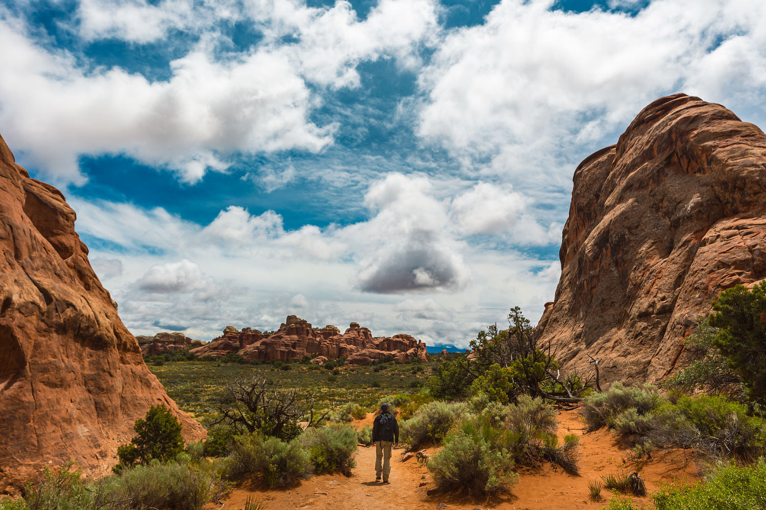
Arches National Park and Dead Horse Point State Park — Day 10
Canyonlands National Park — Day 11
Mesa Verde National Park — Day 12
At 2 p.m., a thunderous knock came from the front door.
My heart was pounding in my ears. I opened the door to find two goofy grins staring back at me—Carter and Caleb. The three of us met when we worked for Philmont Scout Ranch in the summer of 2013 at Sawmill camp. We quickly became close friends that season.
As for proof, a goofy pic of our entire staff.
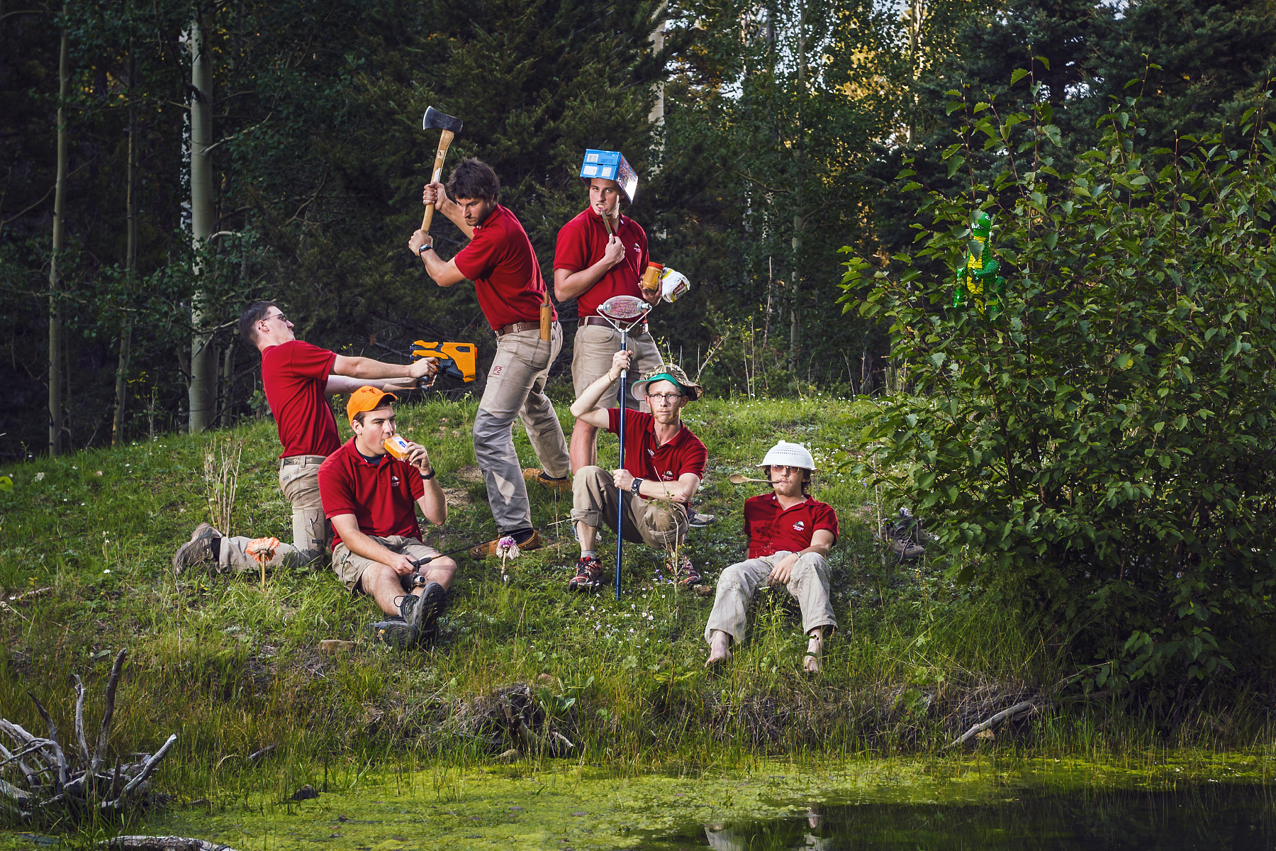
Caleb Jennings is the hippy without shoes, Carter Smith is the giant with a 3/4 ax, and I'm the imp with a nut-collector. Yep, what a crew.
The three of us went out for dinner and drinks; a celebratory commencement.
We came back home for ice cream and a living room showing of Reservoir Dogs.

My duffels are packed, my goodbyes to my family have been said. After much anticipation and waiting, the time has come.
Wheels up, 7 a.m.
Tomorrow, it begins.
The Road Trip has started.
Hey, want a ride?
Stick your thumb out:

The Road Trip Day 1: Barefoot in Monterey
6:37a.m.; I beat my alarm clock by three minutes. A softly rising sun streamed through my bedroom window while I quickly dressed. Coffee brewed and poured...
Pacific Coast Highway, California
May 7, 2015
6:37a.m.; I beat my alarm clock by three minutes.
A softly rising sun streamed through my bedroom window while I quickly dressed. Coffee brewed and poured, and with a few more weepy goodbyes from my parents, we piled in the car and headed off.
Opting for the scenic route, we chose to drive along California's famous highway, the Pacific Coast Highway, or as hip locals say, “the P-C-H, dude”. Miles evaporated while excitement and tunes freely flowed throughout our vehicle.
Lunch time sped up on us.

Pizza lunch on a table in San Louis Obispo, California.
After a quick reference from Yelp, we pulled off the highway and headed for Pizza Solo in San Louis Obispo. We opted for a bacon, chicken, and pepperoni pie. #treatyourbodylikeatemple. It got snarfed down immediately.
Back on the road.
We headed further North. With Los Angeles a considerable distance in the rear-view mirror, heavier and darker clouds began to permeate the sky.

After another hour and a half, it was time to get out, stretch our legs, and check out the beach.


A peaceful moment at Arroyo Laguna State Beach.
It was a spectacular afternoon.
This is the first time I have ever traveled along the PCH. California natives, mostly retirees, regularly discuss driving its entire length.
There was no shortage of amazing coastal scenes. Mile after mile of winding and soothing coastline filled the windows.
Here's an excerpt from my journal:

“The [trees] looked a lot like snarled Bristlecone pines. Dunes and mountains were covered in colorful native brush. Steel blues, muted mustards, and olive grasses adorned the rolling hills. The entire time, hugged by the crushing ocean—jagged rocks breaking through the madly frothing surface of sapphire and turquoise foam.”
Another hour of winding and cruising later, about 70 miles before our hotel, we made one more stop.
There weren't any signs, but there was a large pull-off area on the opposite shoulder. We parked, hopped out, and inspected our surroundings.

What a scene to be rewarded with.

The three of us silently stood still and enjoyed a cool sea breeze. A gentle rumble of breaking waves below us kept an even tempo.
Carter gently reminded us we still had a bit farther to go.

A unique erosion control method.
We arrived at our hotel just as it stopped sprinkling. After a quick unpacking, we went downstairs seeking dinner recommendations. The lobby had complimentary wine and cheese.
Dinner options were within walking distance. Not soon after setting out, my homemade moccasins were thoroughly soaked from the soggy pavement.
I removed them. Socks too. The concrete was cool and wet.
We continued searching for something other than pizza.
Hey, want a ride?
Turn it around:
Stick your thumb out:
The Road Trip Day 2: Foggy Mountain Monoliths
Woke up with yesterday's cloudy skies still hanging around. The coastal air was crisp. We packed up and drove with the windows...

Yosemite National Park, California
May 8, 2015
I woke up to yesterday's cloudy skies still hanging around. The coastal air was crisp.
We packed up and drove with the windows down. Today's journey was less than 200 miles and we had a camping reservation. The goal was to head out early, take our time, and enjoy the views.
Slowly, we gained in elevation. The temperature kept dropping.

Welcome to Fish Camp.
It was cloudy and ominous all day.
Upon arrival at Mariposa Grove, we were surprised to find at least three inches of snow on the ground. Water dripped from the trees, plunking loudly on our car's roof. We each took turns peering through the sunroof watching large droplets splash on the glass.

We got out and took a walk.

It was cold!
Yesterday's overcast delight spoiled me. I hope I brought enough warm clothes for the entire trip.

Caleb Jennings enjoying the cool air at Mariposa Grove.


With temperatures hovering in the mid 30's, there was talk of finding an alternate plan. We were not prepared to camp in the snow.

The decision was to find and rent a room for the next two nights. After all, we are on a vacation.

Headed to Tunnel View via Wawona Tunnel.
After exiting the park, we found a room with a reasonable rate. Camping would have been rough; my sleeping bag is only rated to 20 degrees.
Dinner was Mountain House pasta primavera and a generous glass of whiskey. I lost two cribbage games.
Tomorrow's plan is to hike the Mist Trail.
Hey, want a ride?
Turn it around:
Stick your thumb out:

The Road Trip Day 3: 7,200 Feet of Granite
It was easy to get up this morning. I appreciated the lack of snow. A head poke outside revealed beautiful blue skies.

Yosemite National Park, California
May 9, 2015
It was easy to get up this morning. I appreciated a lack of snow. A head-poke outside revealed beautiful blue skies. What luck!
After a short drive to Happy Isles trailhead, we hopped out, laced up hiking boots, got water filled, and applied sunscreen.
Ready.
Although it was steep, we breezed past the majority of heavily panting visitors.
About 1.5 miles, 1000 feet of elevation gain, and 600 stone steps later, we arrived at the top of Vernal Fall.

We found a comfortable rock and took a water break at the top.
I snapped a quick group shot.

Switchbacks are my favorite.
However, we didn't stop for long. Nobody wanted to hike in the heat of the day. Duh.
Up, up, up.
It was a steady incline the entire way.


Caleb at Clark Point.
Four miles later, we arrived back at the parking lot. Sweaty.
With time left in the day and not wanting to hike 3,000 feet up out of the valley floor, we jumped in the car and drove all the way around to Glacier Point.
Carter locked the car and the three of us waded through the crowd, politely waiting our turn for a view from up against the railing.

View of Upper and Lower Yosemite Falls from Glacier Point.
As luck would have it, a massive cloud eclipsed Half Dome and hung around for the duration of our stay.
Half Dome was half-visible.
I felt cheated, but on the other hand, it was a unique view.
Guess I'll have to return someday soon.

No, 'Cloud's Rest' is the other mountain!
Tired and hungry, we exited the park.
Caleb suggested a quick stop at the general store for some dinner additions. Once back at our room, Carter found some tunes, and I prepped dinner.
Whiskey was poured.

I had a big bowl of vegetarian stew out on the deck and watched sunset.
Tonight is our last night in Yosemite.
Hey, want a ride?
Turn it around:
Stick your thumb out:

The Road Trip Day 4: Whiskey and Stars
I packed my things swiftly. I've improved each day; junk-wrangling is getting more efficient. Carter made a final sweep, then it was off to...

Sequoia National Park, California
May 10, 2015

Caleb watching the passing landscape morph and change.
I packed my things swiftly. I've improved each day; junk-wrangling is getting more efficient. Carter made a final sweep, then it was off to Sequoia National Park.
The 120 mile drive didn't take long. Fields of orchards and farming land slowly turned into rolling hills with massive and elegant oak trees. California: as stereotypical as it gets.
Carter purchased his obligatory bumper sticker at the visitor's center, we got our overnight camping pass, and continued driving deeper into the park.
Conditions at the trailhead were ideal; cold mountain air and warm sun. After 20 minutes of rummaging through our thoroughly packed car, I had Frankensteined together an overnight pack. The three of us were ready to set off.
Man, we are slow, sweaty, sea-level bums!

Pausing for a quick breather.

Descending into lakes Heather and Emerald while looking across the Marble Fork Canyon.
The Lakes Trail was definitely strenuous.
For five miles we climbed upward and gained about 2,000 feet of vertical. Sure, I'm no couch potato, but carrying a backpack at 9,000 feet was exhausting for this non-acclimated landlubber. I probably should eat more snacks next time.
Much to our surprise, we finally descended into Emerald Lake basin which was our camp for the evening. Nestled at the base of a sharp and angular ridgeline, we began setting up camp. Snow-capped peaks completely surrounded the many tiny lakes.
Trees in Emerald Lake basin.
We didn't see another soul.

Tonight's dinner menu: Top Ramen—chicken flavor. The warm, salty broth soothed our aching bones.
Of course, a healthy serving of whiskey was helpful too.
We scrambled to a nearby overlook to watch the sunset. Completely clear skies lead to a wonderful display of alpenglow.
Slowly, the first stars of evening began twinkling in the lavender light.

The cliché about how well our 'hotel room' is rated.
The temperature kept dropping; you could feel the dismal cold outside the tent.
Inside, I was snuggled up in my bag, warm, and happy to have a hot Nalgene cozied up to my feet. Altitude made it difficult to get to sleep despite today's workout.
Tomorrow—a day to chill.
Hey, want a ride?
Turn it around:
Stick your thumb out:

The Road Trip Day 5: Shwackin' and Chillin'
Warm sunlight streamed in through our tent. Somehow, I managed to sleep until 8 a.m. Glorious...

Sequoia National Park, California
May 11, 2015

Gotta find ways to warm up in chilly, subalpine mornings.
Warm sunlight streamed in through our tent. Somehow, I managed to sleep until 8 a.m. Glorious.
I got dressed and found a few oatmeal and fig bars for breakfast
Today's objectives:
1) Relax.
2) Get (closer) to the car.
We scoured the rocky alpine landscape in search of a great view with some hammock-able trees.

Scouting out potential chill-spots.
Carter spotted a nice ledge about a quarter mile away. He had his hammock, Caleb had his Z-rest. I planned on finding a comfortable rock in the shade.
It was a nice spot.

He's gonna regret the sunburn.

Carter busting a fat chill.
Eventually, we snapped back to reality. Tomorrow's drive is going to be long; an early start will be a necessity. We needed to pack up camp and hike back toward the car.
Hiking downhill is a lot less work.
We made great time.
There was a quaint picnic area by the parking lot which seemed closed for the winter season. It looked like a great place for an easy impromptu campsite.
Stirring the pot; you don't want crunchies stuck to the bottom.
The three of us played a few games of cribbage. It seems like I'm losing more games than winning at this rate, but I did manage a 20-point hand. There was yelling.
Dinner was Santa Fe Chicken mixed with some fresh garlic and leftover cheddar cheese we found stashed in the car cooler.
Delicious.
With an empty parking lot and no one else around, we pumped the music a little louder than usual.
Yummy, crunchy.
Bedtime came with the arrival of darkness.
No tent, it looked clear enough.

Hay bales provide more insulation than a wooden floor. Right?
I tossed and turned the whole night. It was below freezing.
My hot water bottle didn't seem to do anything.

Wolverton Picnic Area at night.
Hey, want a ride?
Turn it around:
Stick your thumb out:

The Road Trip Day 6: Badwater, Good Vibes
Holy cow, it was FREEZING. I don't know which was more of a struggle: storing my DSLR at the bottom of my sleeping bag, or...

Death Valley National Park, California
May 12, 2015
Holy cow, it was FREEZING.
I don't know which was more of a struggle: storing my DSLR at the bottom of my sleeping bag, or using two hay bales as a mattress. I got absolutely zero sleep.
Dawn was at 6:30 a.m. We hustled to pack our belongings while attempting to stay warm. Caleb had to summon a bit of courage to put on his pants—they were completely covered in frost!
We had a long drive ahead of us.
Frigid britches.
So, we started driving, stopping only for a Costco pizza in Bakersfield, California.
Through the middle of nowhere, down roads I didn't think would be healthy for any car's suspension, we drove. About six hours later we arrived at Badwater Basin, the lowest point in North America.
Finally, it was warm once again!
It's 282 feet below sea level. The sign was so tiny. Hard to imagine that much water being above my head. And all around me.

The sign in the top left says, “sea level”.
The main reason our drive took so long was to navigate around Mt. Whitney which ironically is the highest point in the contiguous US. Both extremes lie less than 100 miles from each other.
Weird.
We also made a stop at Artist's Palette.

We can't stay for very long.
A sign informed us the color in the rocks comes from oxidizing metals.

I'd visited before on a family vacation many years ago but since forgotten just how vivid the colors were.

What an alien world.
We stopped for a quick group shot before exiting the park.

Feeling artistic at Artist's Palette.
It was another 175 miles to our destination outside of Las Vegas.
Seven hours down, two to go. We continued driving.
Hey, want a ride?
Turn it around:
Stick your thumb out:

The Road Trip Day 7: Colorful Explosion
After yesterday's long haul, it felt nice to take things a little slower. A shower, an opportunity to do laundry, and a bagel with some schmear…

Zion National Park, Utah
May 13, 2015
After yesterday's long haul, it felt nice to take things a little slower.
A shower, an opportunity to do laundry, and a bagel with some schmear hit the spot. Most of the morning was spent talking with our friends who graciously let us crash for the night.
I realized this was the halfway point of our journey.
It was hard not to.
We packed up, said our see-ya-laters, and set out for the day.

Spending some quality time getting to know the Veterans Memorial Highway, also known as I-15.
Roads remained clear the entire way to Zion National Park.
For 150 miles, we meandered up I-15. Apparently, it continues all the way to Canada. Perhaps I'll drive its entirety one day.
The portion we covered was magnificent. Here's an excerpt from my journal:

Click here to view this in Google Street View.
“Succulent cottonwoods adorned wrinkled slot canyons, their crevices filled with sagebrush and rubber rabbitbrush; a colorful explosion.”
Virgin River Canyon Campground looks like a great place to spend a night or three.

Carter is on a hot streak.
We arrived in Zion, got our campsite, set up, and hopped on the shuttle for a quick tour of the canyon floor. It was a great way to get an idea of what we want to do tomorrow.
After the tour we caught another shuttle, this time to Springdale for “hors d'oeuvres and aperitifs”.
Back at camp, chili gently simmered away while we played a few more hands of cribbage and had our chips and beer.
I scavenged empty campsites for firewood. After a few trips, I collected enough unburned $16 firewood to use both nights we plan on staying. Score.
After dinner, I decided to take a walk around the campsites before it was time for bed. Carter informed us there's a 50 percent chance of thundershowers tonight through tomorrow afternoon. We are prepared but all of us are thinking dry thoughts.

Our neighbor's fire illuminated the cottonwoods in a mysterious manner.
Hopefully we don't end up hiking in the rain. I always seem to struggle at having fun in the rain.

Watchman Campground at night.
It looked clear out.
Hey, want a ride?
Turn it around:
Stick your thumb out:

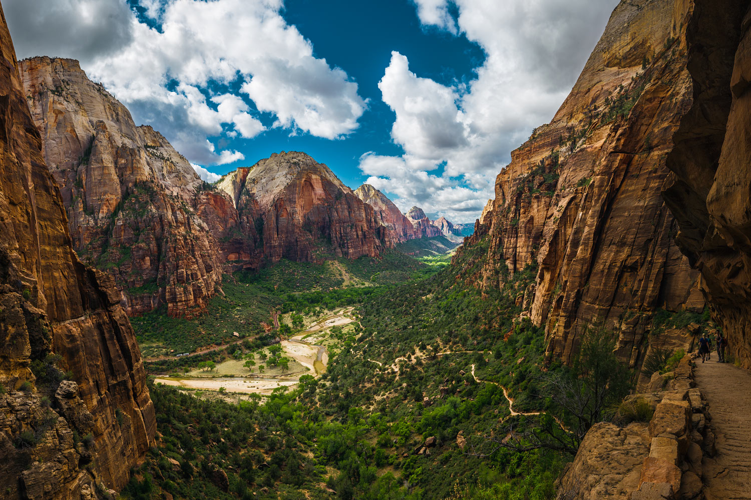
The Road Trip Day 8: Where Angels Land
At 5:27 a.m., some yahoo's car alarm went off. After tossing and turning, I gave up and got dressed. It was a great excuse to get an earlier…

Zion National Park, Utah
May 14, 2015
At 5:27 a.m., some yahoo's car alarm went off.
After tossing and turning, I gave up and got dressed. It was a great excuse to get an earlier start than previously planned.
I shimmied on my clothes and hopped out of the tent. Much to my surprise, I found clear skies. The three of us assembled our day packs and filled up water bottles. Last night, we decided to climb Angels Landing, easily one of the most iconic Zion attractions. The Grotto Trailhead was only a 20-minute drive away.
At 8 a.m., in the cool of morning, we began our five mile hike.

Basically a 500 foot fall on either side with only a narrow rock path to stand on. Oh boy!
1,500 feet, up, up, up. We climbed.

I wonder how old this tree is. I wonder how many people have touched it. It must see some amazing sunrises.
I enjoyed my time up at the summit. It was just past 9 a.m. and it seemed clear we had beaten the majority of other hikers for the day. We shared the view with only four other people.
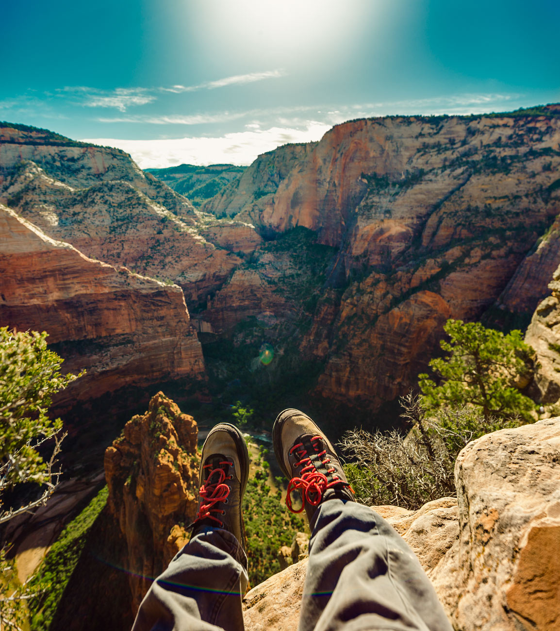
Angels Landing looking into Hidden Canyon.
It was grand.

After thoroughly enjoying the view, it was time to descend. I snapped a few more photos, applied some sunscreen, and we carefully climbed back down.

If you've done the hike, you certainly remember the chain-rope sections.
15 years ago on a family vacation, my dad and I, along with two other family friends did the same Angels Landing hike. I was stunned to find out how much I remembered from my last trip. My hometown barely looks the same, but each sharp switchback and twisting tree seems to be right were I saw it last.

Carter finds an alternate trail.

One of the 21 switchbacks on Walter's Wiggles.
Refrigerator Canyon was completely in shadow when we set off. On the way down however, the canyon floor was bathed in sunlight. It was a magnificent sight to behold.
The Great White Throne, Deertrap, Mountain of the Sun, Bridge Mountain, and The Watchman as seen from above Refrigerator Canyon.
As soon as we got back to camp, it began drizzling. Snacks, cribbage board, and Bluetooth speaker in hand, we retreated to the tents and lounged away the remainder of our afternoon.
We walked to town and searched for dinner options; no one was in the mood to cook. Nothing jumped out at anyone, so we settled on some quaint and kitsch diner which was cheap and quiet.
Back at camp, we had a small fire and passed the whiskey bottle around. We chatted until bedtime arrived.
Hey, want a ride?
Turn it around:
Stick your thumb out:

The Road Trip Day 9: Alien Landscape
I awoke at 7 a.m. sharp, rain began falling at 7:02 a.m. Packing up in a light sprinkle is rarely enjoyable, but it was something we had to do. At least…

Bryce Canyon + Capitol Reef National Parks, Utah
May 15, 2015
I awoke at 7 a.m. sharp, rain began falling at 7:02 a.m.
Packing up in a light sprinkle is rarely enjoyable, but it was something we had to do. At least we got clear skies for yesterday's hike.
Today's drive was one of the longer ones; we boogied to get camp broken down, car packed and refueled, and road snacks restocked.
We waved goodbye to Zion.

Click here to view this in Google Street View.
Light rain suddenly turned to flurries of snow. The storm we had narrowly been avoiding finally caught up to us.
Along the way we stopped at Bryce Canyon. The visitor's center was packed due to the crummy weather. We took a quick visit to the rim, but you couldn't see a single hoodoo; it was completely socked in. Carter got his sticker all the same.

A very limited and snowy view of Bryce Canyon from the Rim trail.
We pressed on.
A pretty common view along State Route 12.

Head of the Rocks Overlook, Utah.

Looks like we skirted the storm.
The scenery was sublime. State Route 12 might be my favorite road in the US—certainly top three.
We started to get ahead of the storm. Another pull-off caught our attention. “Head of the Rocks Overlook”, proclaimed a small sign. Massive, angry clouds traveled West.
We were headed East.

Caleb made a feline friend during brunch.
The Smith's family friend has a restaurant we were told could not be missed, so we skipped breakfast to save time and not spoil our appetites.
Hell's Backbone Grill had a charming rustic vibe. We looked over the menu and didn't take long. Caleb got French toast, Carter got a quesadilla, and I got shirred eggs with several cups of coffee.
It was pure heaven for our travel-addled bodies.

Quite the brunch spread at Hell's Backbone Grill.
We said our thank-yous and got back on the road once again. Capitol Reef was on our way to Moab; we couldn't resist a short stop at the visitor's center.
Carter's sticker-window is running out of real estate.

Chimney Rock and Mummy Cliff as seen from Utah State Route 24.
Tonight, we are staying at a cheap RV and campground spot in Moab. Hour after hour, our vehicular spaceship zoomed through the alien landscape.
We arrived at the River Oasis RV Park in Moab. Apparently, it has free WiFi, but I had trouble loading Google. Dinner was beef stroganoff with several additional cloves of garlic.
Tomorrow's plan is Arches.
Hey, want a ride?
Turn it around:
Stick your thumb out:

The Road Trip Day 10: A Million Square Miles
It was another drizzly, rainy morning. Having showered last night, we had no further obligations or desires to stay another night at the 'majestic' River Oasis RV park…

Arches National Park + Dead Horse Point State Park, Utah
May 16, 2015
It was another drizzly, rainy morning.
Having showered last night, we had no further obligations or desires to stay another night at the 'majestic' River Oasis RV park, so once more, we packed our belongings in the rain. It wasn't bothersome, hell, it rained less than yesterday.
On our way into the park, we stopped for fuel and snacks. I got another Frappucino, easily my fourth during this trip.
My day-bag practically packs itself now. We were ready to go in less than 30 minutes.

A pair of hikers taking a break along Delicate Arch Trail.
Delicate Arch is is in the middle of the park and it made sense to beat the possible crowds. After a short drive into the park, we got out of the car and onto a trail.

It looked just like the postcards.

Pine Tree Arch.

Tunnel Arch.
We also went to Pine Tree Arch, Tunnel Arch, and Landscape Arch. The park didn't seem the least bit crowded. Plus, the rain and clouds had started to clear, leaving us with some gorgeous views.
We spent the second half of our day at Dead Horse Point State Park.
Upon arriving at the parking lot, I promptly got out and rummaged through our swampy ice chest. Tailgate down, I made tuna salad; complete with celery, garlic, and capers. A small roadside-cafe van was selling lunch items, but most importantly, fresh espresso. I was beyond stoked.
I got my iced Americano and considered the day worthwhile.
The three of us munched under the shade of an awning. The sun was warm and the breeze was cool.

Refreshed, we walked up a small hill to check out the acclaimed overlook.

La Sal Mountains as seen from Dead Horse Point lookout.
I was genuinely stunned.
The three of us stared slack-jawed for quite some time.

We drove back into town and checked into the Lazy Lizard Hostel. Everyone was enamored with the place. After unpacking, we immediately booked a second night. It was that cool.
Showered, and with fresh clothes (not even previously worn), we went out for dinner at the Moab Brewery. It had rave reviews and a solid line every time we had driven by earlier. I had a patty melt with Swiss and mushrooms which was complimented well by an orange hef.
Back at the hostel, we continued our cribbage saga. There's no use in fibbing; I got demolished. It didn't matter, we laughed the entire game.
It kept me from remembering—only three days remain.
Hey, want a ride?
Turn it around:
Stick your thumb out:

The Road Trip Day 11: Fractal Canyons
I woke up on the floor earlier than I wanted to; I neglected to close the blinds. Light streamed into our tiny room. Not long after…

Canyonlands National Park, Utah
May 17, 2015
I woke up on the floor earlier than I wanted to; I neglected to close the blinds. Light streamed into our tiny room.
Not long after, my fellow compatriots were up and moving. Our plan was to check out Canyonlands National Park and word from our mutual friends told us to visit the southern half.
Needles District Visitor Center looked like a mirage from the distance. Why was there any structure built there? For the last 75 miles, this was the only man-made thing I saw other than the highway.
The nice park ranger said we would have a hard time passing up the Slickrock Foot trail. We parked the car and hopped out.

Caleb Jennings before his morning Gatorade.

Sprawling fractal canyons as far as I could see. Where were we? When? How? We schwacked over rocks, shrubs, and cyanobacteria. Apparently they're one of the oldest things on our planet.
We got hungry for lunch and aimed for the car. Our ice chest, beginning to take on some odor, had tuna salad fixings from yesterday.
Everything wrapped in tortillas tastes great.

Click here to view this in Google Street View.
There were a few short trail loops on the way out of the park; Roadside Ruin and Cave Spring. Both lived up to their names. For nearly half a mile we walked under eroded boulders. Moss and delicate ferns sprouted from the damp, weeping rocks.
Cleome lutea, or yellow beeplant.

A typical scene at Canyonlands.
We were surrounded by the oddest of tableaux.

Parched and tired, and with snacks no longer carrying their weight, we drove back into Moab. The brewery pulled us in. Beer and gelato was just the kind of refreshing treat we needed.
Back at the hostel, we took turns showering and checking the internet. I scrolled to see if I had any emails or if there were any dumb internet videos.
There were.
We tried to keep strong and remain frugal for dinner; dehydrated didn't sound delicious. It didn't work. We ordered a chicken-pesto pizza from a local shop. And garlic knots.
Also, I think Carter is cheating at cribbage. You can only get so many 16-point hands...
Hey, want a ride?
Turn it around:
Stick your thumb out:

The Road Trip Day 12: The Magnitude of Time
I was kinda bummed to wave goodbye to the Lazy Lizard Hostel. I had a sense that other guests before me felt the same way…

Mesa Verde National Park, Colorado
May 18, 2015
I was kinda bummed to wave goodbye to the Lazy Lizard Hostel. I had a sense that other guests before me felt the same way. With the last remaining arm-load of gear, we turned in the keys to the front desk and piled in the car.
Carter's friend highly recommended a brunch stop at the Wake and Bake Cafe. I had huevos rancheros in a buckwheat crepe. Pretty decent, could have used more salsa.
Today's drive was long, we covered at least 300 miles. We planned for a long stop at Mesa Verde National Park which was on the way.
The park entrance was quite mysterious.
Slowly, we gained in altitude. At some points the road hugged an escarpment; where were we going? We saw the visitors center and things began to make sense. With requisite stickers purchased we headed down a short trail to see the Spruce Tree House.

Spruce Tree House looks like one hell of a place to throw a party.
For nearly two weeks we had been getting accustomed to stunning landscapes and gorgeous vistas throughout America's southwest. It was odd, to say the least, to find myself viewing a small collection of ruins. Dare I say I was bored?
The best part was seeing how those people set up their establishment. It looked quite secluded and safe; if I stumbled on that 1,000 years ago, I would have set up shop.
We still had a lot of ground to cover.

Mountains and clouds somewhere in Durango, Colorado.
After an unmemorable stop at Subway, we arrived at a Super 8 motel in Alamosa; a far departure from last night's homey accommodations. It had a roof and Carter's dad covered our stay, though. I have to remember to write him a thank-you card.
Finishing the whiskey was a bittersweet moment. However, pegging for a win is an unfair highlight of my entire trip.
One more day left.
Hey, want a ride?
Turn it around:
Stick your thumb out:
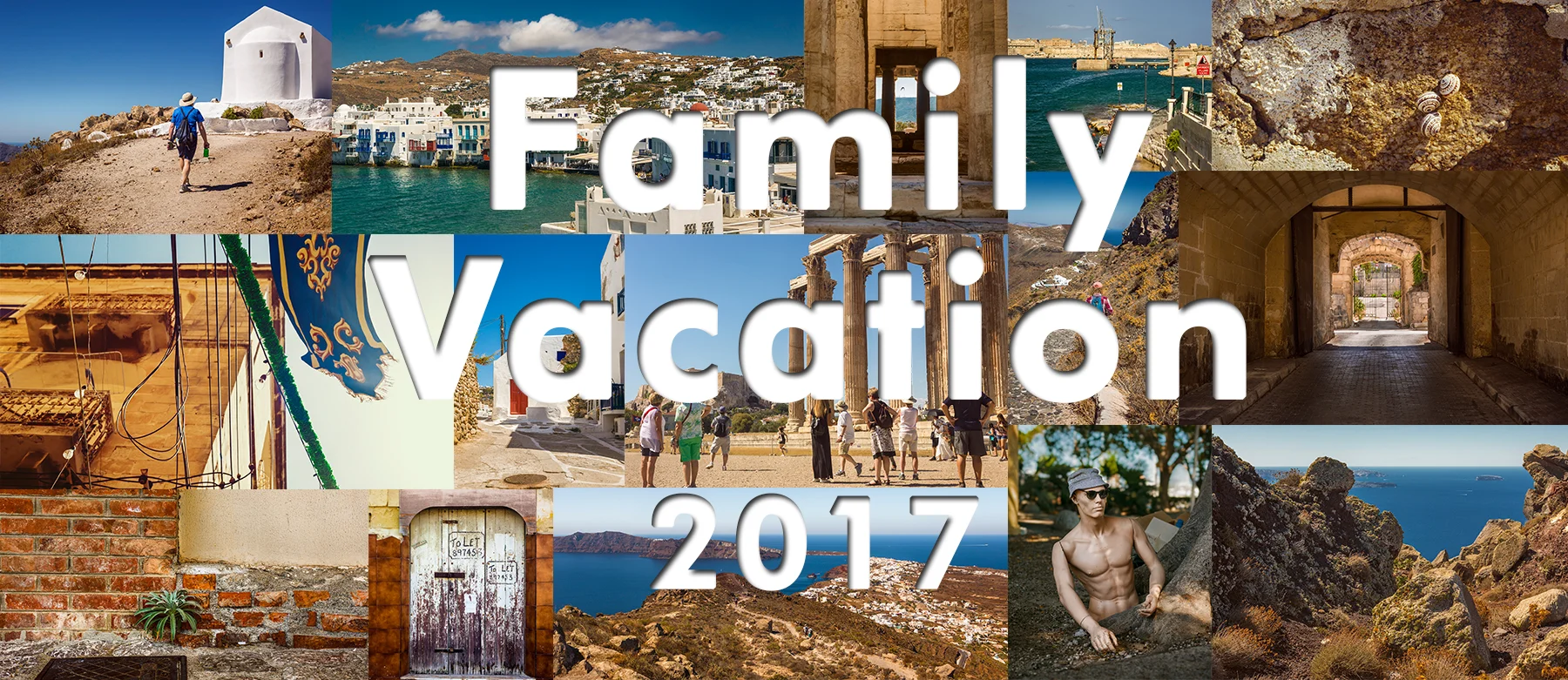
European Family Vacation Extravaganza, pt. 2
Towards the end of the 2017 summer the Kernes family took a vacation around Europe. Part 2 takes place during a 10-day cruise around the Mediterranean.

Family Vacation
Family Vacation 2017 - pt. 2
Towards the end of the 2017 summer the Kernes family took a vacation around Europe. Part 2 takes place during a 10-day cruise around the Mediterranean.
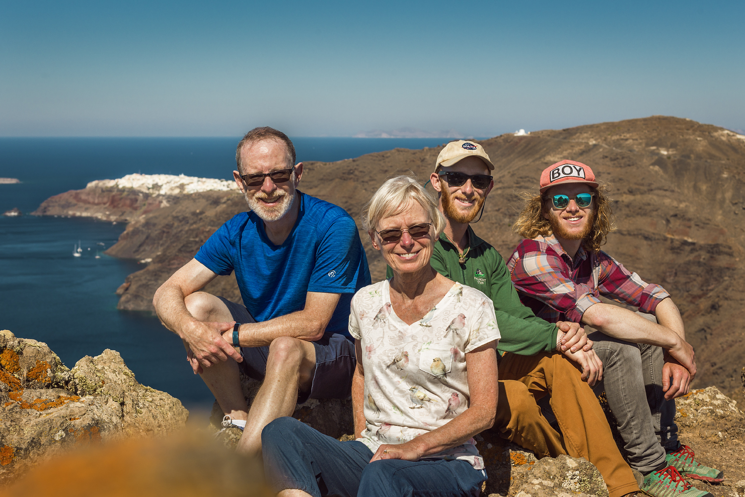
Steven, Amy, Justin, and Adam on the island of Santorini, Greece.
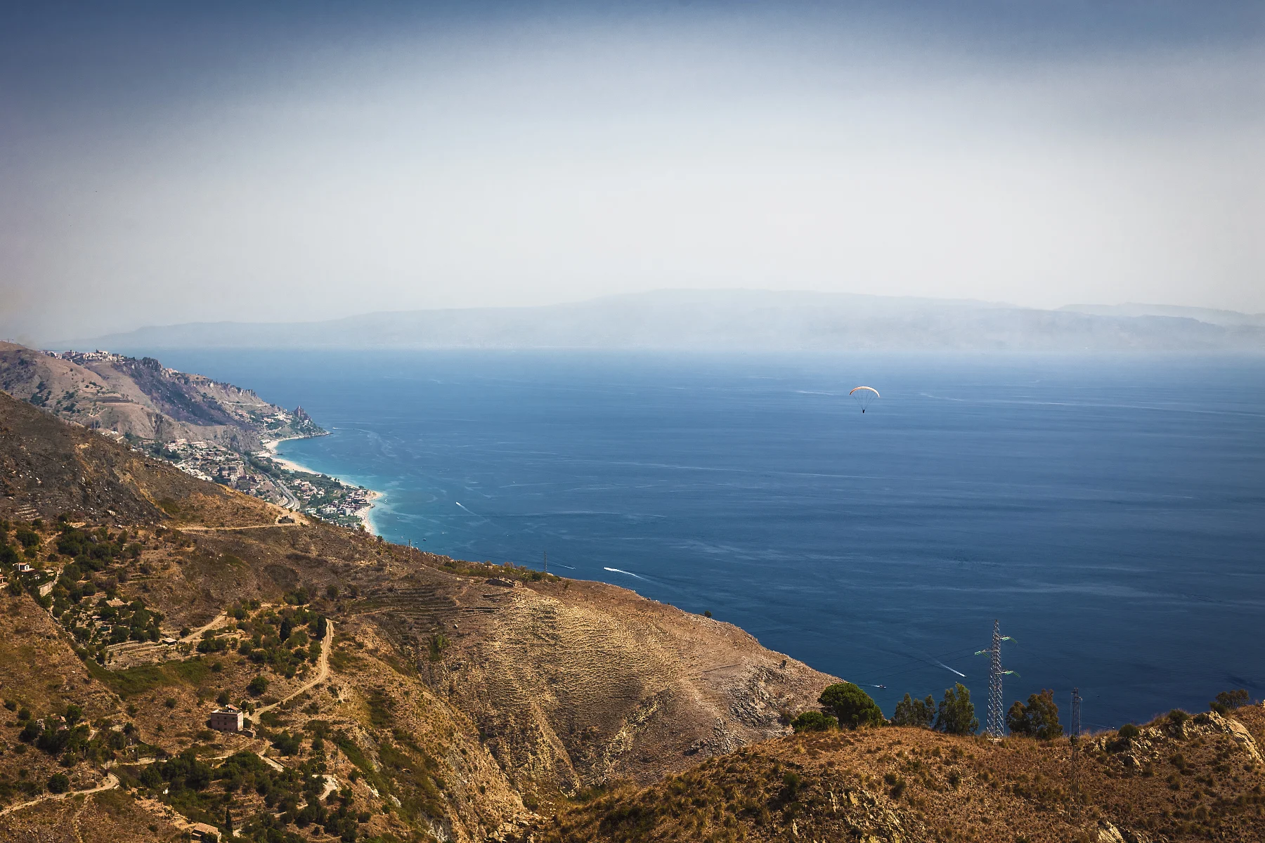
Messina, Italy
Saturday, September 2
My day started on the helipad as our ship pulled into the port of Messina. Blinded by early morning light, I tipped back my complimentary mimosa and went to get breakfast. Our tour was through the towns of Taormina and Castelmola, both of which are on the island of Sicily. There was an infamous and picturesque active volcano, Mt. Etna, but it was so hazy, the view from 20 miles away was almost unintelligible. Apparently there's a ski resort on the Southeast face. Bucket list: shred a volcano. The bus driver navigated through narrow stone streets and around petite compacts. If our tour guide had claimed he was a stunt driver on the weekdays, I would have believed her. Castelmola seemed to be straight out of a fairy tale; it was incredible. I stood on some ruins and looked out over the sea, trying to imagine what it would have been like to see invading ships coming for 'my land'. We walked through colorful alleyways constructed hundreds of years ago. Lunch was a real treat—authentic Sicilian pizza. The four of us split three 'zas with a unique highlight being a prosciutto, honey, walnut, and Parmesan pie.
Hang glider over Piazza S.Antonio in Castelmola, Italy.
Valletta, Malta
Sunday, September 3
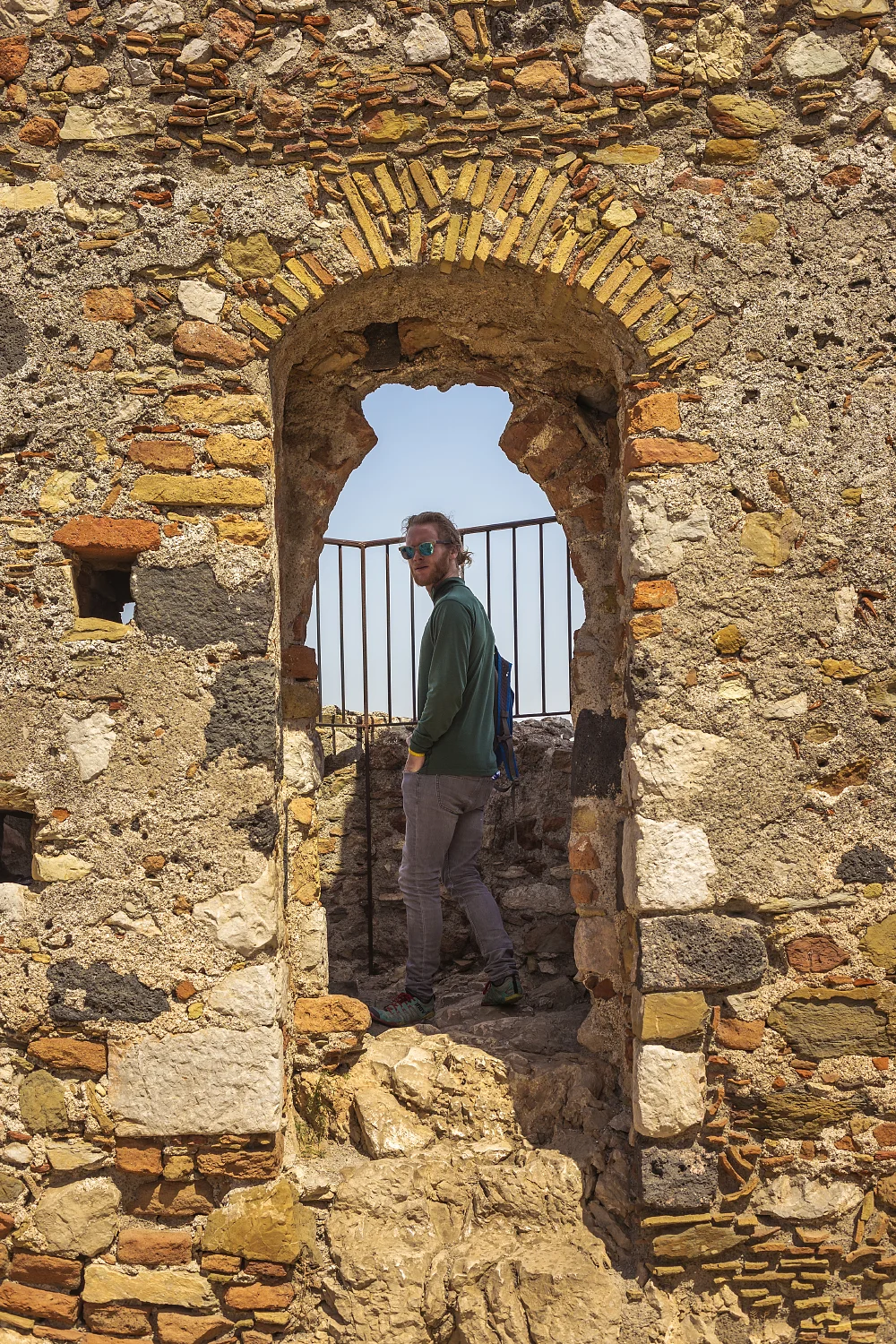
I bagged another new country today; Malta, just south of Sicily by a couple hundred miles. Our port was in Valletta and we took a ferry to neighboring city, Birgu; one of the many peninsulas on the island. We were scheduled for a informative golf cart tour around the city. Dad was handed the keys and we all given some instruction. Navigating new streets with an entirely different alphabet was little tricky—especially on the right hand side of the road. We all took turns driving and getting out whenever we pleased. It was a great way to see part of this country. Adam found a small stand selling beer by on of the quays. The water was littered with million dollar yachts.


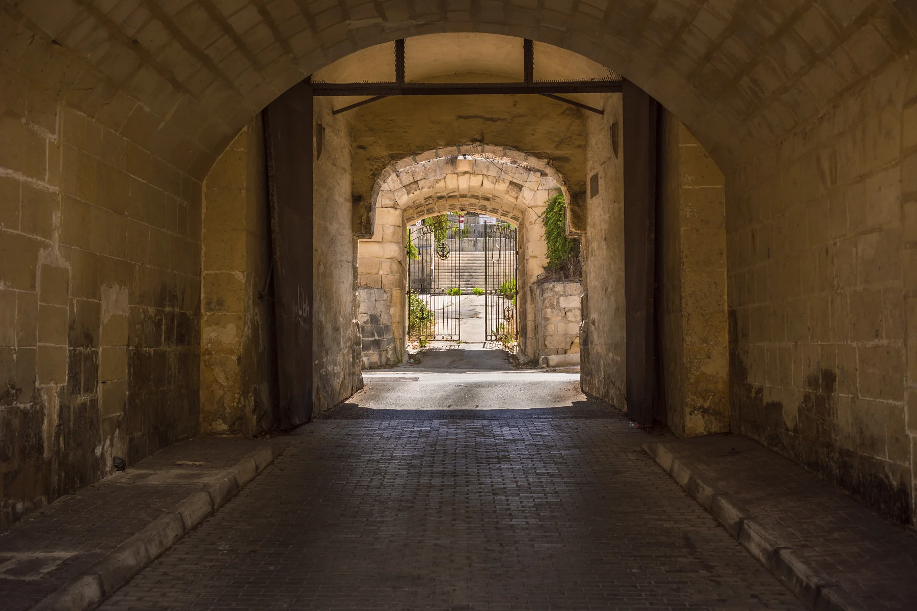
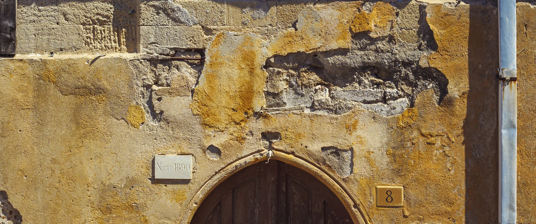
Stone archways in Birgu.
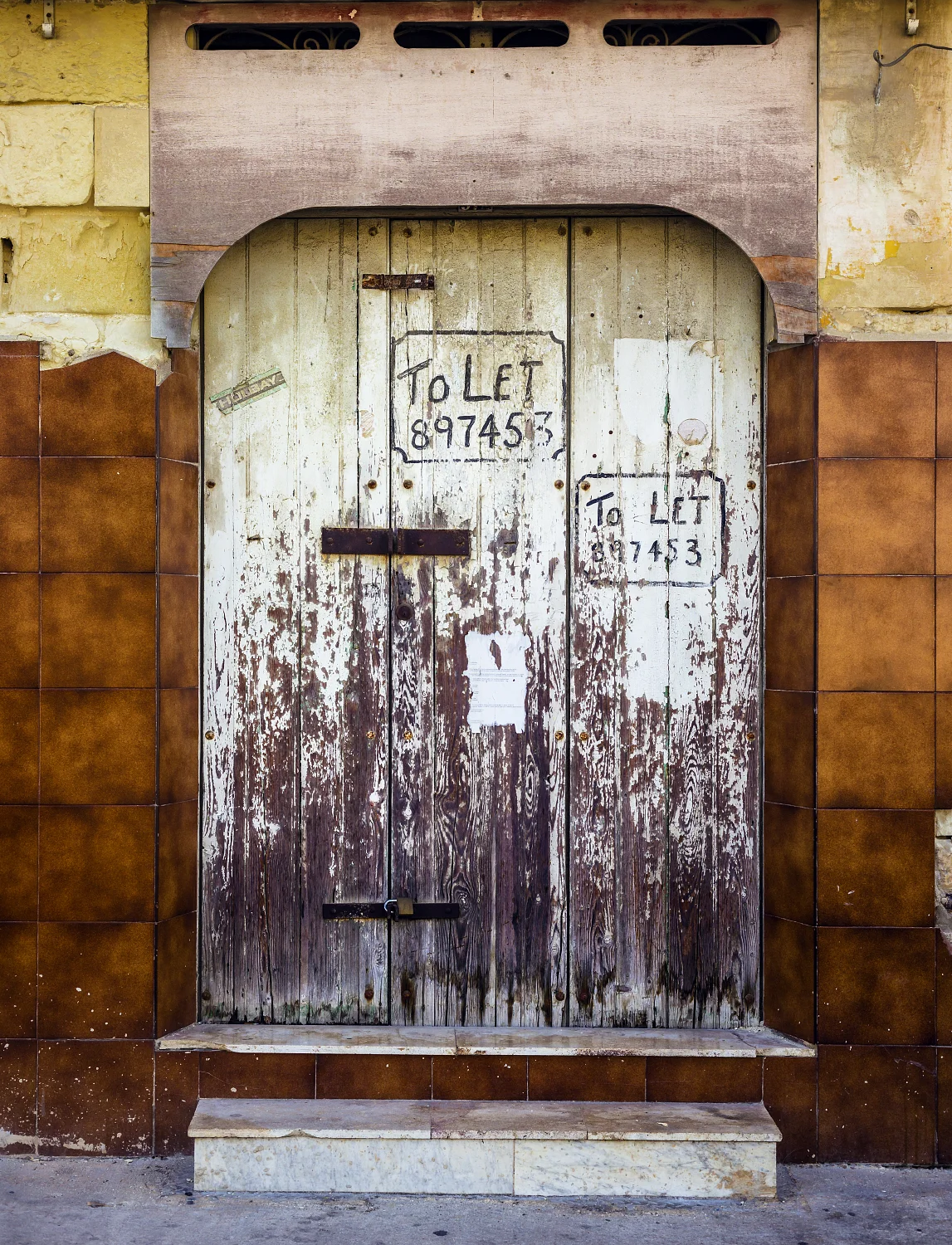
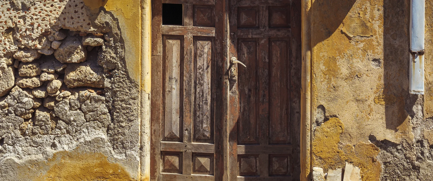
A worn down wooden door.

Maltese locals swimming in The Grand Harbour.
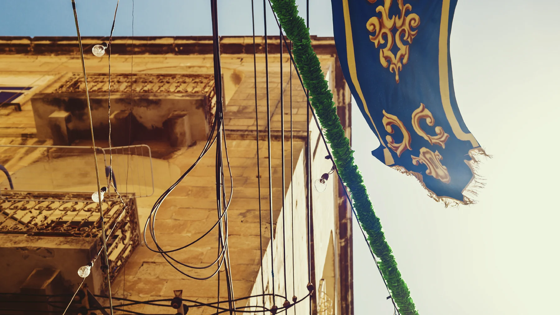
Quiet alleyway in Birgu.
Mykonos, Greece
Tuesday, September 5
Yesterday, we spent a day at sea. I slept late, ate way too much food, and lounged deck-side all afternoon. It left me unprepared for the additional hour gained crossing into another time zone. A small ferry transported us to the main port of Mykonos, Chora to the locals. A city entirely in white engulfed by clear blue waters and sky. It was pushing 100 degrees so Adam and I kept our eyes peeled for places selling beer. Not five minutes of walking around and we were rewarded with a local stout. Greek beer: check. We navigated through stark-white alleyways to find some windmills just off-shore. The entire time, I had my eye on the sea. There weren't many places to access a “beach” but we found a small swath of waterfront with some tourists sunning themselves. I dipped my feet into the Aegean Sea. It felt like the Pacific, but warmer. Expected. Still fun. Adam and I got another beer for the ferry ride back to our ship.

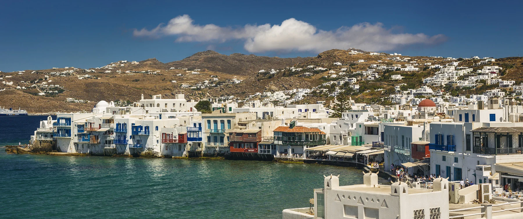
Little Venice, or Mikri Venetia.
Rhodes, Greece
Wednesday, September 6
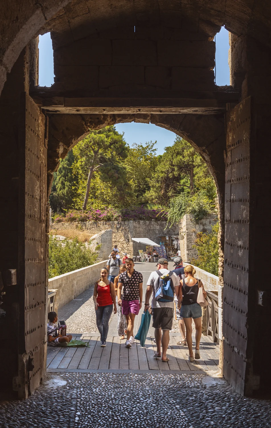
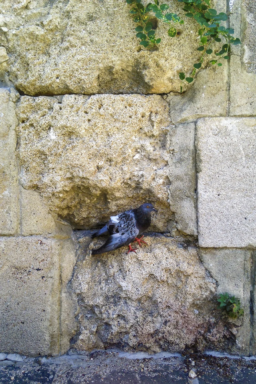
Today has to have been the hottest day of our entire trip. We disembarked and made our way down the pier. It was easily over 100 degrees on the cobblestone streets. Despite being in a new country, once again, I couldn't help but feel tired and worn-out. Is it possible to vacation too hard? Adam and I split off from Mom and Dad and decided to drink away yesterday's hangover in the shade of a quiet bistro. After cooling down, we took a stroll around the Palace of the Grand Master. Around, because we were unwilling to pay admission fees. We made friends with a chill pigeon and found half of a nude mannequin with an impeccable style.
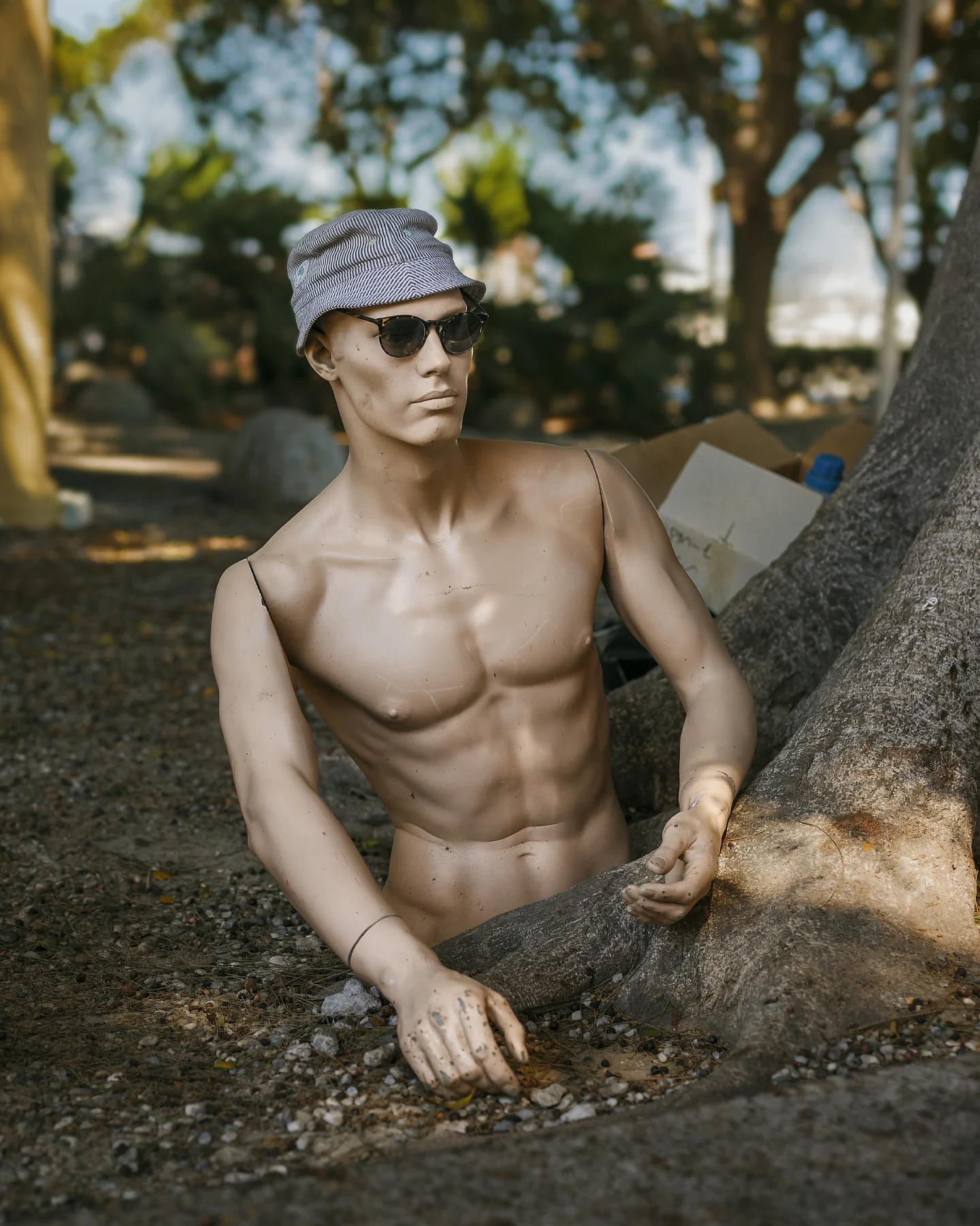
Mannequin with a raw sense of style.
One of the many fortifications of Rhodes.

Santorini, Greece
Thursday, September 7
Our entire trip, I had been anticipating today—Santorini. We took a ferry ashore, and the entire ride over, stared up at cliffs of desolate volcanic rock. The family opted to take three-minute gondola ride to the top, leaving us in the town of Fira. With hiking shoes laced and water bottles filled, we set off to Oia, a large iconic town at the north end of the main island. A leisurely walk through a quaint town quickly became a strenuous hike out on the exposed island. At nearly seven miles, I was impressed to find Mom and her recently replaced hip keeping up with us boys. Finally, we got to Oia and searched for lunch. Dad picked a restaurant called 218°; the name having to do with an expansive tableside view. We had grilled octopus, fried feta, phyllo-wrapped cheese pockets, Kalamata olives; all dipped in refreshing tzatziki. It's getting hard to distinguish favorite meals. Worn out and full, we caught a charter bus back to Fira. The line for the gondola seemed to be about an hour long. Adam and I decided to ditch the wait, grab a beer, and hike down a steep and slick cobblestone burro path to the waterfront. Ma and Pa beat us back to the ship by 15 minutes, but there is always spare time to scratch some burro ears.
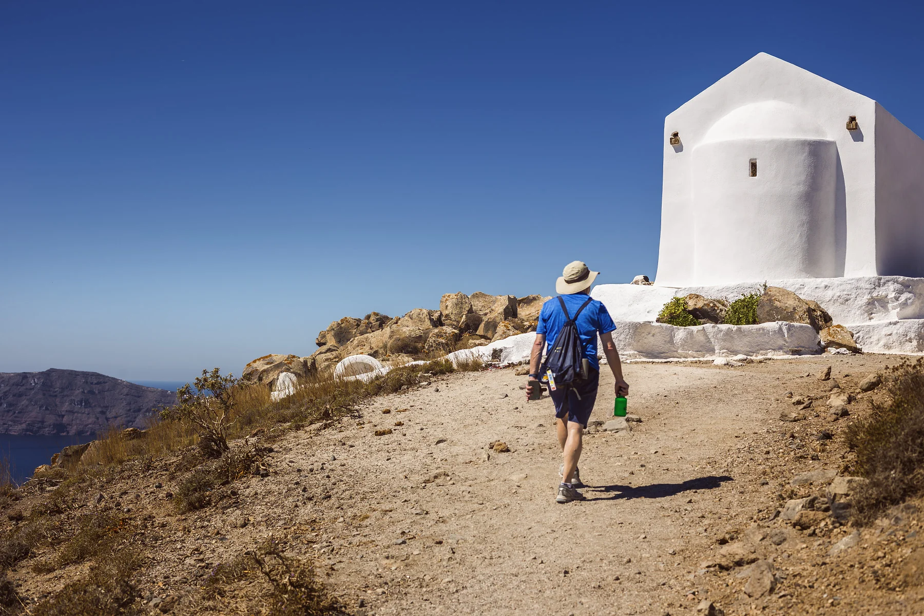
Steve hikes up to see the church of Panagia.
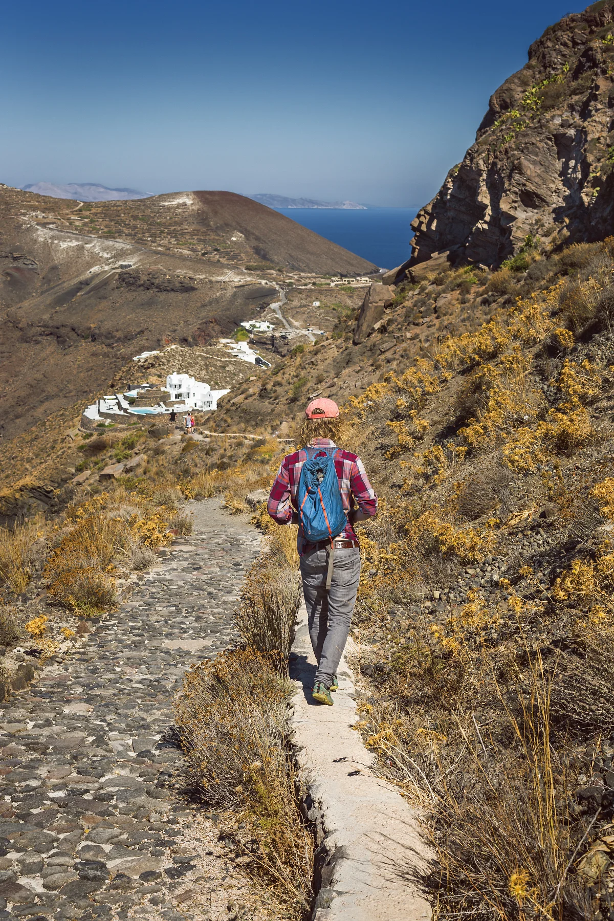
Adam taking the path less traveled to Oia.
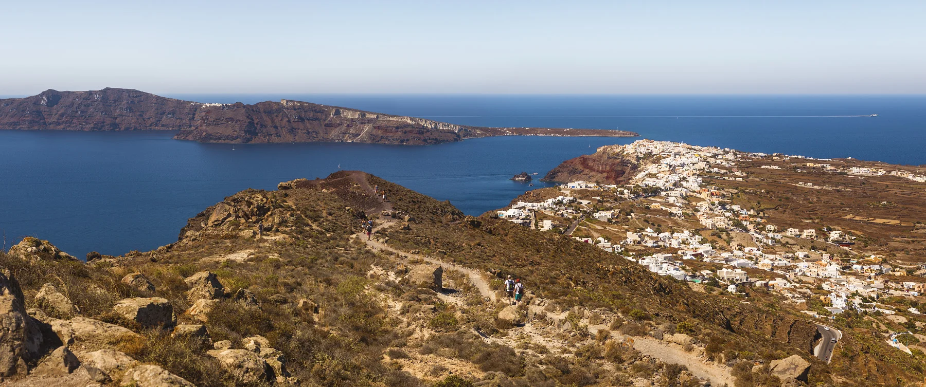
Almost at the North end of Santorini. The town of Oia is on the right, island Thirasia on the left.

Typical landscape found in the semi-arid climate of Santorini.
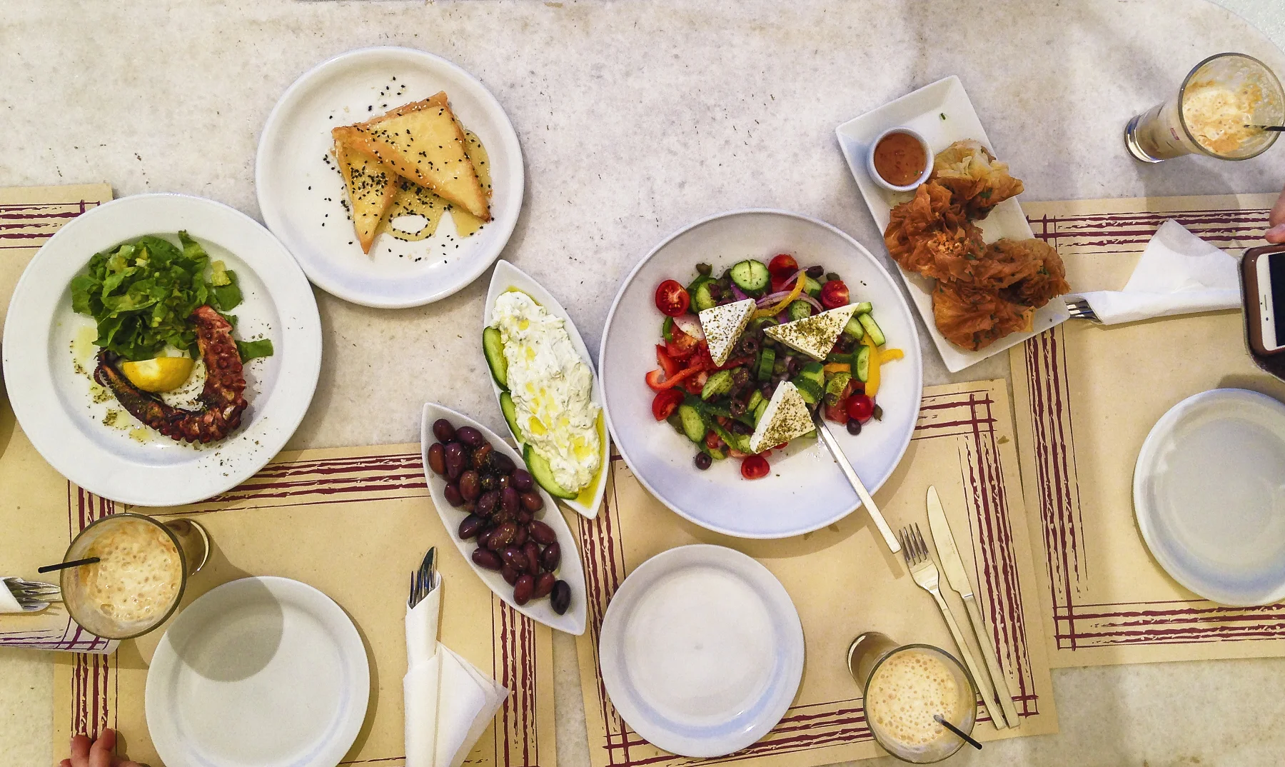
Lunch spread in Oia. Hard to tell if the food or view was better.
Athens, Greece
Friday, September 8
It's the last leg of our trip; we only make port once more before our flight back stateside. Today we had a tour of Athens with only two other couples. At 8AM, our small group made haste for the Acropolis. This was good for two reasons; the day was only going to get hotter and the crowds larger. Five years after a four-year art degree, seeing the Parthenon in person was fulfilling to say the least. After admiring the views, we hopped back in our tour van and headed for The National Archaeological Museum. Apparently, the French President was touring Athens this week as well; traffic was crazy. In the museum, whilst staring at ancient pottery, the President's wife quickly made her way through the same exhibit, flanked by security. Our tour guide didn't seem the least bit phased. We had a much needed lunch break, then it was back sightseeing. We saw the changing of the guard at the Hellenic Parliament; the Panathenaic Stadium, which is made entirely of marble; the Temple of Hephaestus; and ended with the Temple of Olympian Zeus. As we sailed away, we got easily the best sunset of our entire trip. A gorgeous sendoff.
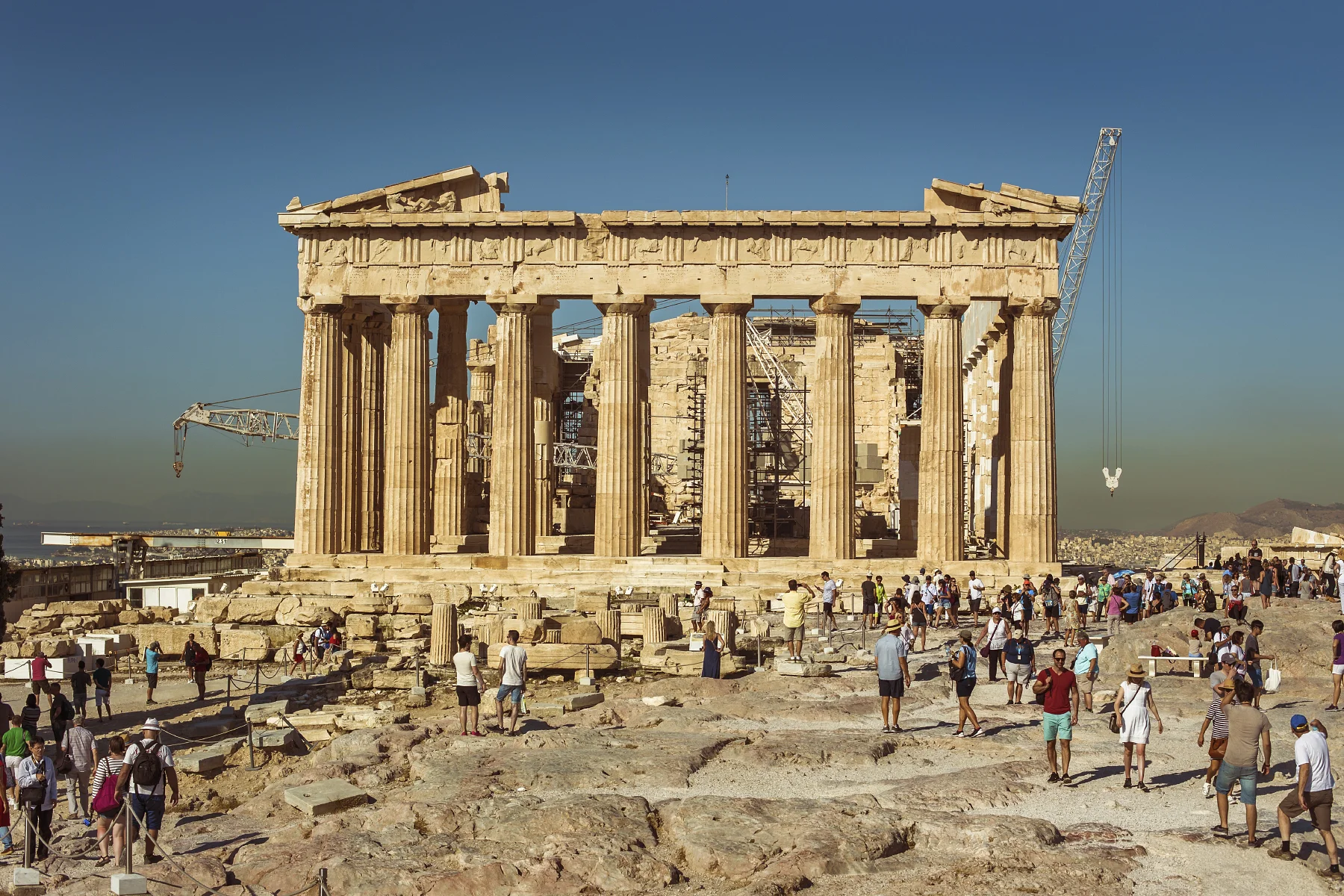
Admiring the Parthenon on a hot summer's day in Athens.

Tourists and locals taking in the Temple of Olympian Zeus.
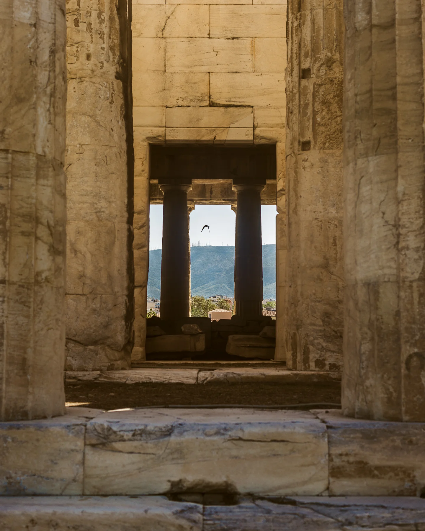
Looking through the Temple of Hephaestus.
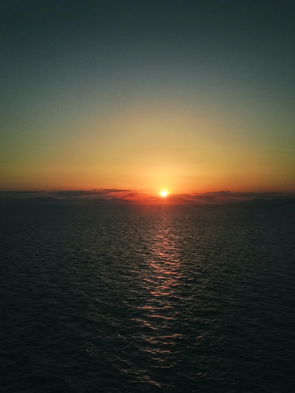
Mediterranean sunsets look better out at sea.
Naples, Italy
Sunday, September 10
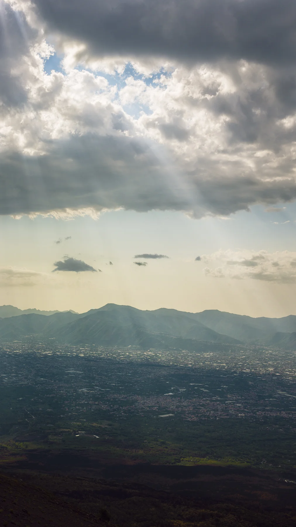
Today was our last port city and it couldn't have been nicer in Naples. For the first half of the day, we were scheduled to hike up Mt. Vesuvius. About 3,000 feet of elevation change was no big deal for us avid outdoors people. However, fat tourists abounded. My ego felt great after a quick jump, skip, and hop to the top of the caldera. Views of the Napoli coast were stunning. For the second half of the day, we were scheduled for a tour of Pompeii. For hours, we walked through piles of rubble and partially standing walls. It was hard to follow our guide along and imagine what had once magnificently stood there. Back in town, we 'accidentally' stumbled into a limoncello store. There were three different free samples. It was a sweet sendoff to a sweet trip.
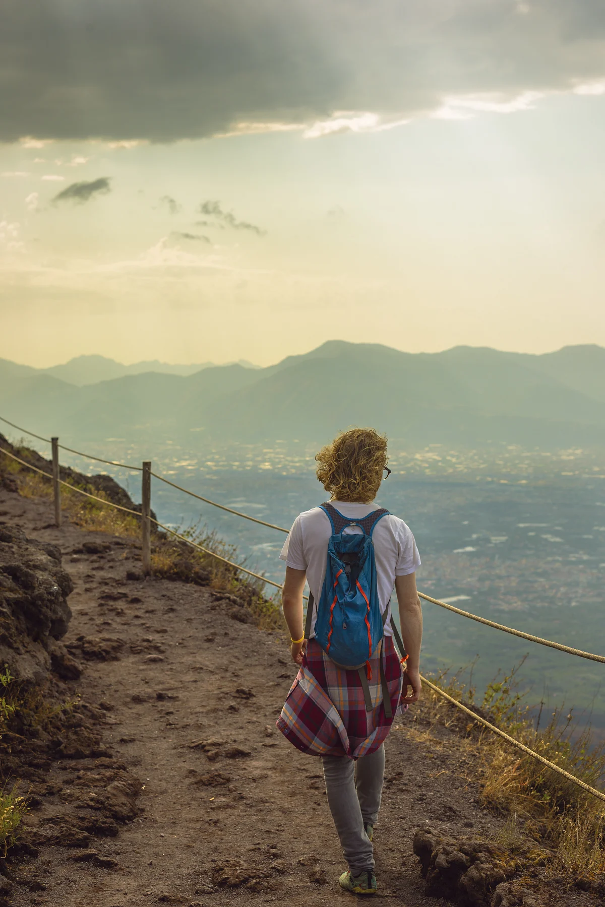
Adam on the trail up to Vesuvius.
The tail end of Italy, where it becomes a 'boot'.

Miss the first half?
About the Blog

Justin Kernes is a photographer and writer who thrives in the great outdoors.
From 2010-2017, he worked in the backcountry at Philmont Scout Ranch in New Mexico.
In 2018 “Tiny Slice” successfully thru-hiked the Pacific Crest Trail.
Search the Blog
Featured Posts


Photos and stories from my thru-hike of the PCT. This post covers day 111, Goat Rocks and my 30th birthday.