
PCT 2018: Days 62-65, South Lake Tahoe to Sierra City
Photos and stories from my thru-hike of the PCT. This post covers days 62-65 from South Lake Tahoe to Sierra City, mile 1,090-1,195.

July 5, Day 62
18.9 miles [1122.1]
Slept in as late as possible due to last night’s celebration. Ate a chocolate snack pie to give my sour stomach something to work on while we lounged at camp. Eventually started making slow, unmotivated miles at 9 A.M. Up and over Dick’s Pass which was the only section of “up” for today’s terrain that looked sucky. Easy cruise the rest of the afternoon. Stirred up an appetite for a packet of PopTarts after a few miles. I just took a zero and had an outrageously fun holiday, still I want a vacation. Dare I say I feel bored? Perhaps any day which follows one like yesterday will be a bit bland. I’m so tired of hiking. The five of us took a windy lunch on top of some rocks along Fontanillis Lake. Did a double-ramen cold-soak and had handfuls of Swedish Fish. More lakes and snack breaks which always turn to smoke breaks. Called it quits without even hitting twenty and made camp. Had a small fire to keep away mosquitoes. Didn’t have much to say, probably dehydrated. Chowed down hard on my usual tuna taco and followed it up with a peanut butter and butter, honey, Oreo, and M&M dessert taco. Enjoyed sunset trickling through the dense blanket of trees surrounding our small camp.
July 6, Day 63
24.5 miles [1146.6]
Went to sleep with the expectation today was going to be long. Prayed to the pit toilet gods that Barker Pass trailhead would be freshly stocked with TP. Completely empty. I’m out, hopefully the abundant lamb’s ear will suffice. Rare internet access and a wandering mind informed me Philmont won’t be open for crews this season; the early fires were too dangerous. I’ve been dreading “the one” for the last eight years, the time I’m not there, it happens. Tried not to dwell on things out of my control like potential fire which could consume this trail. Cruised along Alpine Meadows, ate my other chocolate pie and couldn’t help but notice the package design was being quite generous with their product depiction, then into Squaw Valley. Took a smoke break in the top-shack of the Granite Chief lift with “TB” and “Sticky” and fantasized about winter, sizing up all the shreddable sick ski lines. Pushed on to Tinker Knob in the howling wind. Had a brief see-ya-later with “Sticky” who parted ways for Truckee; hopefully we reconvene. A few sectioners passed us by, thoroughly done with their journey and headed for the highway, and gave me a Backpacker’s Pantry—major score. Half mile more to the only “campsite” on the bare ridge. Squeezed into the only tree cover with “River”, who we met back at Kennedy Meadows, and “Blue”, someone I recognize from around Tuolumne area. Shoveled in dinner and found a good spot to watch sunset. Our evening color show was absolutely bonkers. Wildflowers too numerous to document and identify, remarkably all in bloom for what feels like the last month, shimmered in the setting sun. Layers of clouds speckled and streaked the horizon.

Squaw Valley ski lifts, Lake Tahoe in the distance.

July 7, Day 64
22.3 miles [1168.5]
Windy night of sleep. “Trash Bath’s” tarp didn’t fare so well but I think he could sleep through anything except free food. Packed and hauled ass seven miles down to Highway 40 stopping only for a joint at Jerome chair. Word on trail was a free beer to any thru hiker provided by Donner Ski Ranch. The restaurant awarded me a 40 ounce King Cobra (malt beer, what a thirst-quencher) and we made use of the patio. Proceeded to get inebriated which lead me to order a patty melt with fries; I can barely resist the smell of charbroiled burgers sober, I’ll forget how much it cost. I caught a few moments of a World Cup match, enough to remember the USA still sucks at one global sport. “Trashcan” has been struggling with foot pain, I will sometimes notice him rolling out his arches during lunch. Perhaps it’s his slight cauliflower ear or maybe his constant furrowed brow, his very visage all but promises he’s never said “stop”. He’s decided to take a few days off here, the gang is dwindling. Utilized cell coverage and crushed five and a half miles drunk and distracted talking to a few friends in the outside world. It was a lonely and quiet ten more before we set up camp. There was hardly any laughing this afternoon, it seems like “Shocks” barely talks to me anymore. It still feels like he resents me for being here, like nothing has changed. In a weird space for dinner. Tired, done, just try and stay present.
Someone had a great campsite.
July 8, Day 65
26.9 miles [1195.4]
Hot and emergent midnight poop, it felt absolutely gross. Managed to fall back asleep with relative ease. Sunrise came and we left. “Trash Bath” and I chatted for most of the first ten miles, then he bolted ahead and began running like he always threatens. I think we’re all thoroughly tired of this section. I saw “Shocks” only twice on trail. The other 17 miles were spent alone with me and my racing thoughts. The four of us managed to coalesce under the North Yuba River bridge just before the highway. “Combo” must have been feeling daredevilish; he launched two spectacular 30-foot gainers off of the steep rock outcropping. A rather unexpected and fast-earned hitch cut off a mile of asphalt walking into Sierra City as the sun began to set. Hand-written, sun-bleached signs indicate town is closed on Sunday/Monday’s, I can’t possibly see how that’s a smart business choice even for such a backwoods location. Place is quaint, but it mostly gives off a homely and secluded vibe ranging somewhere between a dilapidated 70’s ski chalet and outdated Chinese restaurant. Fortunately the Post Office is open tomorrow: 10a-2p (reminds me of college administration hours), our resupply and my desperately needed new shoes are in that box. Listened to Jordan Peterson on Joe Rogan’s podcast and he got me ruminating about my current situation with Adam. Lots of nasty and malevolent thoughts. Bad juju. Broke down and got a can of Coke for $1.50. The church has provided a free overnight area, there were already a dozen or so campsites set up in the modestly sized front yard. I laid out my tarp and collapsed. My soles are sore, my calves are tight. No booze and I’m out of weed, stuck in sobriety. Two tuna tacos in hopes of replacing the malcontent with fat and sodium. Hopefully our package shows up tomorrow.
Hike On?

PCT 2018: Days 66-70, Sierra City to Belden
Photos and stories from my thru-hike of the PCT. This post covers days 66-70 from Sierra City to Belden, mile 1,195-1,300.

July 9, Day 66
0 miles [1195.4]
All I wanted was a day off. I got one and instantly regretted it—what a hard day. It started out so nice. I splurged for coffee cake and an Americano at the cafe and ate on the patio with “Conflicted”, who I remembered meeting at lunch in S.L.T., and we talked about the MeatEater podcast. For twenty minutes he schooled me on the finer points of the Pittman-Robertson Act and how hunting drives conservation, how hikers think they’re stewards of the outdoors but really it’s dedicated hunters, taking every opportunity to interrupt himself and me at times to mock rabid social inclusivity in a type of Liberal comedy character. He’s awesome, unlike anyone I’ve ever met. Waited and caffeinated until the Post Office opened—no package. “Trash Bath” and “Combo” hung around patiently but eventually grew weary and bid us a hasty see-ya-later. A small part of me thinks that’s the last time I’ll see either of them, yet I’ve had that thought before and been wrong. We kept checking right up until he, the singular postal worker, closed at 2 P.M.—still no package. Demoralized by the consequences. Adam was visibly stressed and moody, I tried to give him space and chatted with other hikers congregated outside the country store and anxiously watched the day pass. Felt trapped. Tried to forget the time and drank a few pricey tallboys even though my subconscious told me I’m spending too much and it wasn’t going to help in any event. No resupply and with little food in my bag I ordered a “gutbuster” from the deli; a monstrous knife-and-fork burrito bordering on vulgar who’s contents tasted uniformly of everything I had seen exit the kitchen. Braved the free, frigid public shower long enough to turn my surface grime to sludge, I couldn’t hold out long enough to use soap. My towel probably took the brunt of my filth. Sat, sat, sat. Fell into the social media hole. Zeros aren’t fun, Sierra City kinda sucks. Currently it’s well past hiker-midnight, I wish the others around me would stop talking.

The only picture I took on Day 66.
July 10, Day 67
20.6 miles [1216.0]
Another rude wake up by the local gang of bullish, squawking Steller’s jays. Began The Wait and saw lots of hikers arrive, many of whom I recognize. “Dingo”, who we met on Day 2; “Twerk”, pink shirt and all; even “Sticky Fingers” caught back up. Sarah and Kevin who have been immobile or asleep the past 48-hours have seemingly beaten their collective food poisoning and are looking much better. Talked with “Clean Turkey” who’s already been here for three whole days waiting for a replacement debit card. Yikes. Apparently she has made friends with the local family of loggers and was given some fresh roasted corn last night. Friendly postal worker Rick (we got to know each other on a first-name basis) had our resupply package. Huzzah. Snapped a hasty photo and laced up my new shoes. Snazzy, fresh, sproingy. Divvied up our food and immediately headed out. Hot. Hilly. Humid. An immediate 3,000 feet of ascent in the first eight miles. Forced myself to snack at Packsaddle campground, Adam cruised by me like the bump on a log that I was. I’m practically invisible to him, it seems. Beleaguered I shuffled up second steep, unrelenting hill, overwhelmed by dark thoughts. Sobbed and kept walking because you can cry and hike, sitting just feels even worse. Pulled myself together before camp. Dinner was our hard-earned gnocchi meal prepared with pepperoni and olive oil. Adam eked out a small smile and we made a few crass jokes, I felt a lot better. A guy in a wide-brim hat and pale blue Columbia PFG rolled into camp, introduced himself as “Tooth Fairy” and ate dinner with us. My calves and Achilles are exceptionally tight, I wonder if that’s the terrain or my new kicks.
My only two-pair of shoes which lasted almost 3,000 miles.

July 11, Day 68
35.0 miles [1251.0]
Better day but I’m certainly not getting my calories correct. Despite this, we absolutely crushed 35 miles! Not only a 30 but five more on top of that; my new longest day by more than six. I remember days in Scouts where ten miles seemed like another solar system away, hell that was a day’s worth of travel. Warmer start which was a nice motivating factor to leave the comfortable confines of my tent. Floated through miles and miles of dense, thick pines and firs covered in woolly moss like chartreuse spring vests. Hardly saw Adam at all, the few times I did he didn’t look happy about anything. Lunch cheered us both up. During a longer downhill section I ran (it’s still not clear to me why people like running). I nearly tripped and I let me knees buckle and sat down instead of hurling ass over pack. Stood from my burning wreckage and took limb inventory and noticed a hunk of skin missing from the knuckle of my thumb. Surprised not to be hurt worse. Note to self: don’t go home on injury. Passed more than 20 hikers, many of whom I saw in Sierra City. Water sources are getting farther apart, I should have filled up under the bridge but we pressed on. Used the last of my water to rehydrate a chicken risotto Backpacker’s Pantry for dinner. Legitimately thirsty but it’s hard to determine the true severity, just like hunger. There’s water a mile or two up trail. Body is sore but it’s nothing new. There’s a shrill whine of mozzies are all around me. Thirsty, just like me.
July 12, Day 69
30.0 miles [1281.0]
Started the day off with an eight-mile hill, the skeeters started even earlier. Just put one in front of the other with Foo Fighters on a loop. At the top of the hill was Lookout Rock—a vista name which must be on the same level of popularity as Main Street—which seemed like a worthwhile snacking point. Ate a few dozen handfuls of fruit snacks and chips and took in the view with AJ, a Day 3 acquaintance and Whitney summit appearance, and “Pilgrim”, someone I’d only seen from a distance. Upon closer inspection it became apparent his sole article of clothing is a bed sheet fashioned somewhere between tunic and toga. A few more miles to Bucks Lake road where Adam and I took a peaceful lunch in full recline. I gave my dusty, gritty footsies a bandanna bath and sat shirtless in reverence of the lack of mosquitoes. He’s in a good mood, it certainly cheered me up. Resupply is Philmont-heavy with items like Mojo bars, Larabars, and even those “Mark”-bars (rice crispy copy), all my rations bring back memories of hiking in the Sangre de Cristos. Elated to get a shirtless mile or so in the evening during that special time when the air temperature dips five degrees in less than five minutes, it was so relaxing I even got a shirtless poop without being attacked. Haven’t had the opportunity to do that since the desert. We busted another 30 which feels great to do, especially after yesterday’s feat. My feet feel sore but a discomfort relative to the amount of distance I’ve covered, Guthook shows just shy of 6,500 feet of elevation gain today alone. Currently we’re perched along the precipice of a massive canyon which is nearly 4,000 feet to the bottom, camp is hella windy. There are a few other hikers I recognize who rearranged their stakes and made as much space as possible. Big Belden hike is coming up, stop looking at the terrain map, it won’t make it any less steep.
Adam destroys a lunch taco.
July 13, Day 70
21.2 miles [1300.5]
Greeted by gorgeous clouds. Packed and practically fell with the rate of gravity towards Belden. Crossed some railroad tracks and entered “town” which seems like an unfair designation, there can’t be more than 12 people living here. Before I could even set my pack down, a bald man with a plush raccoon tail clipped to his floral print shorts approached and welcomed me before launching into his practiced whispered drug spiel like any hardened festival attendee standing outside the venue holding a cryptic sign proclaiming: “Need Tickets”. I’ve been out for almost a week and Adam let me borrow some cash. We followed “Meow Meow” (more alias than trail name) to his van parked in the back of the already dinky-sized town. His van is a converted refrigerator truck, mostly made out of glass, the clean interior reveals three things: a bed, hardwood floors, and a selection of four other raccoon tails. He filled my jar of wax before 10 A.M, problem solved. Had a fairly sketchy highway walk to Caribou Crossroads, by then I was absolutely starving. Patiently waited for biscuits and gravy with eggs and sausage and a famed blackberry milkshake, the reviews of which had been motivating me for the last few days. Ate and chilled with “Pilgrim”, “Tooth Fairy”, and AJ, as well as “RV”, who I now recall meeting a day outside of Tehachapi and have seen a handful of times since then, is finishing his 700-mile section here. As we wished each other well, I saw him with new eyes; a man well into his fifties who spent 40 days doing exactly what he wanted along with the loving support of his wife and eponymous vehicle which drove town to town for aid and care. It was hard to leave the shaded safety of the RV park but it was a smart choice, especially after losing time in Sierra City. “Tooth Fairy” thought it wise as well and joined Adam and me. Brenda, a true local and quite possibly the most badass grandma I’ve ever met, shuttled hikers back to trail, meanwhile with brash authority telling everyone in the vehicle that if her 6-year-old granddaughter can hike out of Belden without complaining, than gosh darn it, so can we. Began the 15-mile, 5,500-foot assault during the muggiest part of the day. A graffitied trail blaze had a poignant message: “either way, it sucks”. At one of the smaller stream crossings there was a waterfall which had carved out a body-sized pool. I stopped only to remove my shoes and waded in, fully submerged, and tried to escape the hill and heat. Finally made it to the top, crossed mile 1,300, and made camp. Rain looks promising in tonight’s clouds but so far I’ve only had sprinkles.
Inspired by Pollock’s “Lucifer”.
Goodbye, Belden.
Hike On?

PCT 2018: Days 84-87, Etna to California-Oregon Border
Photos and stories from my thru-hike of the PCT. This post covers days 84-87 from Etna to the California/Oregon border, mile 1,600-1,700.

July 27, Day 84
29.2 miles [1629.0]
The near full moon and constant wind gusts mixed with cowboying next to everyone else didn’t lead to great sleep. I glanced over to see “Froggy” nearly packed, folding his tarp and clipping buckles by headlamp. Pooped and got moving, my usual regimen. Had some gut pain which only got worse with each step. I hadn’t even made it two miles before I found myself hunched over, pack off, sitting and sweating, worrying if I was lucky enough to get appendicitis on trail. Let out a few gnarly farts and ate a Pop-Tart and found myself regaining hiker-stasis. Today’s terrain was freshly burned, probably in the last two years, a dusty haze hung around ghoulish trees illuminating their blackened bark. Set up lunch overlooking Fischer and Marten Lakes and prepared two salami and dijonnaise roll-ups, shooting “Froggy” looks of “I-can’t-believe-it-took-me-this-long-to-buy-cured-meat”—tuna tacos have a new contender. “TQ” insisted we help with her one-pound squeeze-bottle of Welch’s jelly and I slathered myself a PB&J wrap. The last few miles of the day were spectacular, everything is blooming with a furious intensity; Marble Mountain Wilderness is magnificent. We set up and shared camp with some weekenders at Paradise lake where I relaxed and scrubbed out the grit from between my toes. Currently the soles of my feet are the only body part which is regularly sore, tonight is no exception. Got good and stoney for dinner, everyone rejoiced at nonexistent bugs. Running dangerously low on power which has me more nervous than I care to admit but I’ll make it work. I haven’t had to ration my music yet.
Nothing but killer trees.
July 28, Day 85
27.4 miles [1656.4]
Knew we were in for a huge, mostly downhill slog into Seiad and left around 5:45 A.M. “Froggy” introduced me to Ello Govna—a drinking game which they had adapted to play on trail—the rules became PI questions you could answer differently each round. Our game got wild: 1) favorite color 2) 'hey “Surge”' 3) $10,000 car 4) sports-related memory 5) bad job 6) grateful for 8) ? 9) Philmont memory 10) *weird noise* 12) collection from childhood 13) what hiking gear do you covet? 14) life goal 15) road trip memory 16) *hootie-hoo* 17) *orgasm noise* 18) birthday memory 19) compliment someone 20) trail friends 21) best day on-trail. Played for six hours and made it 20 miles before breaking for lunch at Grider stream. The girls already had a dunk and were setting up a lunch spot while us guys took our turn to bathe. Tried to ignore my self-consciousness and stripped off my undies with a pitiful lack of authority. God, I’m a prude. The day only got hazier as we road-walked six miles into Seiad Valley, all the while eagerly looking for ways to ford the dangerous and way too large Klamath River to cut off a ridiculous amount of trail, more as a means of distraction from the carbonized heat. Triumphantly arrived at the general store, took a hot lap around and bought a few dollar-pies and beers. Stoked to see “Shocks” as well as “Conflicted” who’s convinced the State of Jefferson is the future and filled the silence with talks of secession, I’m glad they’re doing well. Ate tuna taco dinner outside the store with the whole gang and utilized every last minute to charge electronics. I was stunned to see “Snacks” catch back up, he’s pulled some crazy days! Every hiker here knows Oregon is closer than ever, this is the last California town. “Trash Queen” even said the upcoming border was “the most monumental border”, which we all had a good laugh at, but in a way, she’s right. Walked a few miles down the road to one of the largest oak trees I’ve ever seen, a tree so old and large you can’t help but play out its history like a stop-motion silent film in your head. Set up and circled the trunk to cool off (it’s still gotta be above 80F) and meditated in its grandeur. Huge 10-mile climb tomorrow, one final challenge.
“Froggy”.
“Penguin”.
Klamath River Bridge.
July 29, Day 86
31.3 miles [1687.7]
Had a hard night anticipating today’s big climb, the stagnant midnight heat wasn’t comforting. By 5:45 A.M. the only thing left in camp were a few tent stake holes. Played all my saved Heavyweight podcasts to distract from the hazy onslaught. At one point I passed “Conflicted” who’s exhalations were purely muttered obscenities—he was having a tough time. Looking at the map makes everything worse. I can’t recall anything during snack break and the only thing memorable from lunch was seeing “Shocks” who fixed my vape pen. Once the hill climb was over, Oregon and many retrospective thoughts took up the rest of my day and my wandering mind. It’s hard to remember anything after 30 miles. Got to the last water source, gang took a slap-dash vote and decided to cross the border tomorrow. Surprisingly “Flipper” and “Froggy” took different sides and all six of us started to have a hard time, no one wants to be in Cali-fucking-fornia anymore. Everyone was hungry, tired, and ready to zero. Unsurprisingly I was wishy-washy (good photos or Commit?) and tried to be nonchalant—looks like I haven’t learned anything. Whatever. There’s still plenty more hiking to do. We set up camp four miles out. Tomorrow has a new map, hotel, beer, and shower. OREGON.
July 30, Day 87
32.0 miles [1717.7]
Camp was a ghost town before 5:30 A.M. and I had the same singular thought as everyone else. Arrived at the nondescript border and only felt more excited. High-fives and coyote howls all around—we walked to Oregon! Luckily “Goat Man” was there and took our photo. Had to psyche myself up for the remaining 26 miles to the highway and raced through both snack and lunch breaks. Strong cell reception approaching the highway so I made a few phone calls to chew up the remaining miles: a quick update with mom and dad; no luck on Sam Anderson; Jake Moye and I laughed about being hiker trash. With just two miles left, mid-sentence with “Flipper”, I fell. Hard. I could have broken a bone, but luckily all I suffered was losing my mile-zero water bottle. Knee hurts pretty good, thankfully tomorrow is a day of rest. Arrived at Callahan’s and saw that “Dutchie” was there too. Plopped down at the bar and proudly redeemed my free beer on tap, IPA of course. The bartender was having a slow afternoon and treated us to a few pours of pilsner leftover from a wedding. We toasted to our accomplishment. “Dutchie”, being international, charming (and female) schooled us all on how to land a hitch. It took her three minutes, the first car pulled over as if we had money—she’s a natural. The five of us squeezed into her subcompact and took off for Ashland. Arrived at the hotel, it was time to celebrate “Froggy’s” birthday in earnest. Had a real shower, with hot water and soap, for the first time since Bishop—day 44. HA! “Snacks” did the beer run and made us all proud; craft as well as cheap and plenty of them. Gang attempted to order pizza half in the bag. After much deliberation and chatter, we made the delivery call. Wings, ‘za, and beers. Lots of laughs. To friends, birthdays, and zeros.
Oregon/California border and six happy hikers.
Hike On?

PCT 2018: Days 31-36, Tehachapi to Kennedy Meadows
Photos and stories from my thru-hike of the PCT. This post covers days 31-36 from Tehachapi to Kennedy Meadows, mile 570-700.

June 4, Day 31
22.1 miles [592.9]
By some grace of God I got decent sleep thanks to those two robust bushes. Loaded a new map into my phone and couldn’t help but feel a small sense of accomplishment. Took a nice, lengthy stop at Golden Oaks spring 12 miles from camp. Avoided the heat and cameled-up in the shade all while hanging out with “Mio”. Tried to make a dent in my food because my pack weighs an absolute shit ton—it’s kind of demoralizing. I must have eight days worth and only need six; I guess I can eat as much as I want. I should buy less crackers next time. The wind seemed to subside the further north we went but it still felt like a hiking through the business end of a hairdryer. Hopefully this is the last of the wind farms. Adam seemed to be in a mood, the desert must be getting to him too. We’re probably both dehydrated. Wrapped up the day with tuna taco while dodging a few mosquitoes. They’re only going to get worse from here.
A Mojave sunrise and the last of the wind farms.
A stoveless resupply which is a little heavy on crackers.
June 5, Day 32
23 miles [615.9]
Said goodbye to the last of the wind farms (I made sure to double-check on the map) and made it 10 miles to Robin Bird spring only stopping briefly two times. My stamina is improving. The long-anticipated arrival of “Mio’s” Marine buddy “Bigfoot” had finally happened, I got to know him a little better over the course of the day. We took over an hour in the shade to rest and rehydrate. Barely making it another mile up trail, we stopped again. “Vinyl” and her friend Norah were sprawled out beside a Subaru under a makeshift canopy of towels and umbrellas held together with gold duct tape and good vibes. I met her yesterday and suddenly remembered talks of her birthday party. They welcomed us to their huge picnic spread which had; brie and bread; watermelon and Oreo cookies; kombucha and Sanpellegrino in all flavors; and most importantly, a homemade blueberry pie. Huge portions were being served and I didn’t think there was going to be enough to go around. “I’ll take a tiny slice, please”, I said timidly. “Vinyl”, plastic cutlery in hand, locked eyes with me and a devious smirk crept below her sunglasses. “Sure you can—‘Tiny Slice’” she snarkily said, plopping a huge piece on my paper plate. It killed, the crowd roared. Everyone commemorated the party by spray-painting their hiking poles gold. Adam and I left the shanty-town, pushing another nine miles before making a dinner stop. The weather was prime and legs felt good, ultimately we did another four miles as dusk slowly turned into night. “Tiny Slice”—it could be worse.
Sunset on a distant Owens Peak.
Blueberry pie responsible for my trail name.
June 6, Day 33
24 miles [639.9]
Greeted by a soul-warming sunrise. Despite an intensifying sun and miles of washboarded trail filled with shoe-consuming sand, it was still nice to hike in the limited morning hours with a cool breeze. Just before Bird Spring Pass I came across, quite possibly, the most idyllic Joshua Tree I’d ever witnessed. Even dozens of weekend campouts I spent at the namesake national park never lead to the discovery of such a magnificent specimen. Perhaps it was dehydration, perhaps it was a lack of sittable shade from the last 100 miles, but I was mesmerized. I dropped my pack and flopped down, eyes heavy with midday heat. For the briefest of moments—or maybe it was five minutes—I was thoughtless. Wonderfully adrift. Somehow, I managed to leave. Only a few miles later and we ran into some totally-clutch trail magic. Jim had the full spread: cold cuts, soda, chips, and cooler full of beer. I thanked him profusely, sandwich in hand, and asked about his involvement with the trail. He humbly replied, “I raised a lot of hell when I was younger, so, here I am giving back.” Finally gathered the gumption to leave and made it another nine miles before stopping for dinner and a camp spot. While assembling a dessert burrito, a flock of what I could only assume to be western bluebirds, at least 100 strong, buzzed overhead. Hadn’t even made it halfway through my burrito before realizing we were being assaulted by an army of ants. Still being surprised in the desert.


June 7, Day 34
24.4 miles [662.7]
Tossed and turned until 6 a.m. Uneventful hiking all the way to Walker Pass so I filled the time by listening to more music than usual. At the highway we were greeted by “Coppertone” who happens to be sort of a trail legend. He provided plenty of camp chairs under an awning, a hiker box where Adam scored a new shirt, as well as various snacks laid out on a table. “Coppertone” also offered everyone a float: vanilla or strawberry, root beer or cream soda? I opted for the nontraditional version which several hikers said was the superior choice. Tried to enjoy it slowly but did a poor job. All the while, a helicopter circled unusually low around the campground, only to land several hundred feet away from us. Slurping down the remainder of my float, I saw a flash of orange darting through the trees on a ridgeline above. Just before I began to worry, “Coppertone” offhandedly quipped, “some government officials came by and said they’d be running some tests today”. Twenty minutes later the heli took off, I could just barely make out an orange jumpsuit through the open bay doors. As the chopper left, quiet finally returned. We still needed to confirm a few resupply details with our parents which meant hitching into Lake Isabella or making a phone call. Neither of us had reception, so while I danced around on the shoulder, thumb extended, looking positively too positive, Adam spotted hiker friend “Pocket Rocket” who was in the middle of a phone call. Fortunately, we were able to use her phone and avoid the half-day jaunt into town. With the ‘extra time’ we double-backed to Walker Pass to hang out and hydrate more. I got a few Z’s in on a particularly comfortable camp chair. With most of the heat beat, we pushed another eight miles before finding a spot to cowboy. A terrific tuna taco while avoiding skeeters. Gosh, this has to be the last of the desert, the mountains are nearly here.

US Navy helicopter drills near Walker Pass.

Owens Peak Wilderness.


June 8, Day 35
24.5 miles [687.2]
Spent the first three hiking hours without music or podcasts in an effort to save any remaining phone battery (currently at 9%). The terrain has started to morph once again, perhaps it’s a sign we’re getting closer to the mountains. I’ve cinched my belt quite tight, flaps of fabric now bunch around my waist; my clothes don’t fit anymore. Even though there was nearly 12 miles of solid uphill today, the actual ascents weren’t problematic. I’m just so fed up sweating from every inch of my body with a ‘hot face’. It just sucks. Found a good spot for lunch and a snooze 15 miles in. Climbed a second big hill to finish the evening. A gentleman we’d been leapfrogging all day arrived at camp just as we finished setting up. He introduced himself as “Missing Person”, and without missing a beat said, “you must be brothers, right?” It was almost refreshing to hear someone say it so confidently, most people had been giving Adam and I double-takes, asking if we were twins and which one was older. He flashed a smile of admiration undeniably different than others I had seen. “Mind if I crash your site?” We nodded. The three of us talked and ate dinner, sharing stories from the desert. Offhandedly, he mentioned he hiked the AT 25 years ago—largely in memoriam of his late brother. I tried to keep eating chili cheese Fritos but they just dried up in my mouth. My tent is scheduled to arrive tomorrow, hopefully that eases the tension between Adam and me.

“Missing Person” sets up his camp.

Granite with quartz vein.
Sunset from Chimney Peak Wilderness.
June 9, Day 36
15 miles [702.2]
Broke camp and high-tailed it to Kennedy Meadows. I sniped at Adam the last few miles, saying some really dumb shit. 'Got the clap' as we approached the general store—other hikers applauded each new arrival's success. If I smiled any harder I probably would have ended up in tears. Today was the lowest I've been in recent memory. Even those hard days early on in the desert pale in comparison to the neurotic, worthless feelings I subjected myself to today. Bought some beers and tried to mingle with the dozens of other hikers, hoping to take my mind off of me. Signed up to take a shower in one of the jankiest homemade stalls I've ever witnessed (I should have just taken my towel to the Kern river.) I skipped the washing machine since it had a sign-up list longer than my sleeping pad, opting to have another beer and wash my socks under the spigot. Parents arrived with our resupply and loving support. They treated us to dinner at Grumpy Bear's Retreat, the only restaurant in the area, for a burger. I managed two bites before unraveling, bemoaning problems Adam and I should have managed ourselves. They drove six hours for me to treat them like a petulant child. I feel sick to my stomach. It feels shameful to admit how close I was to quitting, especially when the getaway vehicle was being driven by mom and dad. Grow up, Justin. After dinner, I tried to turn the evening around and bought everyone beers. We started joking around and laughing, sharing stories like the clogged toilet and photos of unbelievable desert sunrises: Kernes family therapy. Divvied up the resupply and setup my new tent. Tried hard not to be awkward as our parents drove out. Later, “Missing Person” came up and said we looked down and out at the diner. I smiled weakly, “family things.” He congratulated us on making it out of the desert. I'm overjoyed to be finished.
Bakeoven Pass and unnamed peaks.
Kennedy Meadows General Store by night.
Hike On?

PCT 2018: Days 41-44, Mount Whitney to Bishop
Photos and stories from my thru-hike of the PCT. This post covers days 41-44 from Mount Whitney to Bishop, mile 766-831.

June 14, Day 41
19.2 miles [791.9]
Frost on my bag once again, another cold start. Still a little bummed out and attempted to wake and bake my woes away. Definitely harbored some anxiety about today’s terrain and what it would bring but I quickly got enamored in the grandeur of the Sierra. In the first few miles I forded Tyndall Creek rather than take the time to find an ideal rock-hop-spot which resulted in soaked shoes ending in torn blisters. Slopping around in slushy snow didn’t help either. I have to remember to keep my shoes dry. We got to the final approach and looked up at the remaining 700 feet of gain while filtering water. It looked like Forester Pass was going to fall into space. A nearly vertical wall of snow was clearly visible from the bottom—the most highly anticipated and fear-mongered location so far. People had asked “are you going to bring microspikes? Where’s your ice axe?” There I was, time to cross the bridge, a phrase I’ve come to love. Intimidation abated with each step taken closer to the saddle. I glided across the snow-covered section with ease. Another hiker who had been tailing us the entire way up had halted before the snow. From 200 feet away, it was easy to tell he wasn’t a happy camper. “You got this”, I yelled over the chasm, “it’s way better than it looks!” He nodded, flashing a thumbs up, then took cautious steps all the way across. We saw him at the top, beaming. After a snack break we glissaded down the backside and continued to Glen Pass; it kicked my ass. Low food with a rationing mentality lead to me bonking. I was whopped, Adam was light years ahead of me. Two passes in a day is ridiculous. The thought of food kept me moving—50 miles to Bishop.
Forester Pass approach, mile 779.3.
Forester Pass and the Kings Canyon and Sequoia National Parks boundary, mile 779.5.

A hiker glissades down Forester Pass.
Northern side of Forester Pass, mile 780.
University Peak, mile 783.
June 15, Day 42
23.8 miles [815.7]
Warm sleep for having camped above 11,000 feet. Got up and out with intention because it’s hard to lie on my back with how tender my heels are—I can feel my heartbeat throbbing in my feet. Nervous about how well I would do but blisters are a known quantity, it really can’t get much worse than this. Just have to keep putting one in front of the other. Only a few miles in, I took my shoes off in order to cross between Rae Lakes with certain dryness. After yesterday’s water-logged experience my new mantra is still ringing in my head: wet is worse. Drifted throughout treeline, dozens of half-frozen alpine lakes speckled the rocky terrain. Pinchot Pass wasn’t forgiving, albeit much easier than Forester and Glen. Intense beauty was all around but I found myself looking down most of the time, the sheer discomfort pulling me away. However, I must have hopped over 50 streams and at each one, with enough searching, there were enough slick rocks or creaky downed limbs for a strategic jump-and-pray, each leap followed by a gratifying mental ding of success—I felt like a video game character. During one of my searches I found a half-full bottle of olive oil bobbing in an eddy which went spectacularly with our pasta dinner. At this point my food bag is mostly bag and trash, free calories were a godsend. Pushed to the base of Mather Pass and set up camp as spumoni skies faded into starry oblivion.
Adam gives me “knucks” for getting over Pinchot Pass.
Marmota flaviventris, yellow-bellied marmot.
Sunset in Upper Basin, Mather Pass, mile 815.7.
June 16, Day 43
27.3 miles [831.0]
Heard other hikers packing and instantly craved more sleep. I stuck my head out of my vestibule and found Adam already breaking down his tent. Hustled and got up and over Mather, then began 4,000 feet of descent for the Bishop Pass trail junction. Obsessed about food to the point of fantasy. Played a mental game where I tried to imagine foods I wouldn’t eat even if offered to me right then and there (I didn’t come up with anything). It worked well at keeping my mind off my feet which are completely fucked up. Cold mornings, soggy shoes, sharp rocks and crusty socks, 25-mile days, and low calories, never have I had this many blisters. Arrived at the junction and devoured my last packet of tuna—dry. Adam and I have both done Bishop Pass many times but always the northern approach, never from the other side. It was brutal. The first three miles might have been my hardest physically. Had a few excruciating moments of wanting to “Stop”; to just not hike anymore, to sleep and get as close to death as I could, but those moments faded just as they always do. A mile before the pass, Adam threw out one of his usual outrageous suggestions. “We could always push for the parking lot”, he dryly said, both of us drenched in sweat and sucking wind, the sun already having set behind massive granite peaks. He was just as done as I was. Somehow, delirious, I agreed, adding another six miles to our day. At 10:30 p.m., broken, tired, and hungry, we arrived at windy South Lake parking lot. My resupply had two packets of Probar Bolts, a highly coveted gummy snack lovingly saved from summer camp, I had already eaten the first pack on top of Whitney, saving the final pack for a special occasion. I chewed them slowly, trying not to think too much about what I’m going to eat tomorrow.
Adam breaks down camp, mile 815.7.
Moonset over Mount Hurd.
June 17, Day 44
0 miles [831.0]
A windy night continued into the morning, I had on all my layers while waiting for a hitch. Didn’t sit long before meeting our lord and savior, weekend warrior, Thomas, who by his own account was headed home a day early since he “wasn’t feeling it”. Got dropped off at the famed bakery and I limited myself to a chocolate croissant, chocolate covered espresso beans, and a large coffee which covered a large portion of my vices. Dined al fresco and watched clean tourists before heading over to McDonald’s for the “real food”; two chicken sandwiches, a large fry, and a coke, all while refilling my podcast supply. Wandered through a few gear shops and found two things: a replacement water filter and “Trash Bath”. The three of us formulated a plan for the upcoming section while booking a room at the Hostel California. There weren’t any laundry services so I dumped out my remaining crusty packet of drink mix and a few straggling raisins from my bear can and threw in my fetid garments with a few hefty squirts of dish soap—the socks took four rounds alone. Adam pointed out that it was opening weekend for “Incredibles 2” and the dinky two-screen theater probably still had a few tickets left. We made use of the free bikes and purchased tickets before taking a quick pit stop at the grocery store for beer and munchies. Even though the theater was completely full with 8-year-olds, the movie was amazing. Stayed well past the credits, then biked back to the grocery store for a full resupply and tonight’s dinner. At the hostel, I cooked brats and onions, in a real kitchen on a real stove no less, Adam made a salad, and “Trash Bath” shared his gallon of mint chip. Feeling the vortex hard on this spectacular zero, it’s not going to be easy to leave.
Erick Schat’s chocolate croissant.
Hostel Bishop bicycle.
Hike On?

PCT 2018: Days 45-49, Bishop to Mammoth Lakes
Photos and stories from my thru-hike of the PCT. This post covers days 45-49 from Bishop to Mammoth Lakes, mile 831-906.

June 18, Day 45
11 miles [831.0]
Drunken slumber wasn’t great but breaking my 44-day streak without a bed on a memory-foam mattress was heavenly. Immediately got coffee from the common area, took my bedraggled gear out to the patio and started evaluating. Water bottles were thoroughly scrubbed, with soap, and electronic devices got topped off while other hikers around me lanced blisters and patched holes in tents. Drank a third cup repackaging last night’s resupply, thank god this one’s only four days. Walked across the street with my fourth cup to Bronco’s Deli and got the daily special machaca and egg burrito, smothering it in as much fresh habanero salsa as I could tolerate. Back at the hostel, “Trash Bath”, “Shocks” and I mowed through a few dozen freezer cookies and the rest of the mint chip ice cream while looking for future problems to solve with a reliable internet connection. It dawned on me my first and only pair of shoes are legitimately starting to wear thin, I purchased the same pair, a half-size bigger (why not, everyone’s doing it), and had them delivered home for future request. Ordered new earbuds since the first pair have been destroyed and the backup set has already lost sound in one ear. Finally we summoned the courage to leave, ultimately getting three hitches to the trailhead. Sometimes I worry but all it takes a happy jig, a smile, and about twenty minutes. Hit the trail around 4 p.m. and had a blast going the “correct way” towards Bishop Pass—this must have been my eighth trip this direction. We passed Long Lake and “TB” took a dip, he’s trying to jump into 50 alpine lakes. Managed to get a mile or two away from the PCT before sundown and set up camp. An amazing zero, this time it actually felt restorative.
“Trash Bath”, “Tiny Slice”, and “Shocks” try to hitch to South Lake, Bishop, California.
Sunset over Bishop Pass.
June 19, Day 46
14.9 miles [844.4]
Warm sleep and good rest made for an easy departure, the group of dudes who politely tried to share our site late last night weren’t moving by the time we left. Within the first mile, as I rounded a switchback while picking out my morning music selection, I saw a grouse sitting on the trail. Before I could identify it any further, it flushed, thereby checking two separate items off my internal “Nature” list. Merged back with the PCT (hooray!) and started the climb up Muir Pass. Postholed for what felt like the entire 3,500 feet of gain, false peaks and crests made the ascent even more demoralizing. I was exhausted; a malaise only altitude is capable of. Muir hut seemed like an apparition until I swung open the hefty wooden door. We celebrated and tried to mute our collective agony by hotboxing the entire hut with a few joints. It seemed like the perfect occasion so I drank the Coke I packed out, taking care to chill it first in a pile of slush. Morale improved. Left the shelter just before 3 p.m. which only made things more challenging because the sun had thawed enough of the usable terrain which had turned it into a frigid stream. The alternative was more frustrating postholing through uncompacted drifts. Made it to the northern end of Evolution Lake which seemed to be a popular spot to set up camp. “Skinny Dip” and “Hot Pants” introduced themselves and we all ate dinner, swatted away skeeters, and bitched about the slow, difficult progress. A few more joints emerged and were passed around the dining rock, all of us believing in and hoping for its magical medicinal properties—my feet are raw hamburger. Didn’t even make it 15 miles, a feeling akin to being unable to run in a nightmare. However, the views were straight from fantasy.
Half moon and Muir Shelter, mile 838.8.
Postholing before Mount Solomons, mile 837.
Muir Shelter, mile 838.6.
Sunset over The Hermit from Evolution Lakes, mile 844.4.
June 20, Day 47
21.2 miles [865.6]
Early rise in an effort to offset yesterday’s short gain. Just over five miles into the day came Evolution Creek which Guthook says is “often seen as one of the most difficult stream crossings in the Sierra.” Unbuckled my hipbelt which basically holds up my pants and took off my shoes per my mantra. As my thighs began to enter the frigid current, whatever soreness there was in my feet was replaced with sharp, stinging cold, pain to the point of questioning if I had sliced my feet on some of the rocks; the water must have been 33 degrees. My shitty too-big pants just made things more frustrating, I nearly tripped on the baggy cuffs trying to pull up the waist while also trying to use my poles to stabilize. Made it across with a wet taint but a dry pack. More downhill miles to Muir Trail Ranch where we took lunch. A few good items were in the hiker boxes but nothing nearly as miraculous as purported. “Shocks” found, made, and shared a peppered beef Mountain House while we tried not to judge the three fresh JMT’ers, all the while buzzarding over their resupply. “Hot Mess” managed to sweet-talk herself into a huge bag of pasta from one the guys. After a fat shade nap, we packed up and headed for Selden Pass. “Trash Bath” likes our company and it seems like he’s going to stick around. Camped directly on the pass in hopes of less mosquitoes but they found us anyway. Demolished a tuna taco and some mint cookies. Don’t know if it’s the altitude, blood loss, or miles, but I’m just whooped.
How “Trash Bath” says good morning.
Muir Trail Ranch international hiker door.
Selden Pass, mile 865.5.
June 21, Day 48
21 miles [885.1]
The best part about camping on a pass is knowing the next day will start with downhill. Even then it was hard for me to motivate for today’s hike. Made a rare slip on an early stream crossing and plunged both feet into the creek. My shoes managed to dry out before lunch. “Missing Person” was having worse luck and said he broke his phone; it fell out of his pocket and smashed on a rock. I recognized the look of despair on face, as clearly as he must have seen me wearing it back at Kennedy Meadows, while he told me and “Shocks” he was thinking of exiting—indefinitely—at Mammoth Lakes in order to solve this new problem. I gave him my fuel for a hot lunch. “How many Nutter Butters do you think I can fit in my mouth at once?” asked “Trash Bath”, not waiting for any guesses while furiously stuffing in six, somehow maintaining a proper airway. Put one in front of the other and trudged along, it’s hard to recall any outstanding events from the day—I’m sapped. Camped on top of Silver Pass in efforts to avoid mosquitoes. Pulled out two creamy chicken Top Ramen packets from my bear can, fished out a few garlic cloves skittering around on the bottom and sliced them, fired up my stove and fried the garlic wafers in olive oil with a few dashes of Tabasco. The aroma was powerful enough to mask our collective stench but not enough to ward off the clouds of skeeters, even at 11,000 feet. One less mythic property of garlic.
Sunset from Silver Pass with the Minarets in the distance.
Sunset over the Minarets, mile 885.1.
Silver Peak and Sharktooth Peak, mile 885.1.
Six Nutter Butter cookies
Mosquito dinner.
June 22, Day 49
23.5 miles [906.6]
Got a fairly late start on Silver Pass for the remaining 21.5 mile mostly-downhill haul into Mammoth Lakes. It seems as though mosquitoes can’t fly faster than 2.5 miles per hour, so I just tried to maintain or outdo that pace for the entire day. Don’t remember much from the hike, stream crossings, trees, and lakes blended together like backseat views on a cross-country road trip. By 5 p.m., “Shocks”, “Trashbath”, and I rolled into Red’s Meadow. Immediately, I hydrated with an IPA from the trading post and we all reveled at making it to another town. My bear can is empty but I didn’t go hungry; success, and it only took 900 miles. Hitching seemed like a distant possibility but an $8 bus ride was a worthwhile investment. The old bird who sold me my first beer, who also sold bus tickets, must have taken another good look at me while I was asking for a bus ticket, selling me my second beer. Grinned like an alcoholic, downed the first and took the second to-go, hoping the bus driver wouldn’t care. Gang decided on John’s Pizza Works and we settled on a supreme-style ‘za; out of the 16 slices I had four or five, nothing but the pan was left. Coke has never tasted so delicious. Ran into “Combo” who had apparently rocketed ahead by a few days in order to hang with his family—he looked real clean. Made a quick stop at the liquor store for beer before setting off into the residential woods of this ski town for a spot to stealth. Got pretty drunk and talked between tents just like all those fifth-grade slumber parties.
Virginia Lake inlet, mile 891.6.
Chief Lake, mile 885.6.

Entering Red’s Meadow.
Hike On?

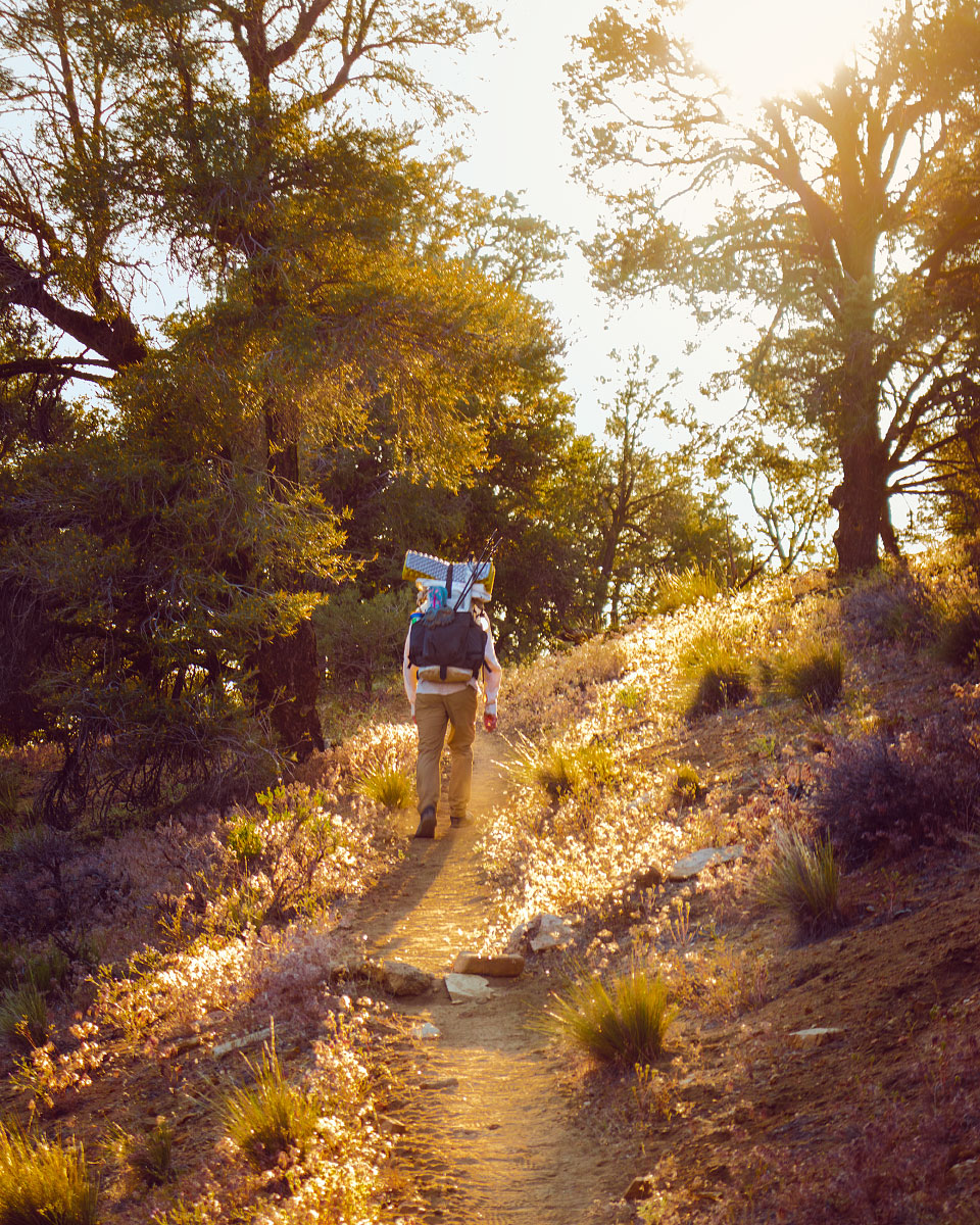
PCT 2018: Days 5-8, Julian to Mike's Place
Photos and stories from my thru-hike of the PCT. This post covers days 5-8 from Julian to Mike’s Place, mile 80-127.
May 9, Day 5
17.6 miles [98.0]
Wow, I had the hardest day. At 2 a.m. Adam woke up with an 8-10-inch long centipede under his quilt, biting him. Like a scene from a horror film, I chased that f@&*er around, dispatching it with flurry of impassioned heel-strikes. I'm not sure now how I feel about cowboy-camping anymore. Neither of us got much sleep after the event. Today's entire hike was exposed. Alien. Wind hotter than hair dryers constantly caught my umbrella, whipping my hand and head, pulling me backwards. All that would seem tolerable, but all day yesterday I had a pain in my right knee upon extension. Tonight, three miles away from camp, I paused for a breather. When I went to move, it felt like a knife had pierced my kneecap, locking my leg in place—9/10 pain. All I could think about was 'failure'. I can't let it consume me. We made an early dinner and I chugged 1,000mg of acetaminophen. Adam insisted on taking my pack for the remaining few miles. What a champ. Eat more, drink more, go slow; you must.
San Felipe Hills, California, mile ~86.
Small natural cave, mile 96.1.
May 10, Day 6
11 miles [109]
Crossed a big milestone today—mile 100. Exited Anza-Borrego and San Felipe Hills, it feels like I'm finally out of another desert. Tried to stay on top of hydration, but nonetheless, my knee hurt all day. Luckily we only planned on making it to Warner Springs—11 miles. I spent way too much time thinking about the implications of injury. Found our way to the Community Center and was surprised at what they had to offer. We both took bucket showers and laundry which were much needed. I also purchased a pair of two-ounce flip-flips which are going to be a big score for camp-life and future showers. Made a small trek to the Post Office to pick up our resupply box. Stopped at the golf course on the way back; there was a closeout sale on junk food. Score. One of the employees was clocking out; she offered us a ride back in her bitchn' 80's Tacoma.
Eagle Rock, California, mile 106.2.
Hiking through Warner Springs Meadows, mile 103.4.
Adam hitches in a pickup truck on Highway 79, mile 109.5.
A very nice Angel from Warner Springs Golf Grill.
May 11, Day 7
0 miles [109]
We took our first zero today; not stoked about needing the rest so early on. I don't think Adam wanted to stop but it's clear he's worried about me. Fortunately, we both got to sleep in due to overcast skies. I wore my puffy all day; finally a nice day in the desert. We used today's downtime to rethink gear, trying not to get sucked into social media. I bought a much needed hooded shirt from 2 Foot Adventures since my right nipple had been rubbed raw by my cheap button-up. This is a major boost in my quality of life. Adam realized his pad popped in the wake of the centipede kerfuffle, but at the end of the day, a Z Lite found it's way into the hiker box. Adam snatched it up—huge score! We also ordered odor-proof bags to store food after a rogue crow took a packet of ramen from our resupply box when I wasn't looking. Finished the day with a life-affirming footbath and ate dinner in the tent.
May 12, Day 8
18 miles [127]
Got an early start leaving Warner Springs; I can finally wake up and pack camp in under 40 minutes. The entirety of today's hike was overcast! Gorgeous Bay Area clouds blanketed the sky which kept me cool during our 18 miles of rolling hills. My knee felt much better for the first nine miles or so, but soon after, a dull and constant pain returned. Challenging. Fortunately, we stayed at Mike's Place tonight. “Off-Trail” made us feel at home by giving us beers and cooking legit wood-fired pizzas. He even offered to let us cook—Adam made a spectacular 'za. Hung out with a dozen other hikers we had seen the past week and reminisced about our short time on trail. Possible chance of rain tonight.
Leaving Warner Springs, mile 109.6.
Adam makes pizza at Mike’s Place, mile 127.0.
Lost Valley, California, mile 118.6.
Hike On?

PCT 2018: Days 9-12, Mike's Place to Cabazon
Photos and stories from my thru-hike of the PCT. This post covers days 9-12 from Mike’s Place to Cabazon, mile 127-211.

May 13, Day 9
18.4 miles [145.4]
Today sucked. Why does life seem so much harder for me than everyone else? Stupid. We woke up in the clouds at Mike's, everything was soaking wet—in the desert. I hastily tried packing the tent only to end up arguing with Adam about something minor and borderline meaningless. Didn't manage my calories well at all and me knees bothered me the whole day. The cloud cover didn't even last long. By 9:30 a.m. I was sweltering once again. Adam made a call home in the afternoon, and somehow, I ended up talking with Mom. Exhausted and dripping, I was curt and rude. Fuck. I hate the phone. I'm so tired of being a goddamn weather-vane of emotions.
Beavertail pricklypear cactus.
Chihuahua road, Lost Valley, California, mile 127.3.
May 14, Day 10
6.4 miles [151.8]
Today we hiked with a group we had been seeing on and off the past few days. This morning, Ryan, Mitchy, “Mio”, Erin, Adam and I all woke soaking wet having cowboy-camped at “Mary's Water”, another morning in a cloud. I was legitimately cold last night. Everyone swiftly got moving, I was the last person to fully pack up. Mood was much better today, I was motivated for town and a burger at Paradise Valley Cafe. It was a short hike to Highway 74 where the owners gave us a hitch back to their cafe. I ended up going with biscuits and gravy and a beer. Very contented, very happy. Knee hurt, but a low-mileage day was helpful. Hitched into Idyllwild; I volunteered to sit shotgun and keep the driver company. Purchased a group campsite, laundry and coin-op showers, more beer and snacks, and a full resupply—five full days worth. Dinner was chili with Fritos and real cheese. What a fun group.
Erin hitching to Idyllwild, mile 151.8.
Adam at Mt. San Jacinto Park.
May 15, Day 11
12.7 miles [186.6]
Spent the morning trying to sleep in with little success. State campgrounds are never going to be quiet. The gang lazed around in the shade and rested up. I medicated with a few Budweiser's. We left Idyllwild in the afternoon and took the Deer Springs trail towards Mount San Jacinto—our goal was sunset on the peak. I now understand this means I skipped 31.7 miles of trail. I knew it had been closed due to fire, but I didn't realize our group didn't plan on going back for the alternate. Note: this doesn't feel great. I should take great caution if I feel the need to do this again. Found myself missing PCT-grade trails and was generally pissed most everyone is faster than me. However, the summit views were intense. Gorgeous, rich hues filled the hazy valley; Palm Springs glowed like a dull ember. We made a hasty camp and cooked Knorr garlic shells by headlamp. “Mio” wants to leave by 3:45 a.m. Ugh.
Adam scrambling on San Jacinto peak.
Deer Springs trail back to the PCT, mile ~183.
Sunset over San Gorgonio mountain.
Sunset over Santiago peak.
The city of Palm Springs, California lit up at dusk.
May 16, Day 12
25.1 miles [211.7]
My alarm rudely went off at 3:30 a.m. I quickly found myself towards the back of the pack during the long, grueling slog down Jacinto. As painful as it was, “Mio” was right—we needed all the time we could get. More than nine hours of descent, my legs are dead. Yesterday we added Darby, to our hiking group. While we waited, rested, and snacked at the water faucet, she taught us “hinky-pinky”, a rhyming word-game. Lots of laughs. Regrouped, we made tracks for Interstate 10. Four miles through sand into a forceful headwind made for rough hiking. We crossed under the overpass and found trail magic! We met Ken, a hopeful hiker for 2019, who offered to drive us anywhere we wanted. Everyone nodded in unison at the idea of In-N-Out in Cabazon. After snarfing down a couple double-doubles, we piled back into the pickup bed and tried to look inconspicuous. I split up an 18-pack of beer; three cans weighs too much. We ended a few miles away from the highway, resulting in my new longest day—25 miles.
Sunrise on Fuller Ridge, mile 187.5.
Descent off Mount San Jacinto, mile ~191.
Seeking shade in the California desert, mile ~196.
A distant San Gorgonio mountain, mile ~195
Mount San Jacinto, north of Interstate 10, mile ~211.
Interstate 10, mile 209.5.
Sunset on Mesa Wind Farm, mile 211.7.
Hike On?

PCT 2018: Days 26-30, Agua Dulce to Tehachapi
Photos and stories from my thru-hike of the PCT. This post covers days 26-30 from Agua Dulce to Tehachapi, mile 462-570.

May 30, Day 26
17.6 miles [478.2]
It was wonderfully cloudy this morning, I still don’t have any idea what to expect in the desert. Enjoyed the misty hike into Green Valley with only one minor knee flare up, then immediately beelined for Heart and Soul Cafe where I devoured a club sandwich and iced Americano. Strolled into Casa de Luna and was immediately won over by the atmosphere. While I was donning my obligatory Hawaiian shirt, “Smokey”, a hiker who looked like he’d been vortexed a few days, introduced himself along with the house rules while simultaneously handing me a freshly packed pipe. I obliged and didn’t bother asking him how he got his name. I found Terrie and made sure to give her a hug—the first of 10 rules. Played some frolf with Adam in the manzanita forest while drinking beer from the gas station. I agreed to stir the nacho cheese to help with dinner prep. Also in the kitchen stirring beans was “Metric Ton”, a curious fellow whose name is derived from his base weight. But the biggest surprise of the day was discovering “Mio” is spending the night! Hippie Daycare exceeded all expectations.

Adam takes a snack break.
Shafts of light penetrate the deep scrub on a misty morning, mile 464.
A foggy, mysterious trail, mile 464.
Power lines over Sierra Pelona mountains, mile 463.8.
May 31, Day 27
25.9 miles [502.1]
Slept decently well at Casa de Luna. As promised, Joe made pancakes for all of us hungry hikers. I was slightly hungover and nursed some coffee. Last night's discussions and gossip about other hikers and the Sierra quickly resumed. Everyone gathered and we danced for Terrie in order to earn our PCT Class bandanas. During my “performance”, I sultrily unzipped my puffy and flung it from my body. Somehow it found the one nail on the garage door and hung itself absolutely perfectly. The crowd burst into raucous laughter. Just before heading out Terrie orchestrated a group photo, one which we'll all remember forever—photo or not. On trail we caught back up with “Mio” who's hiking with his buddy from the military. Just as dusk settled in Adam and I crossed the 500 mile marker. I would have felt more accomplished but something's clearly bothering him and I can't tell what. We talked poorly a few times. Found myself getting irrationally angry. What have I done?
500 mile marker.

Rock texture.
June 1, Day 28
27.2 miles [529.3]
The wind was so strong we took down our tent only 13 minutes after turning out the lights. It was a rough night of sleep. Fifteen miles of this morning’s descent weren’t any less gusty. Thought Adam was ahead of me and played catch-up for two hours, only to make it to Highway 138, completely alone, engulfed in a shadeless desert I had absolutely no desire to be in. It was 95 degrees. It’s June. I’m not even one-fifth done. I let out a heavy sob, one which I had been holding since May. Fuck this desert. Twenty minutes later, he showed up. I felt stupid. We took a long rest in Hiker Town, a poop in a real toilet got rid of a few demons. After trying to get a quick doze in, “Horny Toad” drove the communal Chevy Astro to Neenach Cafe. Somehow this place served hand-formed fresh burgers. I washed one down with a Manzanita Sol and a cherry Coke. Per usual, I didn’t have a plan for the upcoming terrain. Apparently this is the hottest, hardest section. Adam suggested we leave at 6 p.m.to take advantage of the night. Lot of other hikers seemed to be doing the same. We managed just shy of 12 more miles, stopping only for a positively stunning cloudless sunset and tuna taco dinner. We set up camp at 11 p.m., I’m utterly spent, I just feel annihilated.
Leaving Hiker Town, mile 517.6.
Clarkia cylindrica, speckled fairyfan.
Dirt road into Hiker Town, California, mile 517.
269th St. W, 517.6.
LA Aqueduct, mile 520.9.
June 2, Day 29
28.7 miles [558.0]
Woke well before dawn, hell, it was still night. Sunrise came quickly, illuminating thousands and thousands of turbines, all whirring and humming away. When it wasn’t being whipped around, my umbrella blocked most of the views. Mazama Wind farm was lonely, nothing but winding, scrubby hills filled with ghostly pinwheels. After 20 brutal miles, the desert gave us some respite—Mile 549 Bar and Grill—trail magic. I guzzled a blue Squeezit, straight from my childhood, hoping it would somehow transport me back. “Hard Time” seemed to be enjoying himself, every time I passed him he was Snapchatting. Ripped off the band-aid and left. Another eight miles made today our longest yet. Adam was melancholy and despondent the whole time. “I can’t keep doing this”, he told me at dinner, “I can’t be responsible for anyone.” I didn’t know how to respond. Am I burdensome? I don’t want to do this by myself; I want someone to share it with. What a gross thought. The turbines seem even louder at night, buzzing like low-pitched mosquitoes. The desert was so hard today.
Mazama Wind Farm sunrise, mile ~534.
Adam at Mile 549 Bar and Grill, mile 549.
Wind turbine, mile ~539.
Sawmill, Bootleg, and Quail canyons, mile 556.4.
June 3, Day 30
12.8 miles [570.8]
Woke from my bad dream not feeling any better. An overwhelming feeling of “useless, goalless, aimless” filled my entire being. It would have been easy to sit and wallow, but I tied my shoes tight and tried to pull it together. Made it through eight more miles of wind farm before reaching the highway, thankfully it was all downhill. Got a hitch and after relocating from a BBQ joint, found ourselves at a trusty McDonald's. One large iced coffee and impassioned internet search later, I purchased my own tent. Well, Adam did, now we’re square on that camera debt. Did a resupply at Albertsons and Dollar Store as well as coin-op laundry. Even found time to crush a Hot-N-Ready. Ran amok, we probably did five miles in town. Found an angel, Jeff, offering rides back to the trail. He’s only been doing it for three weeks but already helped out nearly 200 hikers. Hard slog up and away from the highway in some of the strongest wind I’ve ever experienced. Hunted a few miles for a shielded place to cowboy—hopefully this little bush helps.
Sunrise leaving camp, mile 558.
Desert signage, mile ~559.
Leaving Highway 58, mile 567.8.
Alta wind farm sunset , mile 568.9.
Hike On?

PCT Thru-Hike: Before – Planning, Preparing, and Problem Solving for 2,650 Miles
In 2018, I thru-hiked the Pacific Crest Trail with my brother. Before the trail, we watched dozens of YouTube videos and read countless gear reviews. In the spirit of giving back—and recording my memories for posterity—here's what we did before either of us set foot on trail.

In 2018, I thru-hiked the Pacific Crest Trail with my brother, “Shocks”. It was the first thru-hike for either of us. Before the trail, we watched dozens of YouTube videos and read countless gear reviews. In the spirit of giving back—and recording my memories for posterity—here's what we did before either of us set foot on trail.
Other Blog Topics
Planning | Analysis | Gear Review

An overall map of the PCT. Photo Courtesy Pacific Crest Trail Association.
From Where to Where?
“The what? The Pacific Crest Highway? Mexico to where? Are you bringing a gun? Walking? The entire thing?” These bombastic questions and more will randomly greet you once you decide to hike. Few will ever understand the power of long distance hiking, but you are different.
You are a dirt-bag vagabond. Hiker trash in the making.
One Year Out
Deciding to Hike
I've always been an outside cat kinda person; living in the great outdoors genuinely appeals to me. Over the years I saw friends of mine set off, posting their progress online. I'm ashamed to admit jealousy was always the first feeling I had.
The spring before we started, Adam approached me and declared his intentions to hike. I remember thinking there wasn't anyway in hell I was going to allow myself to be jealous of my brother. Rather than try and find a way to be proud of him from home like a mature adult would do, I decided it was time to realize my dream and take the leap as well. He welcomed me; I owe him everything.
All you really need is a permit, a backpack, some money saved, and a way to get to the terminus. You probably already have the desire. If you're like me, seeing posts on social media of friends long distance hiking makes you envious. Use those emotions to fuel your hike. This is something you want to do, or you wouldn't be reading this. But the best advice I got was from two Class 2017 hikers; “don't over-plan”. After talking with other hikers on the trail, it became apparent just how much planning a person can do. From planning every meal, to having nights on trail determined, to amount of zeros they were going to take. Nothing against that method, but my motto was, and has always been; “cross that bridge when you come to it”.
I would be remiss to mention Adam did all the work; no hyperbole. I spent my days reading camera reviews and working on old photography projects. Any gear he meticulously researched and bought, I also bought because I valued his reasoning and research.
“Bones or Clams or Whatever You Call Them.”
It's no surprise the Pacific Crest Trail costs money even if you are technically homeless and eating Top Ramen twice a day. And like most things in life, money is usually the prohibitive factor for most people. Not only are you spending for the entire 4-6 months, you're also not earning any money (unless you got mad-hustle and prior investments). Most people I met on trail weren't well-established in the work force, meaning not salaried without benefits. Financially secure hikers were out there, but in my eyes, certainly weren't the majority. Most had saved up or were already living frugal lives and took it to the next step.
During my three-month summer employment (with free room and board), I hiked a lot more instead of spending time at the St. James (local bar). During the winter, I worked lots of six-day weeks for overtime pay. I went out even less than I normally do. I shared an apartment with Adam and cooked as many cheap meals as possible. Frugal living started well before life on trail.
For my particular situation, I knew I would have to save up close to $8,000. I was expecting to have an 'average' trail experience in terms of spending, but I also knew I had to find a place to live after the trail. I didn't have solid plans to move back to Colorado, but I knew what to expect in the event I should (spoiler: I did).
For more information, here’s an entire blog post on what the PCT actually cost me.
Training to Hike 20 Miles a Day
Adam shredding Way Out bowl in Breckenridge, Colorado. Totally counts as training.
“What training did you do for the trail?” was a question I received constantly. I'm still not quite sure how to answer. It stands to reason most people mean conditioning when they say training. And in that sense, I didn't do any conditioning. I didn't even buy my shoes until last-minute (would not recommend). Perhaps I walked 10 miles a week to and from work in my ski town. Not exercising wasn't the best idea (duh, hello), but I wasn't completely inactive. I was working 50 hours a week as a lift operator in Breckenridge, Colorado. Six months of shoveling, skiing, and living above 10,000 feet. I was “active” to say the least. No doubt, I could have used a lot more conditioning.
I did, however, have extensive backpacking experiences to draw from. Training is a learned skill or behavior, and by this measure, I was well ahead of the learning curve for most first time thru-hikers. Backpacking wasn't brand new to me. Years of family car-camping and a solid tenure in Boy Scouts was ample training. What essential items to bring, what to leave behind, how much food I needed, how much water I should carry, what to do when it rains all day; all these factors and more weren't troubling me pre-trail.
Logistics
Transportation To and From the Trail
BEFORE: Arriving at the southern terminus wasn’t difficult. We had a few friends offer to drive us since we are SoCal natives. We ended up taking the train to San Diego and stayed at a friend’s house the night before; he drove us to the terminus in the morning. I don’t think we knew much about Scout and Frodo’s until after the fact. It would have been a cool experience to participate in, but I’m kinda glad we did it our way. Apparently 2019 and 2020 will be their last years hosting hikers.
DURING: One doesn’t just simply walk into Canada. I had my passport at home ready for delivery to the Oregon/Washington border. I found out in Mount Shasta, California that I was going to need an additional Canada Entry Permit (thanks Dad and friends). Dad helped me get it processed while I was hiking.
AFTER: We hiked into Manning Park, Vancouver, Canada in the late afternoon and still had to find a way to get home. With no solid plan, a mind for frugality, and lots of hope and trail experience, we thumbed a ride into Vancouver. The Greyhound bus which ran in prior years wasn’t running in 2018. After a few Google searches we found plane tickets for that next morning and took a metro system to the airport where we spent the night. Less than 24 hours later after becoming PCT thru-hikers, we landed at LAX.
Food and Resupplying
Most likely, you will choose to prepare a portion of food before you leave. Popular advice suggested sending resupply boxes to 10 locations, so we followed suit. Adam calculated the distances between ‘known’ resupply points figuring on 20 miles per day average and came up with an idea for how many total days of food we were going to need.
It should also be mentioned we saved quite a bit of food from our summer employer, Philmont Scout Ranch. To be clear, this was not stolen food. All food came from swap boxes (basically, a hiker box), taken at the end of the day. I think that covers me for possible future employment. What can I say? Kids don’t like Mojo bars.
With that said, we found ourselves in late April at a local Grocery Outlet armed with a shopping cart and only the vaguest of ideas as to how much food we each were going to need for those 10 boxes five months from then.
After amassing all the food we both saved and bought, everything got dumped out onto the living room floor and an inventory list was made. We tested a few methods before finding one which seemed like it was going to work.

We estimated one day's food requirement and then we made dozens of one-day food piles, replicating the 'meal plan' with some slight menu variations. Each of those piles were then packaged into a Ziploc in either one or two day quantities. The reasoning being 1) we roughly know how much we're going to eat each day 2) we knew which towns we wanted delivery to. The biggest variable seemed to be knowing how many days we were going to hike once we got to one of those known resupply towns. Some hikers would buy a lot of food a few towns ahead and mail it to themselves in a known hard spot to find cheap and reliable food.
Our idea was to share resupply boxes to save on shipping and since we planned on hiking together. Our parents graciously offered to cover the postage fees to mail out our resupply boxes; this was a pretty nice windfall. And we could certainly count on them to mail the food.
Final Thoughts
Saving enough money, buying appropriate gear, and conditioning yourself are the first of many problems you will solve along your journey. Don’t over-plan, it’s easy to get excited and make lists. Save enough money, but have a mind for frugality. Don’t plan every meal, but go on a few hard all-day hikes to see what you consume. Don’t buy top-of-the-line gear for everything, but splurge on a few good items. You can’t plan for everything.
“Sow the seeds of expectation; reap disappointment.”

The Road Trip Day 1: Barefoot in Monterey
6:37a.m.; I beat my alarm clock by three minutes. A softly rising sun streamed through my bedroom window while I quickly dressed. Coffee brewed and poured...
Pacific Coast Highway, California
May 7, 2015
6:37a.m.; I beat my alarm clock by three minutes.
A softly rising sun streamed through my bedroom window while I quickly dressed. Coffee brewed and poured, and with a few more weepy goodbyes from my parents, we piled in the car and headed off.
Opting for the scenic route, we chose to drive along California's famous highway, the Pacific Coast Highway, or as hip locals say, “the P-C-H, dude”. Miles evaporated while excitement and tunes freely flowed throughout our vehicle.
Lunch time sped up on us.

Pizza lunch on a table in San Louis Obispo, California.
After a quick reference from Yelp, we pulled off the highway and headed for Pizza Solo in San Louis Obispo. We opted for a bacon, chicken, and pepperoni pie. #treatyourbodylikeatemple. It got snarfed down immediately.
Back on the road.
We headed further North. With Los Angeles a considerable distance in the rear-view mirror, heavier and darker clouds began to permeate the sky.

After another hour and a half, it was time to get out, stretch our legs, and check out the beach.


A peaceful moment at Arroyo Laguna State Beach.
It was a spectacular afternoon.
This is the first time I have ever traveled along the PCH. California natives, mostly retirees, regularly discuss driving its entire length.
There was no shortage of amazing coastal scenes. Mile after mile of winding and soothing coastline filled the windows.
Here's an excerpt from my journal:

“The [trees] looked a lot like snarled Bristlecone pines. Dunes and mountains were covered in colorful native brush. Steel blues, muted mustards, and olive grasses adorned the rolling hills. The entire time, hugged by the crushing ocean—jagged rocks breaking through the madly frothing surface of sapphire and turquoise foam.”
Another hour of winding and cruising later, about 70 miles before our hotel, we made one more stop.
There weren't any signs, but there was a large pull-off area on the opposite shoulder. We parked, hopped out, and inspected our surroundings.

What a scene to be rewarded with.

The three of us silently stood still and enjoyed a cool sea breeze. A gentle rumble of breaking waves below us kept an even tempo.
Carter gently reminded us we still had a bit farther to go.

A unique erosion control method.
We arrived at our hotel just as it stopped sprinkling. After a quick unpacking, we went downstairs seeking dinner recommendations. The lobby had complimentary wine and cheese.
Dinner options were within walking distance. Not soon after setting out, my homemade moccasins were thoroughly soaked from the soggy pavement.
I removed them. Socks too. The concrete was cool and wet.
We continued searching for something other than pizza.
Hey, want a ride?
Turn it around:
Stick your thumb out:
The Road Trip Day 2: Foggy Mountain Monoliths
Woke up with yesterday's cloudy skies still hanging around. The coastal air was crisp. We packed up and drove with the windows...

Yosemite National Park, California
May 8, 2015
I woke up to yesterday's cloudy skies still hanging around. The coastal air was crisp.
We packed up and drove with the windows down. Today's journey was less than 200 miles and we had a camping reservation. The goal was to head out early, take our time, and enjoy the views.
Slowly, we gained in elevation. The temperature kept dropping.

Welcome to Fish Camp.
It was cloudy and ominous all day.
Upon arrival at Mariposa Grove, we were surprised to find at least three inches of snow on the ground. Water dripped from the trees, plunking loudly on our car's roof. We each took turns peering through the sunroof watching large droplets splash on the glass.

We got out and took a walk.

It was cold!
Yesterday's overcast delight spoiled me. I hope I brought enough warm clothes for the entire trip.

Caleb Jennings enjoying the cool air at Mariposa Grove.


With temperatures hovering in the mid 30's, there was talk of finding an alternate plan. We were not prepared to camp in the snow.

The decision was to find and rent a room for the next two nights. After all, we are on a vacation.

Headed to Tunnel View via Wawona Tunnel.
After exiting the park, we found a room with a reasonable rate. Camping would have been rough; my sleeping bag is only rated to 20 degrees.
Dinner was Mountain House pasta primavera and a generous glass of whiskey. I lost two cribbage games.
Tomorrow's plan is to hike the Mist Trail.
Hey, want a ride?
Turn it around:
Stick your thumb out:

The Road Trip Day 3: 7,200 Feet of Granite
It was easy to get up this morning. I appreciated the lack of snow. A head poke outside revealed beautiful blue skies.

Yosemite National Park, California
May 9, 2015
It was easy to get up this morning. I appreciated a lack of snow. A head-poke outside revealed beautiful blue skies. What luck!
After a short drive to Happy Isles trailhead, we hopped out, laced up hiking boots, got water filled, and applied sunscreen.
Ready.
Although it was steep, we breezed past the majority of heavily panting visitors.
About 1.5 miles, 1000 feet of elevation gain, and 600 stone steps later, we arrived at the top of Vernal Fall.

We found a comfortable rock and took a water break at the top.
I snapped a quick group shot.

Switchbacks are my favorite.
However, we didn't stop for long. Nobody wanted to hike in the heat of the day. Duh.
Up, up, up.
It was a steady incline the entire way.


Caleb at Clark Point.
Four miles later, we arrived back at the parking lot. Sweaty.
With time left in the day and not wanting to hike 3,000 feet up out of the valley floor, we jumped in the car and drove all the way around to Glacier Point.
Carter locked the car and the three of us waded through the crowd, politely waiting our turn for a view from up against the railing.

View of Upper and Lower Yosemite Falls from Glacier Point.
As luck would have it, a massive cloud eclipsed Half Dome and hung around for the duration of our stay.
Half Dome was half-visible.
I felt cheated, but on the other hand, it was a unique view.
Guess I'll have to return someday soon.

No, 'Cloud's Rest' is the other mountain!
Tired and hungry, we exited the park.
Caleb suggested a quick stop at the general store for some dinner additions. Once back at our room, Carter found some tunes, and I prepped dinner.
Whiskey was poured.

I had a big bowl of vegetarian stew out on the deck and watched sunset.
Tonight is our last night in Yosemite.
Hey, want a ride?
Turn it around:
Stick your thumb out:

The Road Trip Day 4: Whiskey and Stars
I packed my things swiftly. I've improved each day; junk-wrangling is getting more efficient. Carter made a final sweep, then it was off to...

Sequoia National Park, California
May 10, 2015

Caleb watching the passing landscape morph and change.
I packed my things swiftly. I've improved each day; junk-wrangling is getting more efficient. Carter made a final sweep, then it was off to Sequoia National Park.
The 120 mile drive didn't take long. Fields of orchards and farming land slowly turned into rolling hills with massive and elegant oak trees. California: as stereotypical as it gets.
Carter purchased his obligatory bumper sticker at the visitor's center, we got our overnight camping pass, and continued driving deeper into the park.
Conditions at the trailhead were ideal; cold mountain air and warm sun. After 20 minutes of rummaging through our thoroughly packed car, I had Frankensteined together an overnight pack. The three of us were ready to set off.
Man, we are slow, sweaty, sea-level bums!

Pausing for a quick breather.

Descending into lakes Heather and Emerald while looking across the Marble Fork Canyon.
The Lakes Trail was definitely strenuous.
For five miles we climbed upward and gained about 2,000 feet of vertical. Sure, I'm no couch potato, but carrying a backpack at 9,000 feet was exhausting for this non-acclimated landlubber. I probably should eat more snacks next time.
Much to our surprise, we finally descended into Emerald Lake basin which was our camp for the evening. Nestled at the base of a sharp and angular ridgeline, we began setting up camp. Snow-capped peaks completely surrounded the many tiny lakes.
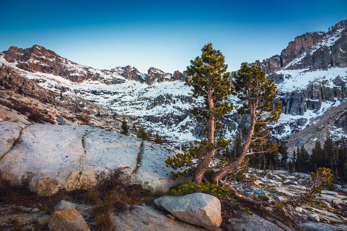
Trees in Emerald Lake basin.
We didn't see another soul.

Tonight's dinner menu: Top Ramen—chicken flavor. The warm, salty broth soothed our aching bones.
Of course, a healthy serving of whiskey was helpful too.
We scrambled to a nearby overlook to watch the sunset. Completely clear skies lead to a wonderful display of alpenglow.
Slowly, the first stars of evening began twinkling in the lavender light.

The cliché about how well our 'hotel room' is rated.
The temperature kept dropping; you could feel the dismal cold outside the tent.
Inside, I was snuggled up in my bag, warm, and happy to have a hot Nalgene cozied up to my feet. Altitude made it difficult to get to sleep despite today's workout.
Tomorrow—a day to chill.
Hey, want a ride?
Turn it around:
Stick your thumb out:

The Road Trip Day 5: Shwackin' and Chillin'
Warm sunlight streamed in through our tent. Somehow, I managed to sleep until 8 a.m. Glorious...

Sequoia National Park, California
May 11, 2015

Gotta find ways to warm up in chilly, subalpine mornings.
Warm sunlight streamed in through our tent. Somehow, I managed to sleep until 8 a.m. Glorious.
I got dressed and found a few oatmeal and fig bars for breakfast
Today's objectives:
1) Relax.
2) Get (closer) to the car.
We scoured the rocky alpine landscape in search of a great view with some hammock-able trees.

Scouting out potential chill-spots.
Carter spotted a nice ledge about a quarter mile away. He had his hammock, Caleb had his Z-rest. I planned on finding a comfortable rock in the shade.
It was a nice spot.

He's gonna regret the sunburn.

Carter busting a fat chill.
Eventually, we snapped back to reality. Tomorrow's drive is going to be long; an early start will be a necessity. We needed to pack up camp and hike back toward the car.
Hiking downhill is a lot less work.
We made great time.
There was a quaint picnic area by the parking lot which seemed closed for the winter season. It looked like a great place for an easy impromptu campsite.
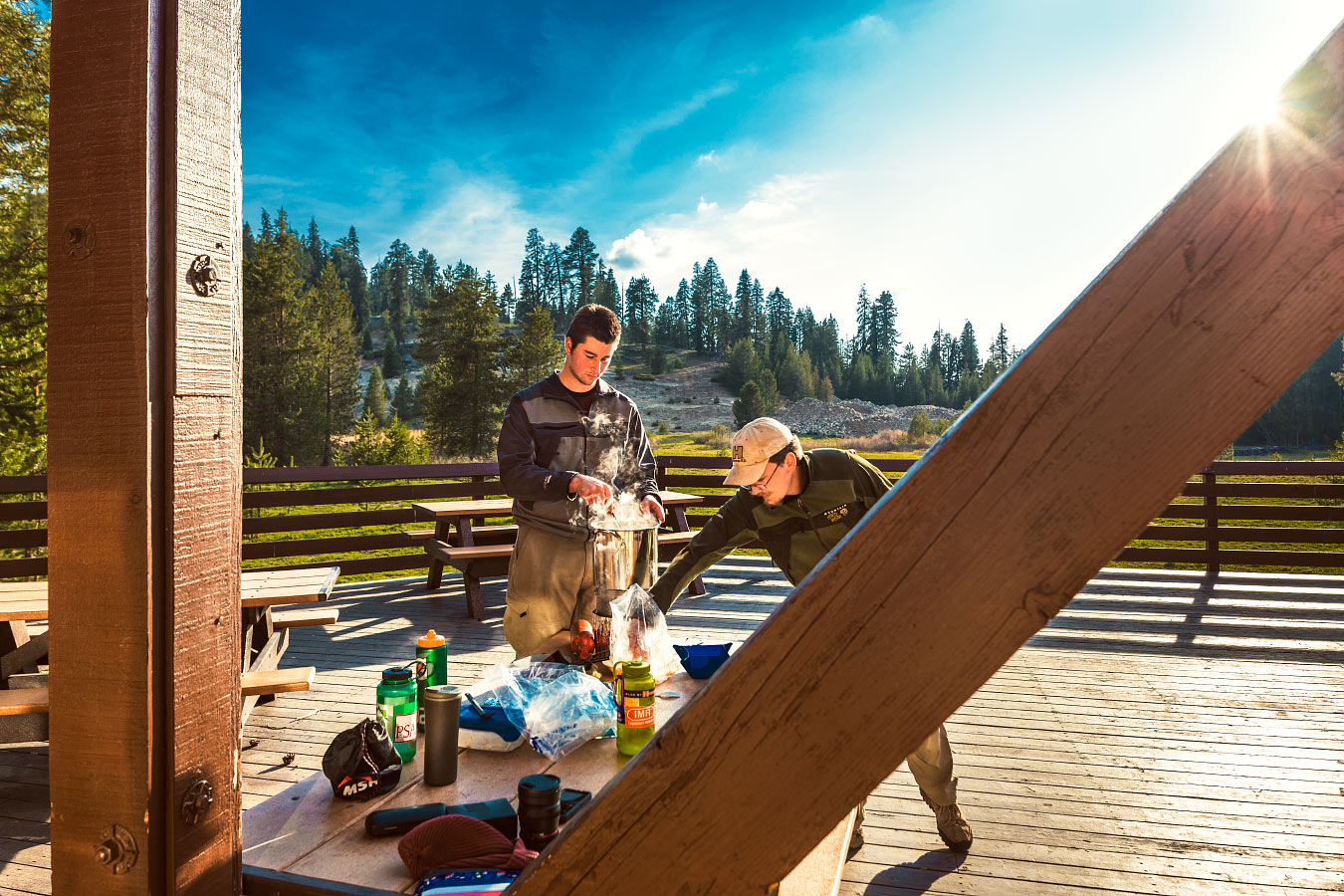
Stirring the pot; you don't want crunchies stuck to the bottom.
The three of us played a few games of cribbage. It seems like I'm losing more games than winning at this rate, but I did manage a 20-point hand. There was yelling.
Dinner was Santa Fe Chicken mixed with some fresh garlic and leftover cheddar cheese we found stashed in the car cooler.
Delicious.
With an empty parking lot and no one else around, we pumped the music a little louder than usual.
Yummy, crunchy.
Bedtime came with the arrival of darkness.
No tent, it looked clear enough.

Hay bales provide more insulation than a wooden floor. Right?
I tossed and turned the whole night. It was below freezing.
My hot water bottle didn't seem to do anything.

Wolverton Picnic Area at night.
Hey, want a ride?
Turn it around:
Stick your thumb out:
About the Blog

Justin Kernes is a photographer and writer who thrives in the great outdoors.
From 2010-2017, he worked in the backcountry at Philmont Scout Ranch in New Mexico.
In 2018 “Tiny Slice” successfully thru-hiked the Pacific Crest Trail.
Search the Blog
Featured Posts


Photos and stories from my thru-hike of the PCT. This post covers day 111, Goat Rocks and my 30th birthday.