

PCT 2018: Days 17-21, Big Bear to Wrightwood
Photos and stories from my thru-hike of the PCT. This post covers days 17-21 from Big Bear to Wrightwood, mile 266-376.

May 21, Day 17
16.2 miles [282.3]
Leaving our host's house was quite challenging. A few hikers still needed to do some errands which felt like it took forever. Adam and I got dropped off at Von's for a few supplies, then waited patiently for our ride to show up. While standing at an intersection, a braceleted arm shot out of a '01 Toyota Camry, waiving a $20 bill. Two girls, their Coachella sticker prominently displayed on the rear window, iced Starbucks in hand, were looking right at us. I yelled back “Hiking!”, then immediately realized I wasn't above accepting free money while I watched them speed off. Oh well. Finally, around noon, we arrived back at Highway 18, resupplied, showered, and rested. I felt amazing. Did 16 miles before setting up camp on top of a small mountain Mitchy insisted we check out. He wasn't wrong, the view was completely worthwhile. Crushed a tuna taco—I could get used to these.
The gang gets dropped off at highway 18, mile 266.1.
Dog goes for a ride, Big Bear, California.
Sun worn wood texture.
Scrub oak and setting sun, the colors of California.
Sunset over San Bernadino National Forest, mile 282.3.
May 22, Day 18
27.8 miles [310.1]
New longest day at 27.8 miles in addition to crossing the 300 mile-marker! Got decent sleep, started hiking by 7 a.m. Didn't talk much with the group, knees felt good so I just kept moving. At one of the Deep Creek Canyon crossings there was a collapsible ice-chest with fresh apples and caramel which was quite refreshing in the afternoon heat. Most of the day just went by until Adam and I arrived a the Deep Creek Hot Springs. I soaked my feet and cleaned off the past few days of dust and sweat in the soothing, warm water. We waited for an hour but our group didn't show up. With daylight left and camping at the hot springs illegal, we did a few more miles while dusk settled in. Finished the day with tuna taco and avoided mosquitoes. I guess they exist in the desert too. Bastards.
My worn hand from using a hiking pole.
Sunset over Deep Creek, mile 310.1.
May 23, Day 19
25.5 miles [335.6]
Another 25-plus mile day. Had a Snickers and washed my feet on the last crossing of Deep Creek. Made great time and managed 18 miles to Silverwood Lake where we stopped for lunch. I'd noticed over the past few days Adam has been quieter than usual, his playful snarky demeanor replaced with quiet somberness. It was bumming me out. I inquired and he told me he wants more independence, something I'm shocked I didn't realize sooner. We left the lunch spot, not saying another word. I guess I could do this hike alone—I just don't want to that badly. Bad thoughts. It was hard to think about anything else for the remainder of the day. Only the hope of tomorrow's McDonald's was enough to keep my legs moving. We set up camp, distant train horns filled the still air every 20 minutes. While eating dinner, we met “Kickstand” who mentioned he's working on a calendar year triple crown. It took me a few moments to realize the extent of his plans. “Mind if I crash your campsite?” he asks, taking off his pack and pulling out dinner. We both nod, tired from the days efforts. “Man, it's so cool that you guys are doing this. My brother would bitch and moan about Tuna Creations or filtering water.” Nervously laughing, I found myself holding back tears. It had been an exceptionally hard day.
Cleghorn Mountain, outside of Big Bear, mile 331.8.
The last crossing of Deep Creek.
Abandoned used pair of shoes.
A band of quartz, mile ~312.
Cedar Spring dam, mile 324.
May 24, Day 20
26.1 miles [361.7]
Today hurt the most since it was our third day in a row doing over 25 miles—but I'm still stoked. Woke up covered in dew which made me nervous about packing away my quilt. Made it to McDonald's like it was the last mile of the Boston Marathon. When we arrived we saw “Kickstand” impatiently waiting, he begrudgingly mentioned it was closed due to a power-outage. Also waiting were two other hikers, Will and “Two for Two”. With all layers on we waited in the damp clouds watching tourists and commuters get out, throw a small fit their Micky-D's was closed, and drive off. I wanted to inform them this was our only water source for another 21 miles. After an hour, they finally opened. I ordered a McMuffin, two hash browns, two sausage burritos, and a coffee, devouring it quicker than it took to make. Will, wracked with hiker-hunger, had some trouble understanding exactly what was included in the combo meal, taking several laps with the cashier. I made sure to call him “Combo” for the rest of the day. A quick stop at the gas station for a beer to smash and one to pack out and we were back on trail. The clouds burned off and we were left hiking up a huge hill, hot, exposed, and buzzed. Had another tuna taco and the other Steel Reserve.
Agave americana, mile ~362.
Burn area and rebirth, mile ~360.
Hiking in the mist towards Cabazon, mile ~363.
Adam admiring an agave bloom, mile ~347.
Cajon Pass view, mile 343.4
Swarthout Canyon, mile 347.2.
Interstate 15 at Cajon Pass, mile 342.
May 25, Day 21
14.5 miles [376.2]
Woke up to an island in the sky—a huge bank of clouds covered the valley floor—and saw where we were five days ago. Took a relaxing snack break on the Discovery chair lift at Mountain High. Hitched into Wrightwood and got a free hot dog with fixin's at the market. Resupplied at Jensen's, then celebrated our hard work with a BBQ chicken pizza from Mile High splurging for cinnamon twists, what the heck. Got a ride out from Ed in his BMW 328i and tried to levitate over his leather seats. Neglected to fill up water and found myself needing more only a few miles after starting. Made a naive call to filter water at Jackson Flat which was off trail and probably not necessary. Adam wasn't thrilled. Aimed to get as close to Mount Baden-Powell as possible; the cool evening air made the ascent far more enjoyable. Cloud cover which had hung out all day suddenly began to glow with the setting sun. Rich cotton-candy hues filled the fog around me. It's going to be a cold night.
Pinus lambertiana, sugar pine, mile ~376.
Ascending Mount Baden-Powell, mile ~376.
Vincent Gap, highway 2, mile 374.
Hike On?

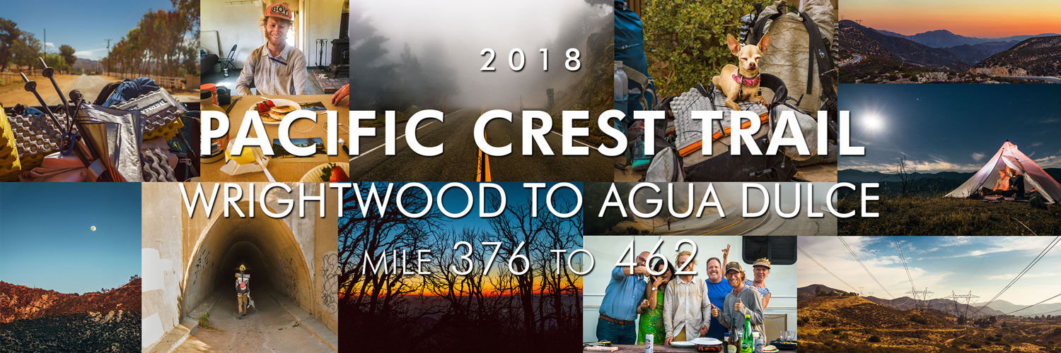
PCT 2018: Days 22-25, Wrightwood to Agua Dulce
Photos and stories from my thru-hike of the PCT. This post covers days 22-25 from Wrightwood to Agua Dulce, mile 376-462.
May 26, Day 22
19.7 miles [395.9]
Slept in until 7:15 a.m. fully aware we had to climb the remaining 1,000 vertical feet of Mount Baden-Powell. Met some nice people at the summit and took a relaxing breakfast stop. More gorgeous clouds today but my knees and feet are shot from the sheer amount of ups and downs. Passed by what felt like 100 Scouts headed towards Little Jimmy campground; I remember camping there as a young boy with my Troop. Crossed back and forth over Highway 2, eventually taking Buckhorn detour and roadwalking for nearly three miles. It was completely overcast. Occasionally a patch of clear would appear, quickly gobbled up by the moving mist. Heavy clouds filled the foothills below and trees above. I wore my puffy for most of the afternoon. Found some magic at Islip Saddle; Doritos, brownies, and some lavender-flavored after-dinner mints whose flavor had me contemplating if there was any food I wouldn’t eat. We walked through a very full Cooper Canyon, a popular campground for local Angelenos. A family enjoying their campfire saw us quietly walking by. “What you got in those bags?” asked the mother pointing at our backpacks Corona in hand. Adam and I smiled at each other. “Everything” doesn’t mean the same thing to weekend warriors.
Islip saddle, mile 386.1.
Highway 2, Angeles Crest, mile 389.3.
May 27, Day 23
25 miles [420.9]
It’s hard to believe we got trail magic on four separate occasions today alone. First was at Camp Glenwood where we met Maxx, who welcomed us inside with chocolate chip pancakes and fresh strawberries. Adam let me steal a spoonful of peanut butter. Maxx spied my Philmont ball cap, which I had switched out in Big Bear, and asked if I had been to the Ranch. I smiled big. We talked about his trek, the flood, and amazing staff. Next, we made it to Three Points junction and met JT, a thru-hiker from 2014, who tossed us both a PBR. Didn’t even make it three miles before magic spot number three; a stash of craft beers in the shade of a magnificent Douglas fir. Miles melted by. Just when I thought it couldn’t get better, we were graciously provided with dinner by a couple who are planning on hiking next season. They had an easy-up at Mill Creek Fire station and all the sandwich accoutrements. I made a chicken-avocado-cheddar and washed it down with a Coke. To top it off, they even knew about Philmont—their kid went on trek. We thanked them until it became borderline uncomfortable. Did two more miles and set up camp under a nearly full moon. Maybe it’s all the beer I drank, but it was hard not to think about the Ranch.
Moon rise over Angeles Crest Highway, mile 418.6.
Sunset at camp, mile 420.9.
Strawberry peak sunset, mile 418.6.
Pancakes at Camp Glenwood, mile 400.6.
May 28, Day 24
24.1 miles [445.0]
Greeted by another stellar desert sunrise upon waking. Temperature hovered in the high 90's all day which made for tough hiking. Pushed 15 miles to the North Fork Ranger Station where I refilled water, bought a Coke, and did extensive feet-maintenance. I could have sat there in the shade all afternoon. Another eight miles to the Acton KOA which offered $10 showers and frozen treats. Couldn't wrangle a deal with the attendant so I settled for a chocolate Dove bar and decided another spigot foot wash was all I needed—the 'off-limits' pool called my name the entire time. Marginally refreshed we began to hike out, only to be stopped by a pair of couples dining alfresco in the RV section. “You guys hungry?” they yelled as we walked by. We smiled, I still feel awkward accepting such benevolent charity. We sat and ate kebabs and pasta salad, everyone shared camping mishap stories. They insisted we take a bottle of wine and Perrier and beamed when I called them “Trail Angels”. My outlook on the day has changed; fellowship is more renewing than a hot shower.
Camping above Soledad Canyon, mile 445.0.
Trail magic at Acton KOA.
May 29, Day 25
17.6 miles [462.6]
Up at 5 a.m. and to no surprise it got hot almost immediately. Luckily the terrain was fairly easy into Agua Dulce. Vasquez Rocks was worth a return trip. Bought a strawberry Arizona iced tea and hitched in a truck bed over to Hiker Heaven to wait out the midday heat. “Numbers” gave us the run-down, I signed up for a shower and laundry immediately—it had been over two weeks. I lazed around in the shade with other hikers, sipping on the bottle of white wine we got yesterday, and talked about surviving for nearly 500 miles. Got drunk pretty quickly since I had only eaten a few snacks. Refreshed, we went back into town for resupply. Adam and I gorged ourselves on an eight-piece fried chicken dinner and a bagged kale salad from the deli counter. Pumped for Casa de Luna tomorrow, I’ve heard it’s an iconic location in trail culture. My clothes smell fresh, I am clean, I have food. Life’s good.
“Tiny” the dog at Hiker Heaven.
Highway 14 tunnel, mile 451.1.
Truck bed views near Agua Dulce.
Petersen road power lines, mile 456.6.
Hike On?

PCT 2018: Days 26-30, Agua Dulce to Tehachapi
Photos and stories from my thru-hike of the PCT. This post covers days 26-30 from Agua Dulce to Tehachapi, mile 462-570.

May 30, Day 26
17.6 miles [478.2]
It was wonderfully cloudy this morning, I still don’t have any idea what to expect in the desert. Enjoyed the misty hike into Green Valley with only one minor knee flare up, then immediately beelined for Heart and Soul Cafe where I devoured a club sandwich and iced Americano. Strolled into Casa de Luna and was immediately won over by the atmosphere. While I was donning my obligatory Hawaiian shirt, “Smokey”, a hiker who looked like he’d been vortexed a few days, introduced himself along with the house rules while simultaneously handing me a freshly packed pipe. I obliged and didn’t bother asking him how he got his name. I found Terrie and made sure to give her a hug—the first of 10 rules. Played some frolf with Adam in the manzanita forest while drinking beer from the gas station. I agreed to stir the nacho cheese to help with dinner prep. Also in the kitchen stirring beans was “Metric Ton”, a curious fellow whose name is derived from his base weight. But the biggest surprise of the day was discovering “Mio” is spending the night! Hippie Daycare exceeded all expectations.

Adam takes a snack break.
Shafts of light penetrate the deep scrub on a misty morning, mile 464.
A foggy, mysterious trail, mile 464.
Power lines over Sierra Pelona mountains, mile 463.8.
May 31, Day 27
25.9 miles [502.1]
Slept decently well at Casa de Luna. As promised, Joe made pancakes for all of us hungry hikers. I was slightly hungover and nursed some coffee. Last night's discussions and gossip about other hikers and the Sierra quickly resumed. Everyone gathered and we danced for Terrie in order to earn our PCT Class bandanas. During my “performance”, I sultrily unzipped my puffy and flung it from my body. Somehow it found the one nail on the garage door and hung itself absolutely perfectly. The crowd burst into raucous laughter. Just before heading out Terrie orchestrated a group photo, one which we'll all remember forever—photo or not. On trail we caught back up with “Mio” who's hiking with his buddy from the military. Just as dusk settled in Adam and I crossed the 500 mile marker. I would have felt more accomplished but something's clearly bothering him and I can't tell what. We talked poorly a few times. Found myself getting irrationally angry. What have I done?
500 mile marker.

Rock texture.
June 1, Day 28
27.2 miles [529.3]
The wind was so strong we took down our tent only 13 minutes after turning out the lights. It was a rough night of sleep. Fifteen miles of this morning’s descent weren’t any less gusty. Thought Adam was ahead of me and played catch-up for two hours, only to make it to Highway 138, completely alone, engulfed in a shadeless desert I had absolutely no desire to be in. It was 95 degrees. It’s June. I’m not even one-fifth done. I let out a heavy sob, one which I had been holding since May. Fuck this desert. Twenty minutes later, he showed up. I felt stupid. We took a long rest in Hiker Town, a poop in a real toilet got rid of a few demons. After trying to get a quick doze in, “Horny Toad” drove the communal Chevy Astro to Neenach Cafe. Somehow this place served hand-formed fresh burgers. I washed one down with a Manzanita Sol and a cherry Coke. Per usual, I didn’t have a plan for the upcoming terrain. Apparently this is the hottest, hardest section. Adam suggested we leave at 6 p.m.to take advantage of the night. Lot of other hikers seemed to be doing the same. We managed just shy of 12 more miles, stopping only for a positively stunning cloudless sunset and tuna taco dinner. We set up camp at 11 p.m., I’m utterly spent, I just feel annihilated.
Leaving Hiker Town, mile 517.6.
Clarkia cylindrica, speckled fairyfan.
Dirt road into Hiker Town, California, mile 517.
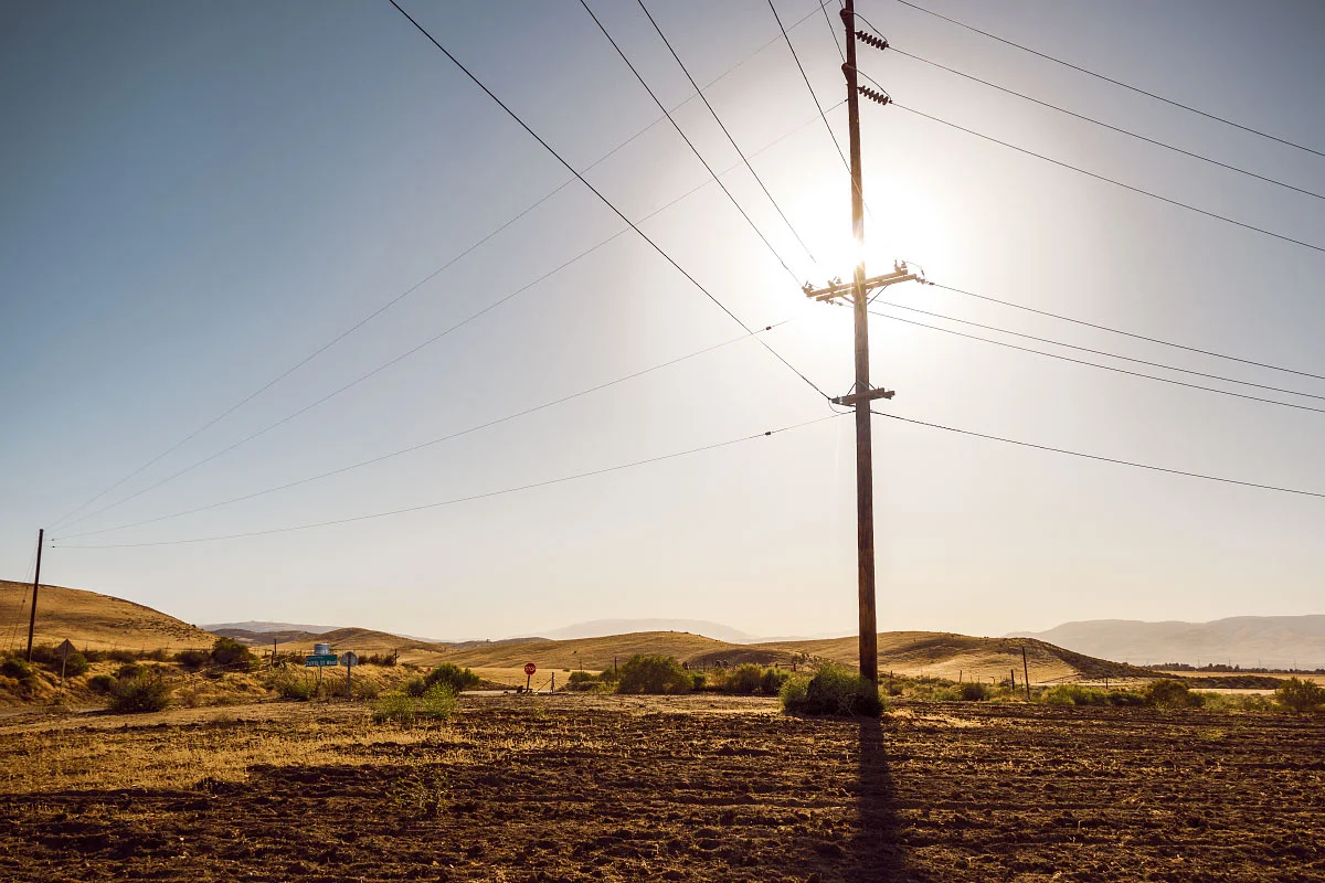
269th St. W, 517.6.
LA Aqueduct, mile 520.9.
June 2, Day 29
28.7 miles [558.0]
Woke well before dawn, hell, it was still night. Sunrise came quickly, illuminating thousands and thousands of turbines, all whirring and humming away. When it wasn’t being whipped around, my umbrella blocked most of the views. Mazama Wind farm was lonely, nothing but winding, scrubby hills filled with ghostly pinwheels. After 20 brutal miles, the desert gave us some respite—Mile 549 Bar and Grill—trail magic. I guzzled a blue Squeezit, straight from my childhood, hoping it would somehow transport me back. “Hard Time” seemed to be enjoying himself, every time I passed him he was Snapchatting. Ripped off the band-aid and left. Another eight miles made today our longest yet. Adam was melancholy and despondent the whole time. “I can’t keep doing this”, he told me at dinner, “I can’t be responsible for anyone.” I didn’t know how to respond. Am I burdensome? I don’t want to do this by myself; I want someone to share it with. What a gross thought. The turbines seem even louder at night, buzzing like low-pitched mosquitoes. The desert was so hard today.
Mazama Wind Farm sunrise, mile ~534.
Adam at Mile 549 Bar and Grill, mile 549.
Wind turbine, mile ~539.
Sawmill, Bootleg, and Quail canyons, mile 556.4.
June 3, Day 30
12.8 miles [570.8]
Woke from my bad dream not feeling any better. An overwhelming feeling of “useless, goalless, aimless” filled my entire being. It would have been easy to sit and wallow, but I tied my shoes tight and tried to pull it together. Made it through eight more miles of wind farm before reaching the highway, thankfully it was all downhill. Got a hitch and after relocating from a BBQ joint, found ourselves at a trusty McDonald's. One large iced coffee and impassioned internet search later, I purchased my own tent. Well, Adam did, now we’re square on that camera debt. Did a resupply at Albertsons and Dollar Store as well as coin-op laundry. Even found time to crush a Hot-N-Ready. Ran amok, we probably did five miles in town. Found an angel, Jeff, offering rides back to the trail. He’s only been doing it for three weeks but already helped out nearly 200 hikers. Hard slog up and away from the highway in some of the strongest wind I’ve ever experienced. Hunted a few miles for a shielded place to cowboy—hopefully this little bush helps.
Sunrise leaving camp, mile 558.
Desert signage, mile ~559.
Leaving Highway 58, mile 567.8.
Alta wind farm sunset , mile 568.9.
Hike On?

PCT Thru-Hike: Before – Planning, Preparing, and Problem Solving for 2,650 Miles
In 2018, I thru-hiked the Pacific Crest Trail with my brother. Before the trail, we watched dozens of YouTube videos and read countless gear reviews. In the spirit of giving back—and recording my memories for posterity—here's what we did before either of us set foot on trail.

In 2018, I thru-hiked the Pacific Crest Trail with my brother, “Shocks”. It was the first thru-hike for either of us. Before the trail, we watched dozens of YouTube videos and read countless gear reviews. In the spirit of giving back—and recording my memories for posterity—here's what we did before either of us set foot on trail.
Other Blog Topics
Planning | Analysis | Gear Review

An overall map of the PCT. Photo Courtesy Pacific Crest Trail Association.
From Where to Where?
“The what? The Pacific Crest Highway? Mexico to where? Are you bringing a gun? Walking? The entire thing?” These bombastic questions and more will randomly greet you once you decide to hike. Few will ever understand the power of long distance hiking, but you are different.
You are a dirt-bag vagabond. Hiker trash in the making.
One Year Out
Deciding to Hike
I've always been an outside cat kinda person; living in the great outdoors genuinely appeals to me. Over the years I saw friends of mine set off, posting their progress online. I'm ashamed to admit jealousy was always the first feeling I had.
The spring before we started, Adam approached me and declared his intentions to hike. I remember thinking there wasn't anyway in hell I was going to allow myself to be jealous of my brother. Rather than try and find a way to be proud of him from home like a mature adult would do, I decided it was time to realize my dream and take the leap as well. He welcomed me; I owe him everything.
All you really need is a permit, a backpack, some money saved, and a way to get to the terminus. You probably already have the desire. If you're like me, seeing posts on social media of friends long distance hiking makes you envious. Use those emotions to fuel your hike. This is something you want to do, or you wouldn't be reading this. But the best advice I got was from two Class 2017 hikers; “don't over-plan”. After talking with other hikers on the trail, it became apparent just how much planning a person can do. From planning every meal, to having nights on trail determined, to amount of zeros they were going to take. Nothing against that method, but my motto was, and has always been; “cross that bridge when you come to it”.
I would be remiss to mention Adam did all the work; no hyperbole. I spent my days reading camera reviews and working on old photography projects. Any gear he meticulously researched and bought, I also bought because I valued his reasoning and research.
“Bones or Clams or Whatever You Call Them.”
It's no surprise the Pacific Crest Trail costs money even if you are technically homeless and eating Top Ramen twice a day. And like most things in life, money is usually the prohibitive factor for most people. Not only are you spending for the entire 4-6 months, you're also not earning any money (unless you got mad-hustle and prior investments). Most people I met on trail weren't well-established in the work force, meaning not salaried without benefits. Financially secure hikers were out there, but in my eyes, certainly weren't the majority. Most had saved up or were already living frugal lives and took it to the next step.
During my three-month summer employment (with free room and board), I hiked a lot more instead of spending time at the St. James (local bar). During the winter, I worked lots of six-day weeks for overtime pay. I went out even less than I normally do. I shared an apartment with Adam and cooked as many cheap meals as possible. Frugal living started well before life on trail.
For my particular situation, I knew I would have to save up close to $8,000. I was expecting to have an 'average' trail experience in terms of spending, but I also knew I had to find a place to live after the trail. I didn't have solid plans to move back to Colorado, but I knew what to expect in the event I should (spoiler: I did).
For more information, here’s an entire blog post on what the PCT actually cost me.
Training to Hike 20 Miles a Day
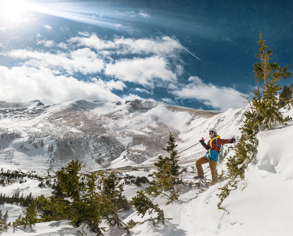
Adam shredding Way Out bowl in Breckenridge, Colorado. Totally counts as training.
“What training did you do for the trail?” was a question I received constantly. I'm still not quite sure how to answer. It stands to reason most people mean conditioning when they say training. And in that sense, I didn't do any conditioning. I didn't even buy my shoes until last-minute (would not recommend). Perhaps I walked 10 miles a week to and from work in my ski town. Not exercising wasn't the best idea (duh, hello), but I wasn't completely inactive. I was working 50 hours a week as a lift operator in Breckenridge, Colorado. Six months of shoveling, skiing, and living above 10,000 feet. I was “active” to say the least. No doubt, I could have used a lot more conditioning.
I did, however, have extensive backpacking experiences to draw from. Training is a learned skill or behavior, and by this measure, I was well ahead of the learning curve for most first time thru-hikers. Backpacking wasn't brand new to me. Years of family car-camping and a solid tenure in Boy Scouts was ample training. What essential items to bring, what to leave behind, how much food I needed, how much water I should carry, what to do when it rains all day; all these factors and more weren't troubling me pre-trail.
Logistics
Transportation To and From the Trail
BEFORE: Arriving at the southern terminus wasn’t difficult. We had a few friends offer to drive us since we are SoCal natives. We ended up taking the train to San Diego and stayed at a friend’s house the night before; he drove us to the terminus in the morning. I don’t think we knew much about Scout and Frodo’s until after the fact. It would have been a cool experience to participate in, but I’m kinda glad we did it our way. Apparently 2019 and 2020 will be their last years hosting hikers.
DURING: One doesn’t just simply walk into Canada. I had my passport at home ready for delivery to the Oregon/Washington border. I found out in Mount Shasta, California that I was going to need an additional Canada Entry Permit (thanks Dad and friends). Dad helped me get it processed while I was hiking.
AFTER: We hiked into Manning Park, Vancouver, Canada in the late afternoon and still had to find a way to get home. With no solid plan, a mind for frugality, and lots of hope and trail experience, we thumbed a ride into Vancouver. The Greyhound bus which ran in prior years wasn’t running in 2018. After a few Google searches we found plane tickets for that next morning and took a metro system to the airport where we spent the night. Less than 24 hours later after becoming PCT thru-hikers, we landed at LAX.
Food and Resupplying
Most likely, you will choose to prepare a portion of food before you leave. Popular advice suggested sending resupply boxes to 10 locations, so we followed suit. Adam calculated the distances between ‘known’ resupply points figuring on 20 miles per day average and came up with an idea for how many total days of food we were going to need.
It should also be mentioned we saved quite a bit of food from our summer employer, Philmont Scout Ranch. To be clear, this was not stolen food. All food came from swap boxes (basically, a hiker box), taken at the end of the day. I think that covers me for possible future employment. What can I say? Kids don’t like Mojo bars.
With that said, we found ourselves in late April at a local Grocery Outlet armed with a shopping cart and only the vaguest of ideas as to how much food we each were going to need for those 10 boxes five months from then.
After amassing all the food we both saved and bought, everything got dumped out onto the living room floor and an inventory list was made. We tested a few methods before finding one which seemed like it was going to work.

We estimated one day's food requirement and then we made dozens of one-day food piles, replicating the 'meal plan' with some slight menu variations. Each of those piles were then packaged into a Ziploc in either one or two day quantities. The reasoning being 1) we roughly know how much we're going to eat each day 2) we knew which towns we wanted delivery to. The biggest variable seemed to be knowing how many days we were going to hike once we got to one of those known resupply towns. Some hikers would buy a lot of food a few towns ahead and mail it to themselves in a known hard spot to find cheap and reliable food.
Our idea was to share resupply boxes to save on shipping and since we planned on hiking together. Our parents graciously offered to cover the postage fees to mail out our resupply boxes; this was a pretty nice windfall. And we could certainly count on them to mail the food.
Final Thoughts
Saving enough money, buying appropriate gear, and conditioning yourself are the first of many problems you will solve along your journey. Don’t over-plan, it’s easy to get excited and make lists. Save enough money, but have a mind for frugality. Don’t plan every meal, but go on a few hard all-day hikes to see what you consume. Don’t buy top-of-the-line gear for everything, but splurge on a few good items. You can’t plan for everything.
“Sow the seeds of expectation; reap disappointment.”

The Road Trip: Three Friends Tour America's West
For the better part of the last three months, Carter, Caleb, and I have been planning a two-week long road trip throughout the western United States.

Brea, California
May 6, 2015
I can't wait for tomorrow.
For the better part of the last three months, Carter, Caleb, and I have been planning a two-week long road trip throughout the western United States. Every stagnant pause at the dinner table, every quiet car ride around town, all of my available thinking time has been dedicated to this trip.
You could say I'm excited.
Just a little bit.
Here's an overall map and where we plan on staying. Quite a swath of land to discover in only 13 days. (Click image to enlarge)
Although we intend on having a fair bit of time for relaxing, our itinerary has been rigorously planned, every roadside attraction has been accounted for. But as you can see, our main goal is visiting National Parks.
List of our upcoming attractions:
Yosemite National Park — Days 2 & 3
Sequoia & Kings Canyon National Parks — Days 4 & 5
Death Valley National Park — Day 6
Zion National Park — Days 7 & 8
Bryce Canyon National Park, Capitol Reef National Park, and Grand Staircase-Escalante National Monument — Day 9
Arches National Park and Dead Horse Point State Park — Day 10
Canyonlands National Park — Day 11
Mesa Verde National Park — Day 12
At 2 p.m., a thunderous knock came from the front door.
My heart was pounding in my ears. I opened the door to find two goofy grins staring back at me—Carter and Caleb. The three of us met when we worked for Philmont Scout Ranch in the summer of 2013 at Sawmill camp. We quickly became close friends that season.
As for proof, a goofy pic of our entire staff.
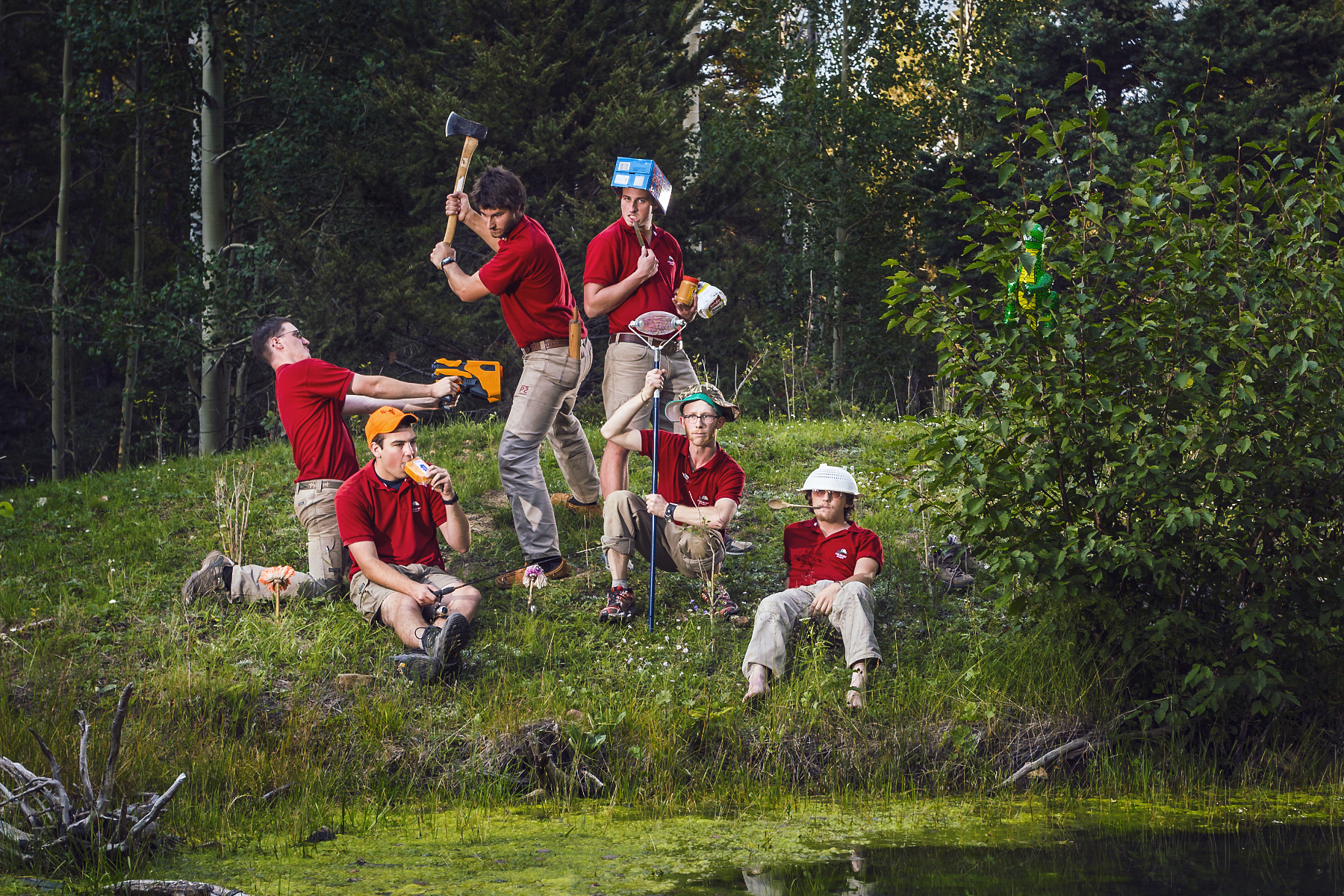
Caleb Jennings is the hippy without shoes, Carter Smith is the giant with a 3/4 ax, and I'm the imp with a nut-collector. Yep, what a crew.
The three of us went out for dinner and drinks; a celebratory commencement.
We came back home for ice cream and a living room showing of Reservoir Dogs.

My duffels are packed, my goodbyes to my family have been said. After much anticipation and waiting, the time has come.
Wheels up, 7 a.m.
Tomorrow, it begins.
The Road Trip has started.
Hey, want a ride?
Stick your thumb out:

The Road Trip Day 1: Barefoot in Monterey
6:37a.m.; I beat my alarm clock by three minutes. A softly rising sun streamed through my bedroom window while I quickly dressed. Coffee brewed and poured...
Pacific Coast Highway, California
May 7, 2015
6:37a.m.; I beat my alarm clock by three minutes.
A softly rising sun streamed through my bedroom window while I quickly dressed. Coffee brewed and poured, and with a few more weepy goodbyes from my parents, we piled in the car and headed off.
Opting for the scenic route, we chose to drive along California's famous highway, the Pacific Coast Highway, or as hip locals say, “the P-C-H, dude”. Miles evaporated while excitement and tunes freely flowed throughout our vehicle.
Lunch time sped up on us.

Pizza lunch on a table in San Louis Obispo, California.
After a quick reference from Yelp, we pulled off the highway and headed for Pizza Solo in San Louis Obispo. We opted for a bacon, chicken, and pepperoni pie. #treatyourbodylikeatemple. It got snarfed down immediately.
Back on the road.
We headed further North. With Los Angeles a considerable distance in the rear-view mirror, heavier and darker clouds began to permeate the sky.

After another hour and a half, it was time to get out, stretch our legs, and check out the beach.


A peaceful moment at Arroyo Laguna State Beach.
It was a spectacular afternoon.
This is the first time I have ever traveled along the PCH. California natives, mostly retirees, regularly discuss driving its entire length.
There was no shortage of amazing coastal scenes. Mile after mile of winding and soothing coastline filled the windows.
Here's an excerpt from my journal:

“The [trees] looked a lot like snarled Bristlecone pines. Dunes and mountains were covered in colorful native brush. Steel blues, muted mustards, and olive grasses adorned the rolling hills. The entire time, hugged by the crushing ocean—jagged rocks breaking through the madly frothing surface of sapphire and turquoise foam.”
Another hour of winding and cruising later, about 70 miles before our hotel, we made one more stop.
There weren't any signs, but there was a large pull-off area on the opposite shoulder. We parked, hopped out, and inspected our surroundings.

What a scene to be rewarded with.

The three of us silently stood still and enjoyed a cool sea breeze. A gentle rumble of breaking waves below us kept an even tempo.
Carter gently reminded us we still had a bit farther to go.

A unique erosion control method.
We arrived at our hotel just as it stopped sprinkling. After a quick unpacking, we went downstairs seeking dinner recommendations. The lobby had complimentary wine and cheese.
Dinner options were within walking distance. Not soon after setting out, my homemade moccasins were thoroughly soaked from the soggy pavement.
I removed them. Socks too. The concrete was cool and wet.
We continued searching for something other than pizza.
Hey, want a ride?
Turn it around:
Stick your thumb out:
The Road Trip Day 2: Foggy Mountain Monoliths
Woke up with yesterday's cloudy skies still hanging around. The coastal air was crisp. We packed up and drove with the windows...

Yosemite National Park, California
May 8, 2015
I woke up to yesterday's cloudy skies still hanging around. The coastal air was crisp.
We packed up and drove with the windows down. Today's journey was less than 200 miles and we had a camping reservation. The goal was to head out early, take our time, and enjoy the views.
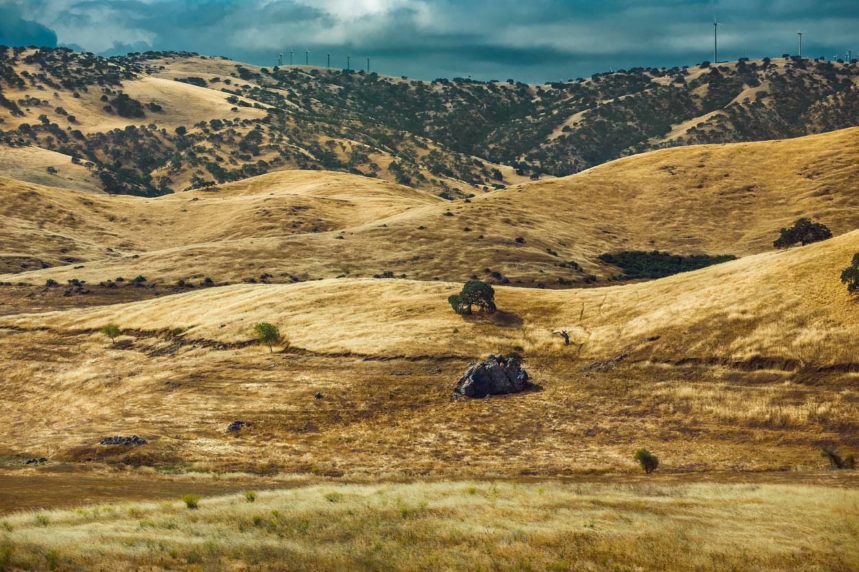
Slowly, we gained in elevation. The temperature kept dropping.

Welcome to Fish Camp.
It was cloudy and ominous all day.
Upon arrival at Mariposa Grove, we were surprised to find at least three inches of snow on the ground. Water dripped from the trees, plunking loudly on our car's roof. We each took turns peering through the sunroof watching large droplets splash on the glass.

We got out and took a walk.

It was cold!
Yesterday's overcast delight spoiled me. I hope I brought enough warm clothes for the entire trip.

Caleb Jennings enjoying the cool air at Mariposa Grove.


With temperatures hovering in the mid 30's, there was talk of finding an alternate plan. We were not prepared to camp in the snow.

The decision was to find and rent a room for the next two nights. After all, we are on a vacation.

Headed to Tunnel View via Wawona Tunnel.
After exiting the park, we found a room with a reasonable rate. Camping would have been rough; my sleeping bag is only rated to 20 degrees.
Dinner was Mountain House pasta primavera and a generous glass of whiskey. I lost two cribbage games.
Tomorrow's plan is to hike the Mist Trail.
Hey, want a ride?
Turn it around:
Stick your thumb out:

The Road Trip Day 3: 7,200 Feet of Granite
It was easy to get up this morning. I appreciated the lack of snow. A head poke outside revealed beautiful blue skies.

Yosemite National Park, California
May 9, 2015
It was easy to get up this morning. I appreciated a lack of snow. A head-poke outside revealed beautiful blue skies. What luck!
After a short drive to Happy Isles trailhead, we hopped out, laced up hiking boots, got water filled, and applied sunscreen.
Ready.
Although it was steep, we breezed past the majority of heavily panting visitors.
About 1.5 miles, 1000 feet of elevation gain, and 600 stone steps later, we arrived at the top of Vernal Fall.

We found a comfortable rock and took a water break at the top.
I snapped a quick group shot.

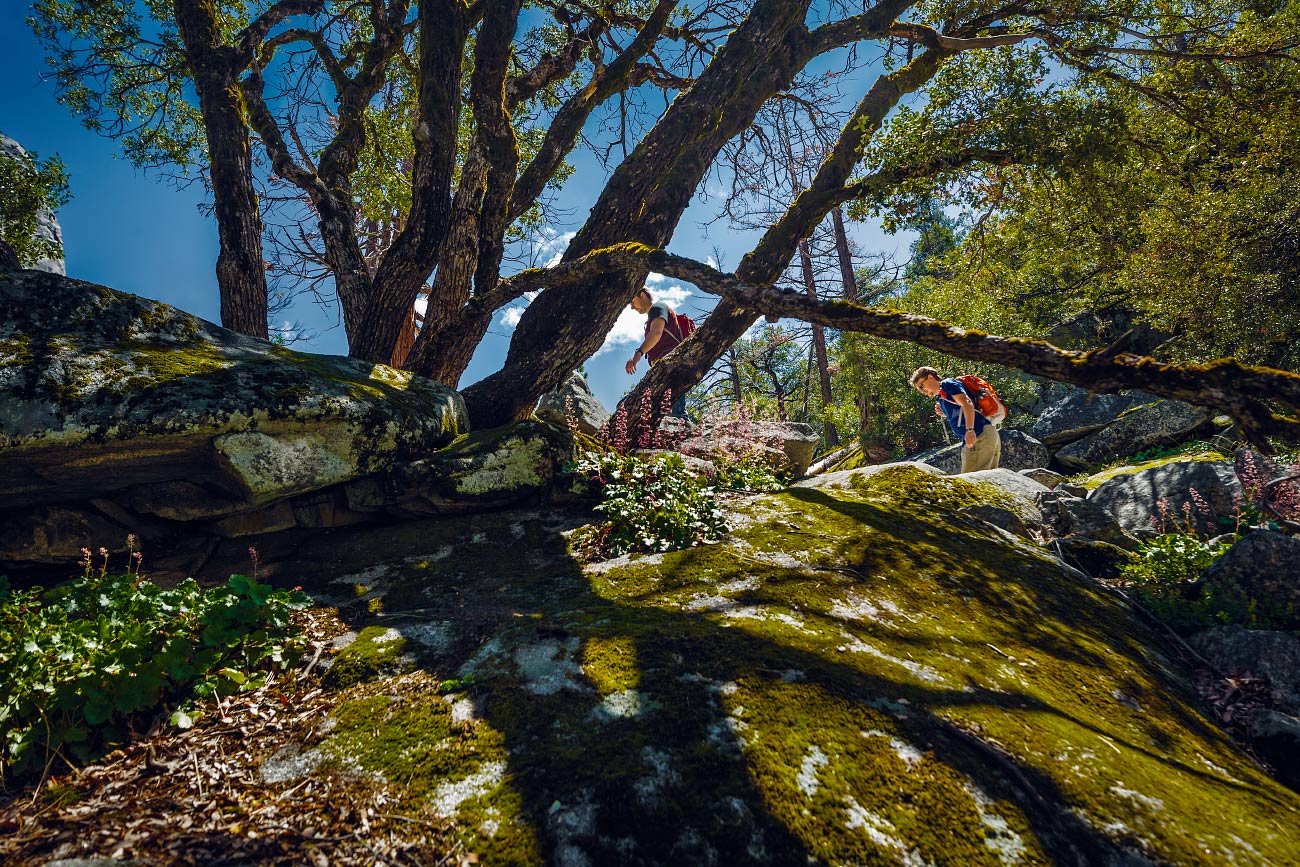
Switchbacks are my favorite.
However, we didn't stop for long. Nobody wanted to hike in the heat of the day. Duh.
Up, up, up.
It was a steady incline the entire way.


Caleb at Clark Point.
Four miles later, we arrived back at the parking lot. Sweaty.
With time left in the day and not wanting to hike 3,000 feet up out of the valley floor, we jumped in the car and drove all the way around to Glacier Point.
Carter locked the car and the three of us waded through the crowd, politely waiting our turn for a view from up against the railing.

View of Upper and Lower Yosemite Falls from Glacier Point.
As luck would have it, a massive cloud eclipsed Half Dome and hung around for the duration of our stay.
Half Dome was half-visible.
I felt cheated, but on the other hand, it was a unique view.
Guess I'll have to return someday soon.

No, 'Cloud's Rest' is the other mountain!
Tired and hungry, we exited the park.
Caleb suggested a quick stop at the general store for some dinner additions. Once back at our room, Carter found some tunes, and I prepped dinner.
Whiskey was poured.

I had a big bowl of vegetarian stew out on the deck and watched sunset.
Tonight is our last night in Yosemite.
Hey, want a ride?
Turn it around:
Stick your thumb out:

The Road Trip Day 4: Whiskey and Stars
I packed my things swiftly. I've improved each day; junk-wrangling is getting more efficient. Carter made a final sweep, then it was off to...

Sequoia National Park, California
May 10, 2015

Caleb watching the passing landscape morph and change.
I packed my things swiftly. I've improved each day; junk-wrangling is getting more efficient. Carter made a final sweep, then it was off to Sequoia National Park.
The 120 mile drive didn't take long. Fields of orchards and farming land slowly turned into rolling hills with massive and elegant oak trees. California: as stereotypical as it gets.
Carter purchased his obligatory bumper sticker at the visitor's center, we got our overnight camping pass, and continued driving deeper into the park.
Conditions at the trailhead were ideal; cold mountain air and warm sun. After 20 minutes of rummaging through our thoroughly packed car, I had Frankensteined together an overnight pack. The three of us were ready to set off.
Man, we are slow, sweaty, sea-level bums!

Pausing for a quick breather.

Descending into lakes Heather and Emerald while looking across the Marble Fork Canyon.
The Lakes Trail was definitely strenuous.
For five miles we climbed upward and gained about 2,000 feet of vertical. Sure, I'm no couch potato, but carrying a backpack at 9,000 feet was exhausting for this non-acclimated landlubber. I probably should eat more snacks next time.
Much to our surprise, we finally descended into Emerald Lake basin which was our camp for the evening. Nestled at the base of a sharp and angular ridgeline, we began setting up camp. Snow-capped peaks completely surrounded the many tiny lakes.
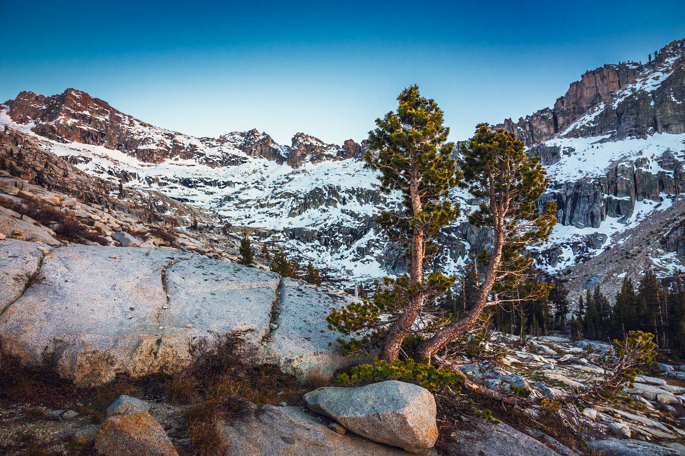
Trees in Emerald Lake basin.
We didn't see another soul.

Tonight's dinner menu: Top Ramen—chicken flavor. The warm, salty broth soothed our aching bones.
Of course, a healthy serving of whiskey was helpful too.
We scrambled to a nearby overlook to watch the sunset. Completely clear skies lead to a wonderful display of alpenglow.
Slowly, the first stars of evening began twinkling in the lavender light.

The cliché about how well our 'hotel room' is rated.
The temperature kept dropping; you could feel the dismal cold outside the tent.
Inside, I was snuggled up in my bag, warm, and happy to have a hot Nalgene cozied up to my feet. Altitude made it difficult to get to sleep despite today's workout.
Tomorrow—a day to chill.
Hey, want a ride?
Turn it around:
Stick your thumb out:

The Road Trip Day 5: Shwackin' and Chillin'
Warm sunlight streamed in through our tent. Somehow, I managed to sleep until 8 a.m. Glorious...

Sequoia National Park, California
May 11, 2015

Gotta find ways to warm up in chilly, subalpine mornings.
Warm sunlight streamed in through our tent. Somehow, I managed to sleep until 8 a.m. Glorious.
I got dressed and found a few oatmeal and fig bars for breakfast
Today's objectives:
1) Relax.
2) Get (closer) to the car.
We scoured the rocky alpine landscape in search of a great view with some hammock-able trees.

Scouting out potential chill-spots.
Carter spotted a nice ledge about a quarter mile away. He had his hammock, Caleb had his Z-rest. I planned on finding a comfortable rock in the shade.
It was a nice spot.

He's gonna regret the sunburn.

Carter busting a fat chill.
Eventually, we snapped back to reality. Tomorrow's drive is going to be long; an early start will be a necessity. We needed to pack up camp and hike back toward the car.
Hiking downhill is a lot less work.
We made great time.
There was a quaint picnic area by the parking lot which seemed closed for the winter season. It looked like a great place for an easy impromptu campsite.
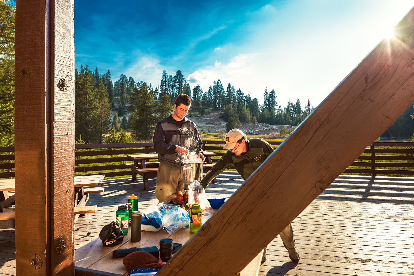
Stirring the pot; you don't want crunchies stuck to the bottom.
The three of us played a few games of cribbage. It seems like I'm losing more games than winning at this rate, but I did manage a 20-point hand. There was yelling.
Dinner was Santa Fe Chicken mixed with some fresh garlic and leftover cheddar cheese we found stashed in the car cooler.
Delicious.
With an empty parking lot and no one else around, we pumped the music a little louder than usual.
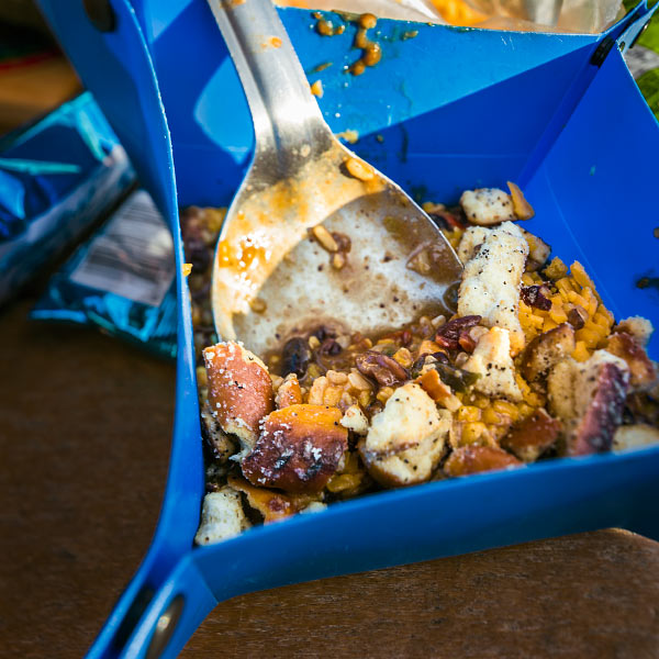
Yummy, crunchy.
Bedtime came with the arrival of darkness.
No tent, it looked clear enough.

Hay bales provide more insulation than a wooden floor. Right?
I tossed and turned the whole night. It was below freezing.
My hot water bottle didn't seem to do anything.

Wolverton Picnic Area at night.
Hey, want a ride?
Turn it around:
Stick your thumb out:

The Road Trip Day 6: Badwater, Good Vibes
Holy cow, it was FREEZING. I don't know which was more of a struggle: storing my DSLR at the bottom of my sleeping bag, or...

Death Valley National Park, California
May 12, 2015
Holy cow, it was FREEZING.
I don't know which was more of a struggle: storing my DSLR at the bottom of my sleeping bag, or using two hay bales as a mattress. I got absolutely zero sleep.
Dawn was at 6:30 a.m. We hustled to pack our belongings while attempting to stay warm. Caleb had to summon a bit of courage to put on his pants—they were completely covered in frost!
We had a long drive ahead of us.
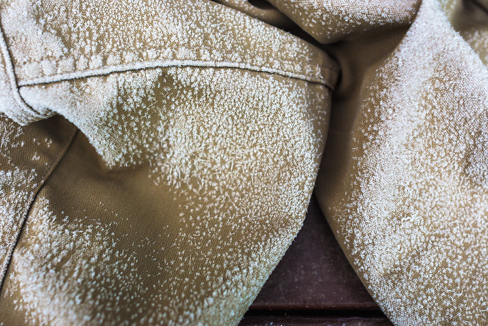
Frigid britches.
So, we started driving, stopping only for a Costco pizza in Bakersfield, California.
Through the middle of nowhere, down roads I didn't think would be healthy for any car's suspension, we drove. About six hours later we arrived at Badwater Basin, the lowest point in North America.
Finally, it was warm once again!
It's 282 feet below sea level. The sign was so tiny. Hard to imagine that much water being above my head. And all around me.

The sign in the top left says, “sea level”.
The main reason our drive took so long was to navigate around Mt. Whitney which ironically is the highest point in the contiguous US. Both extremes lie less than 100 miles from each other.
Weird.
We also made a stop at Artist's Palette.

We can't stay for very long.
A sign informed us the color in the rocks comes from oxidizing metals.

I'd visited before on a family vacation many years ago but since forgotten just how vivid the colors were.

What an alien world.
We stopped for a quick group shot before exiting the park.

Feeling artistic at Artist's Palette.
It was another 175 miles to our destination outside of Las Vegas.
Seven hours down, two to go. We continued driving.
Hey, want a ride?
Turn it around:
Stick your thumb out:

The Road Trip Day 7: Colorful Explosion
After yesterday's long haul, it felt nice to take things a little slower. A shower, an opportunity to do laundry, and a bagel with some schmear…

Zion National Park, Utah
May 13, 2015
After yesterday's long haul, it felt nice to take things a little slower.
A shower, an opportunity to do laundry, and a bagel with some schmear hit the spot. Most of the morning was spent talking with our friends who graciously let us crash for the night.
I realized this was the halfway point of our journey.
It was hard not to.
We packed up, said our see-ya-laters, and set out for the day.

Spending some quality time getting to know the Veterans Memorial Highway, also known as I-15.
Roads remained clear the entire way to Zion National Park.
For 150 miles, we meandered up I-15. Apparently, it continues all the way to Canada. Perhaps I'll drive its entirety one day.
The portion we covered was magnificent. Here's an excerpt from my journal:

Click here to view this in Google Street View.
“Succulent cottonwoods adorned wrinkled slot canyons, their crevices filled with sagebrush and rubber rabbitbrush; a colorful explosion.”
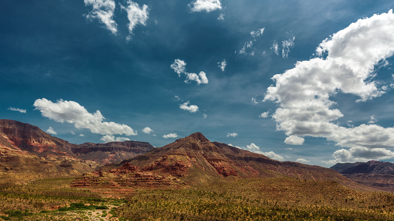
Virgin River Canyon Campground looks like a great place to spend a night or three.

Carter is on a hot streak.
We arrived in Zion, got our campsite, set up, and hopped on the shuttle for a quick tour of the canyon floor. It was a great way to get an idea of what we want to do tomorrow.
After the tour we caught another shuttle, this time to Springdale for “hors d'oeuvres and aperitifs”.
Back at camp, chili gently simmered away while we played a few more hands of cribbage and had our chips and beer.
I scavenged empty campsites for firewood. After a few trips, I collected enough unburned $16 firewood to use both nights we plan on staying. Score.
After dinner, I decided to take a walk around the campsites before it was time for bed. Carter informed us there's a 50 percent chance of thundershowers tonight through tomorrow afternoon. We are prepared but all of us are thinking dry thoughts.

Our neighbor's fire illuminated the cottonwoods in a mysterious manner.
Hopefully we don't end up hiking in the rain. I always seem to struggle at having fun in the rain.

Watchman Campground at night.
It looked clear out.
Hey, want a ride?
Turn it around:
Stick your thumb out:

The Road Trip Day 8: Where Angels Land
At 5:27 a.m., some yahoo's car alarm went off. After tossing and turning, I gave up and got dressed. It was a great excuse to get an earlier…

Zion National Park, Utah
May 14, 2015
At 5:27 a.m., some yahoo's car alarm went off.
After tossing and turning, I gave up and got dressed. It was a great excuse to get an earlier start than previously planned.
I shimmied on my clothes and hopped out of the tent. Much to my surprise, I found clear skies. The three of us assembled our day packs and filled up water bottles. Last night, we decided to climb Angels Landing, easily one of the most iconic Zion attractions. The Grotto Trailhead was only a 20-minute drive away.
At 8 a.m., in the cool of morning, we began our five mile hike.

Basically a 500 foot fall on either side with only a narrow rock path to stand on. Oh boy!
1,500 feet, up, up, up. We climbed.

I wonder how old this tree is. I wonder how many people have touched it. It must see some amazing sunrises.
I enjoyed my time up at the summit. It was just past 9 a.m. and it seemed clear we had beaten the majority of other hikers for the day. We shared the view with only four other people.
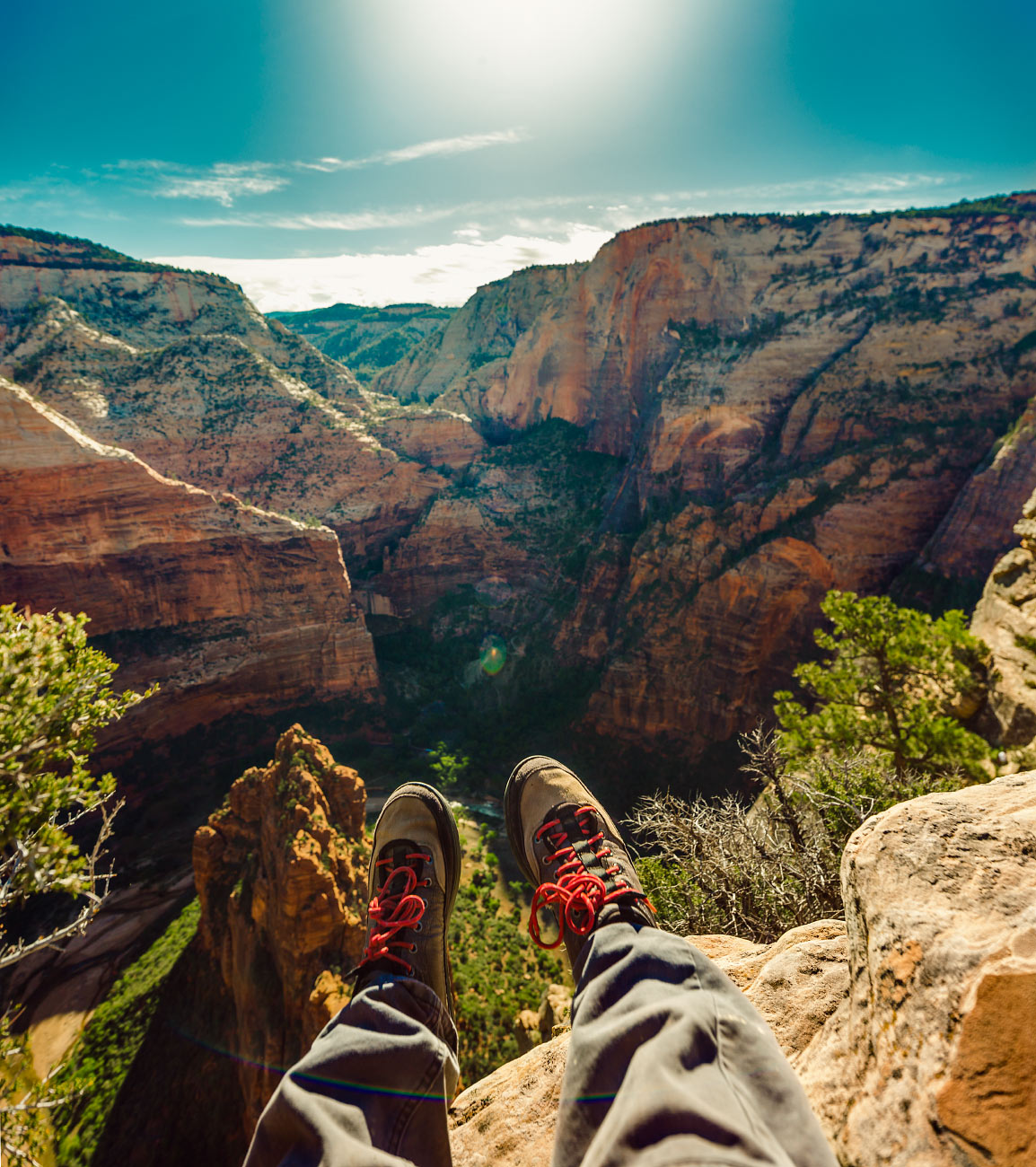
Angels Landing looking into Hidden Canyon.
It was grand.
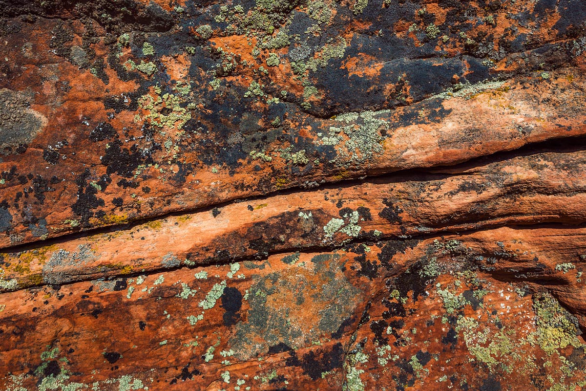

After thoroughly enjoying the view, it was time to descend. I snapped a few more photos, applied some sunscreen, and we carefully climbed back down.

If you've done the hike, you certainly remember the chain-rope sections.
15 years ago on a family vacation, my dad and I, along with two other family friends did the same Angels Landing hike. I was stunned to find out how much I remembered from my last trip. My hometown barely looks the same, but each sharp switchback and twisting tree seems to be right were I saw it last.

Carter finds an alternate trail.

One of the 21 switchbacks on Walter's Wiggles.
Refrigerator Canyon was completely in shadow when we set off. On the way down however, the canyon floor was bathed in sunlight. It was a magnificent sight to behold.
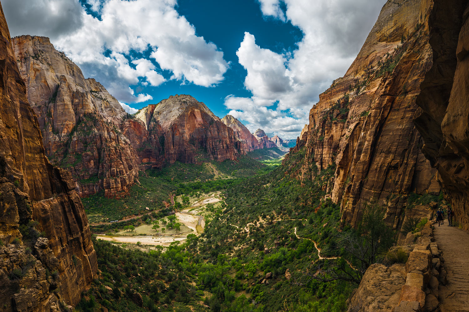
The Great White Throne, Deertrap, Mountain of the Sun, Bridge Mountain, and The Watchman as seen from above Refrigerator Canyon.
As soon as we got back to camp, it began drizzling. Snacks, cribbage board, and Bluetooth speaker in hand, we retreated to the tents and lounged away the remainder of our afternoon.
We walked to town and searched for dinner options; no one was in the mood to cook. Nothing jumped out at anyone, so we settled on some quaint and kitsch diner which was cheap and quiet.
Back at camp, we had a small fire and passed the whiskey bottle around. We chatted until bedtime arrived.
Hey, want a ride?
Turn it around:
Stick your thumb out:

The Road Trip Day 9: Alien Landscape
I awoke at 7 a.m. sharp, rain began falling at 7:02 a.m. Packing up in a light sprinkle is rarely enjoyable, but it was something we had to do. At least…

Bryce Canyon + Capitol Reef National Parks, Utah
May 15, 2015
I awoke at 7 a.m. sharp, rain began falling at 7:02 a.m.
Packing up in a light sprinkle is rarely enjoyable, but it was something we had to do. At least we got clear skies for yesterday's hike.
Today's drive was one of the longer ones; we boogied to get camp broken down, car packed and refueled, and road snacks restocked.
We waved goodbye to Zion.

Click here to view this in Google Street View.
Light rain suddenly turned to flurries of snow. The storm we had narrowly been avoiding finally caught up to us.
Along the way we stopped at Bryce Canyon. The visitor's center was packed due to the crummy weather. We took a quick visit to the rim, but you couldn't see a single hoodoo; it was completely socked in. Carter got his sticker all the same.

A very limited and snowy view of Bryce Canyon from the Rim trail.
We pressed on.
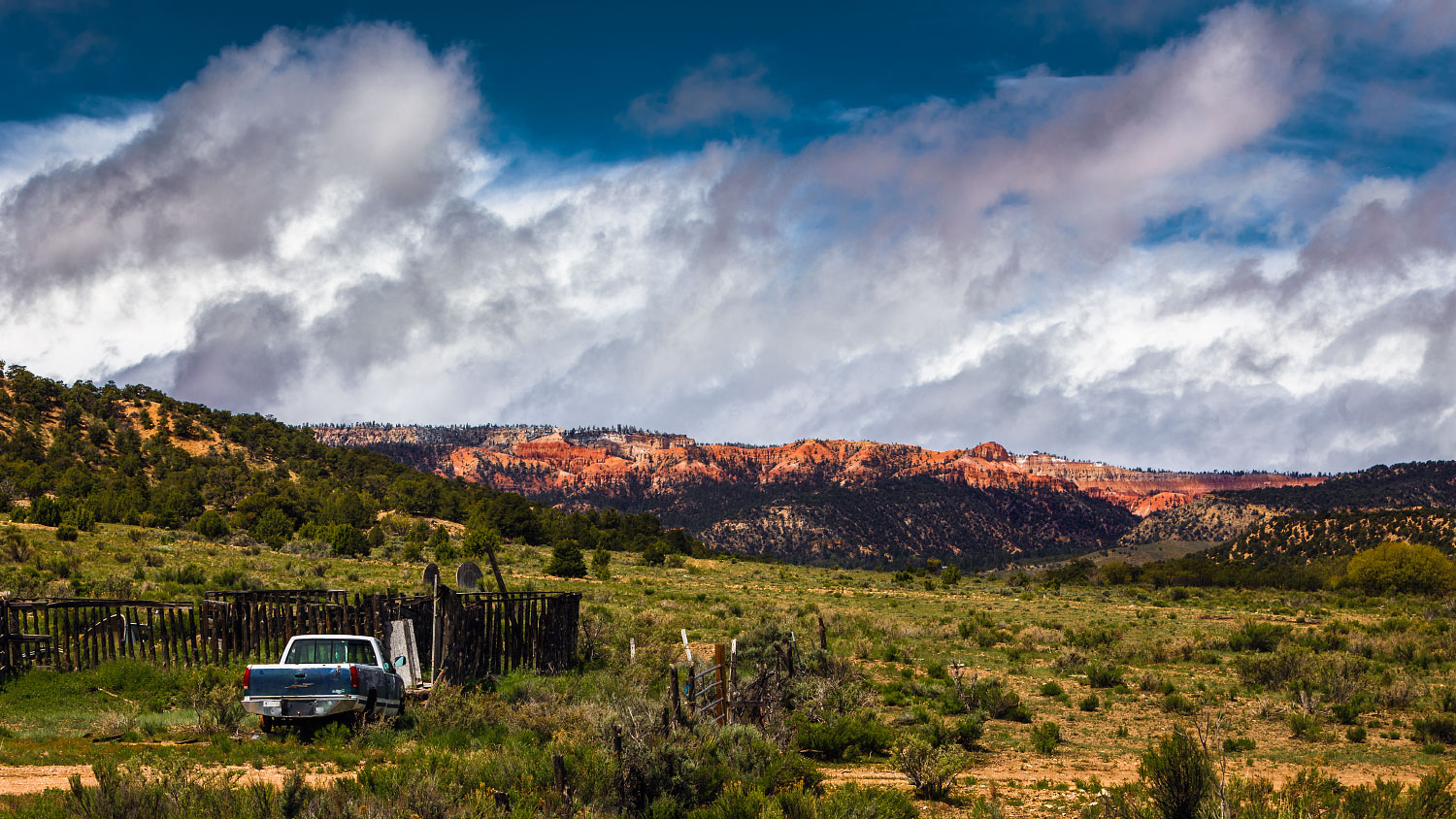
A pretty common view along State Route 12.

Head of the Rocks Overlook, Utah.

Looks like we skirted the storm.
The scenery was sublime. State Route 12 might be my favorite road in the US—certainly top three.
We started to get ahead of the storm. Another pull-off caught our attention. “Head of the Rocks Overlook”, proclaimed a small sign. Massive, angry clouds traveled West.
We were headed East.

Caleb made a feline friend during brunch.
The Smith's family friend has a restaurant we were told could not be missed, so we skipped breakfast to save time and not spoil our appetites.
Hell's Backbone Grill had a charming rustic vibe. We looked over the menu and didn't take long. Caleb got French toast, Carter got a quesadilla, and I got shirred eggs with several cups of coffee.
It was pure heaven for our travel-addled bodies.

Quite the brunch spread at Hell's Backbone Grill.
We said our thank-yous and got back on the road once again. Capitol Reef was on our way to Moab; we couldn't resist a short stop at the visitor's center.
Carter's sticker-window is running out of real estate.

Chimney Rock and Mummy Cliff as seen from Utah State Route 24.
Tonight, we are staying at a cheap RV and campground spot in Moab. Hour after hour, our vehicular spaceship zoomed through the alien landscape.
We arrived at the River Oasis RV Park in Moab. Apparently, it has free WiFi, but I had trouble loading Google. Dinner was beef stroganoff with several additional cloves of garlic.
Tomorrow's plan is Arches.
Hey, want a ride?
Turn it around:
Stick your thumb out:

The Road Trip Day 10: A Million Square Miles
It was another drizzly, rainy morning. Having showered last night, we had no further obligations or desires to stay another night at the 'majestic' River Oasis RV park…

Arches National Park + Dead Horse Point State Park, Utah
May 16, 2015
It was another drizzly, rainy morning.
Having showered last night, we had no further obligations or desires to stay another night at the 'majestic' River Oasis RV park, so once more, we packed our belongings in the rain. It wasn't bothersome, hell, it rained less than yesterday.
On our way into the park, we stopped for fuel and snacks. I got another Frappucino, easily my fourth during this trip.
My day-bag practically packs itself now. We were ready to go in less than 30 minutes.

A pair of hikers taking a break along Delicate Arch Trail.
Delicate Arch is is in the middle of the park and it made sense to beat the possible crowds. After a short drive into the park, we got out of the car and onto a trail.

It looked just like the postcards.

Pine Tree Arch.

Tunnel Arch.
We also went to Pine Tree Arch, Tunnel Arch, and Landscape Arch. The park didn't seem the least bit crowded. Plus, the rain and clouds had started to clear, leaving us with some gorgeous views.
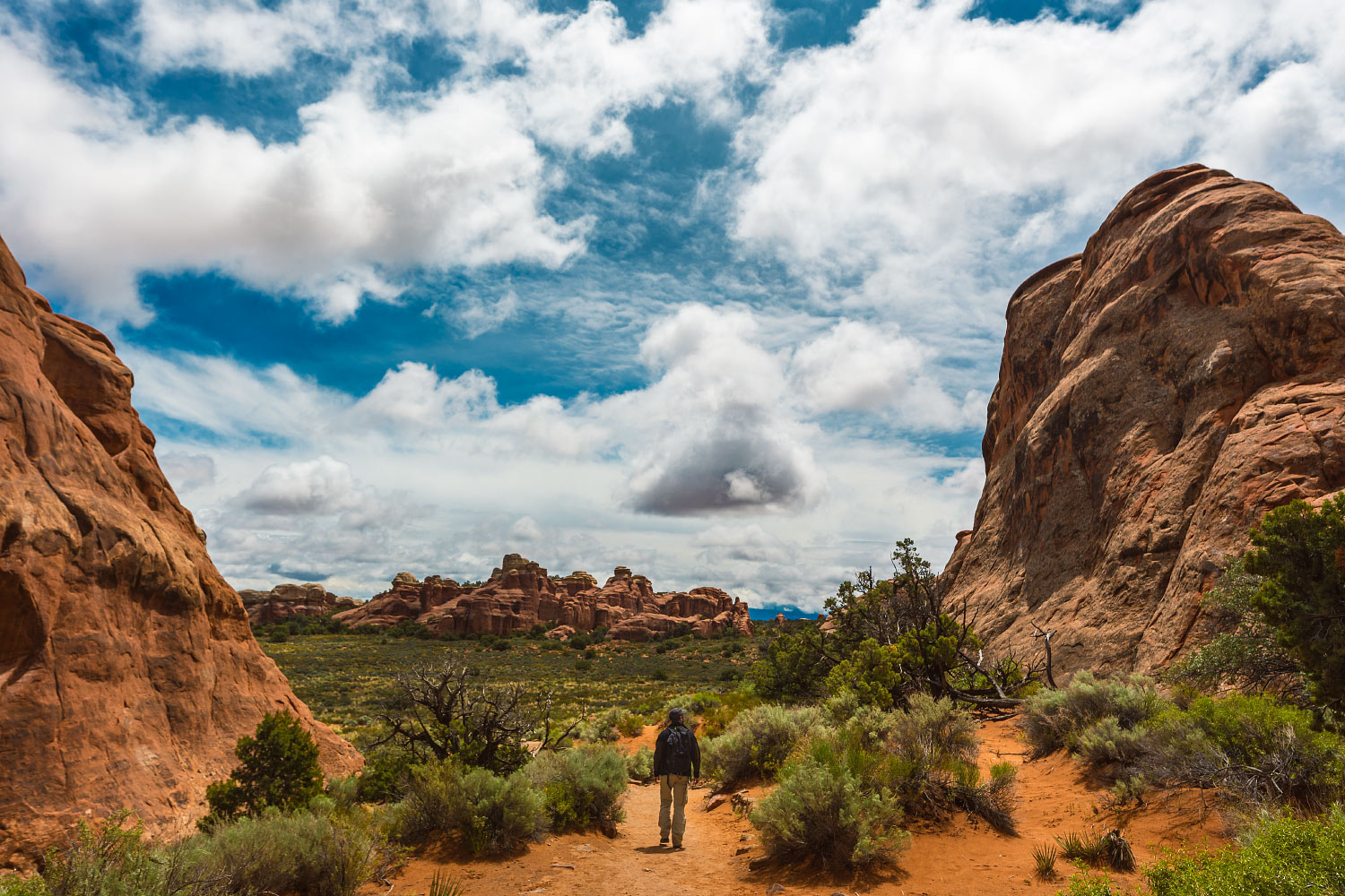
We spent the second half of our day at Dead Horse Point State Park.
Upon arriving at the parking lot, I promptly got out and rummaged through our swampy ice chest. Tailgate down, I made tuna salad; complete with celery, garlic, and capers. A small roadside-cafe van was selling lunch items, but most importantly, fresh espresso. I was beyond stoked.
I got my iced Americano and considered the day worthwhile.
The three of us munched under the shade of an awning. The sun was warm and the breeze was cool.

Refreshed, we walked up a small hill to check out the acclaimed overlook.

La Sal Mountains as seen from Dead Horse Point lookout.
I was genuinely stunned.
The three of us stared slack-jawed for quite some time.

We drove back into town and checked into the Lazy Lizard Hostel. Everyone was enamored with the place. After unpacking, we immediately booked a second night. It was that cool.
Showered, and with fresh clothes (not even previously worn), we went out for dinner at the Moab Brewery. It had rave reviews and a solid line every time we had driven by earlier. I had a patty melt with Swiss and mushrooms which was complimented well by an orange hef.
Back at the hostel, we continued our cribbage saga. There's no use in fibbing; I got demolished. It didn't matter, we laughed the entire game.
It kept me from remembering—only three days remain.
Hey, want a ride?
Turn it around:
Stick your thumb out:
About the Blog

Justin Kernes is a photographer and writer who thrives in the great outdoors.
From 2010-2017, he worked in the backcountry at Philmont Scout Ranch in New Mexico.
In 2018 “Tiny Slice” successfully thru-hiked the Pacific Crest Trail.
Search the Blog
Featured Posts


Photos and stories from my thru-hike of the PCT. This post covers day 111, Goat Rocks and my 30th birthday.